Download
3D Flyover
Add to list
More
12.9 km
~2 hrs 35 min
0 m
Loop
“Wander through Wageningen’s enchanting riverbanks, ancient woodlands, and wildflower meadows for a serene escape.”
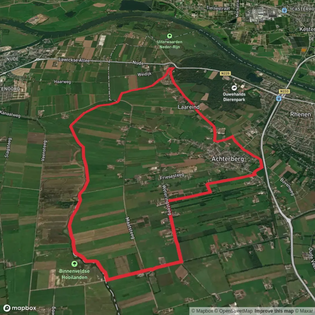
Starting from the outskirts of Wageningen, near the Wageningen University & Research campus, this 13 km (about 8 miles) loop hike weaves through the heart of Gelderland’s lush river landscapes and tranquil woodlands. With virtually no elevation gain, this route is accessible for hikers of all abilities and is especially suitable for those seeking a leisurely day outdoors.
Getting There
Wageningen is well-connected by public transport. From Ede-Wageningen train station, frequent buses (such as line 88) take you directly to the university area, which is a short walk from the trailhead. If arriving by car, parking is available at the university campus or nearby sports facilities.
Trail Overview and Navigation
The loop combines three well-known local trails: the Trekvogelpad, Harsloerpad, and Grift en Graftenpad. The route is well-marked, but for precise navigation and to track your progress, use HiiKER, which provides up-to-date maps and trail information.
River Valleys and Wetlands
The first section leads you along the banks of the Grift, a historic canal that once played a vital role in local water management. Here, you’ll pass through open meadows and reed beds, home to herons, storks, and a variety of waterfowl. In spring and early summer, the area bursts with wildflowers and the calls of songbirds.
Woodlands and Historic Estates
Midway, the trail enters the Harsloerpad, winding through mixed deciduous forests and past the remnants of old estates. Look for ancient oaks and beech trees, and keep an eye out for roe deer and red squirrels. The path skirts the edge of the Binnenveld, a nature reserve known for its rare orchids and butterflies.
Cultural and Historical Highlights
This region has a rich agricultural history, with centuries-old farmhouses dotting the landscape. The Grift canal itself dates back to the 17th century, built to drain the flood-prone valley and support farming. Interpretive signs along the route provide insights into the area’s transformation from marshland to productive farmland.
Final Stretch and Return
The last segment follows the Trekvogelpad, a long-distance migratory bird route, looping back toward Wageningen. This section offers wide views over the floodplains of the Nederrijn river, with grazing cattle and, in winter, flocks of geese. The flat terrain and well-maintained paths make for easy walking, even after rain.
Practical Tips
Expect mostly flat, sometimes muddy paths—waterproof footwear is recommended, especially after wet weather. There are several benches and picnic spots along the way, but limited facilities, so bring water and snacks. The route is popular with cyclists and birdwatchers, particularly on weekends.
For those interested in extending their hike, connections to other regional trails are available, and HiiKER can help you plan additional routes. The area is accessible year-round, but spring and early autumn offer the most vibrant scenery and wildlife activity.

Surfaces
Asphalt
Unknown
Unpaved
Sand
Comments and Reviews
User comments, reviews and discussions about the Trekvogelpad, Harsloerpad and Grift en Graftenpad Loop, Netherlands.
average rating out of 5
0 rating(s)