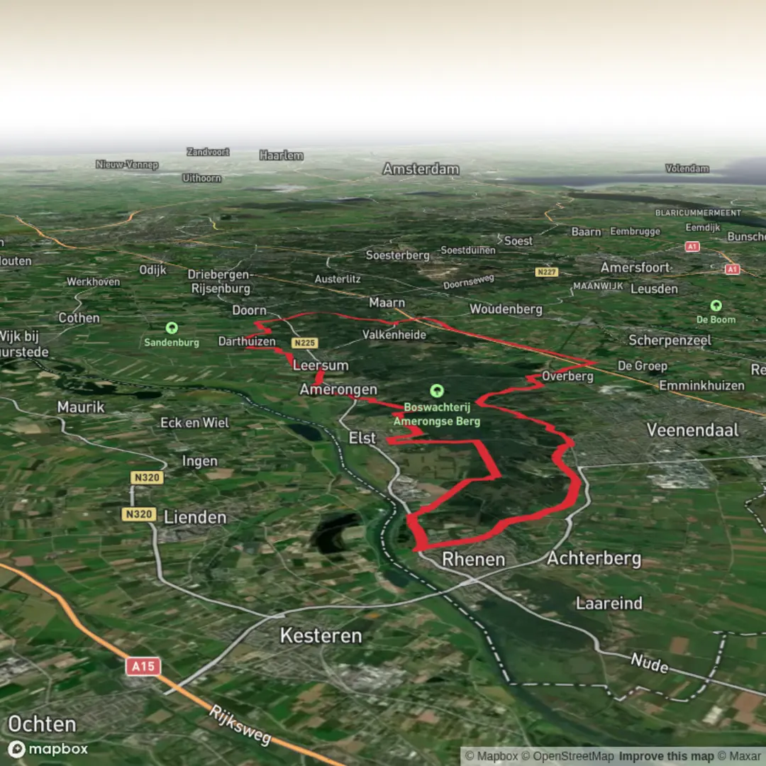
Prattenburgsche and Sandenburg via Woudenbergseweg, Bosweg and Stokweg
Download
3D Flyover
Add to list
More
47.9 km
~2 days
268 m
Multi-Day
“A long, gentle wander from beech-and-oak avenues to pastoral estates, where history hums.”
This is a long, low-stress day on the central Netherlands’ wooded ridge and estate country: about 48 km / 30 mi with roughly 300 m / 985 ft of climbing spread out in gentle rollers. Expect a steady rhythm of beech and oak lanes, conifer blocks, sandy forest tracks, and estate roads linking two very different landscapes: the Utrechtse Heuvelrug (a glacial ridge with subtle but constant undulation) and the Langbroekerwetering estate zone (flatter, more pastoral, threaded with historic country houses and old infrastructure).
The place-names in your route title point to the main connectors: - Woudenbergseweg: a key east–west approach across the Heuvelrug forests (often straight, fast walking, and exposed to wind). - Bosweg: typically a quieter forest road/track segment—expect shade, softer footing, and fewer cyclists than the main through-roads. - Stokweg: a rural/estate edge road feel—more open views, farm traffic possible, and a noticeable change from deep forest to “coulisse” (hedged) countryside.
Getting to the start (public transport + car) + where “near” usually lands
Your “Hike head: near …” is incomplete, but this route name strongly suggests you’re starting somewhere between Rhenen / Veenendaal / Elst (Utrecht) for Prattenburg, and swinging toward Doorn / Langbroek for Sandenburg.
A practical, recognizable start area to plan around is the Prattenburg estate entrance on Cuneraweg in Rhenen, near Cuneraweg 420, 3911 RW Rhenen (a well-known reference point for the estate). (verhaalvanutrecht.nl)
If you share the GPX or coordinates, I can pin the exact nearest address/landmark.
By train + bus - Rhenen Station is the most useful rail endpoint for the Prattenburg side; from there you can use local buses toward the estate edge or walk a short connector to the forest lanes. - For the Sandenburg/Doorn side, Driebergen-Zeist Station is the major hub with frequent buses toward Doorn and nearby trailheads.
By car - Aim for parking near the public road edges by the estates/forest access points rather than expecting dedicated hiker lots at the private landgoed entrances. Notably, Landgoed Sandenburg indicates there isn’t a dedicated walker parking area, and suggests arriving by bike where possible—so if you drive, plan on parking legally along public roads and walking in. (sandenburg.nl)
What the walking feels like (surface, gradients, pacing)
Underfoot: mostly firm estate roads and forest tracks, with intermittent sandy stretches typical of the Heuvelrug. After rain, the forest can hold moisture in low spots, but you’re rarely dealing with true mud-bogs for long—more “soft patches” than ankle-suck.
Climbing: the ~300 m / 985 ft gain is not about big hills; it’s the cumulative effect of short rises and dips as you cross the ridge. You’ll notice it most on long straight lanes where the grade is subtle but persistent.
Pacing: for most hikers, this is a 9–11 hour moving day depending on breaks and how much time you spend at estate viewpoints/landmarks. Because the terrain is forgiving, the real challenge is distance management: feet care, fueling, and staying ahead of daylight in winter.
Key segments and landmarks you’ll notice
1) Prattenburg estate forests (early kilometers)
You’ll quickly settle into classic Dutch estate woodland: long, straight beech avenues and a managed forest structure. Prattenburg is a large country estate with a long history and a distinctive pattern of lanes and park-forest design. (ensie.nl)
If your line passes near the main house area, you may catch glimpses of formal plantings and older estate infrastructure tucked behind tree lines.
Historical note: Prattenburg’s roots go back centuries; sources on local history describe ownership and development reaching back into the late medieval period (with documented transactions in the 15th century), and the estate later expanding into a substantial landholding. (oudrhenen.nl)
That matters on the ground because many of the “too-straight-to-be

Surfaces
Asphalt
Unknown
Gravel
Unpaved
Concrete
Comments and Reviews
User comments, reviews and discussions about the Prattenburgsche and Sandenburg via Woudenbergseweg, Bosweg and Stokweg, Netherlands.
average rating out of 5
0 rating(s)