Download
3D Flyover
Add to list
More
30.3 km
~6 hrs 30 min
262 m
Multi-Day
“A big-sky Veluwe loop of heaths, sandy ridges and long forests—windy, rolling, and endurance-leaning.”
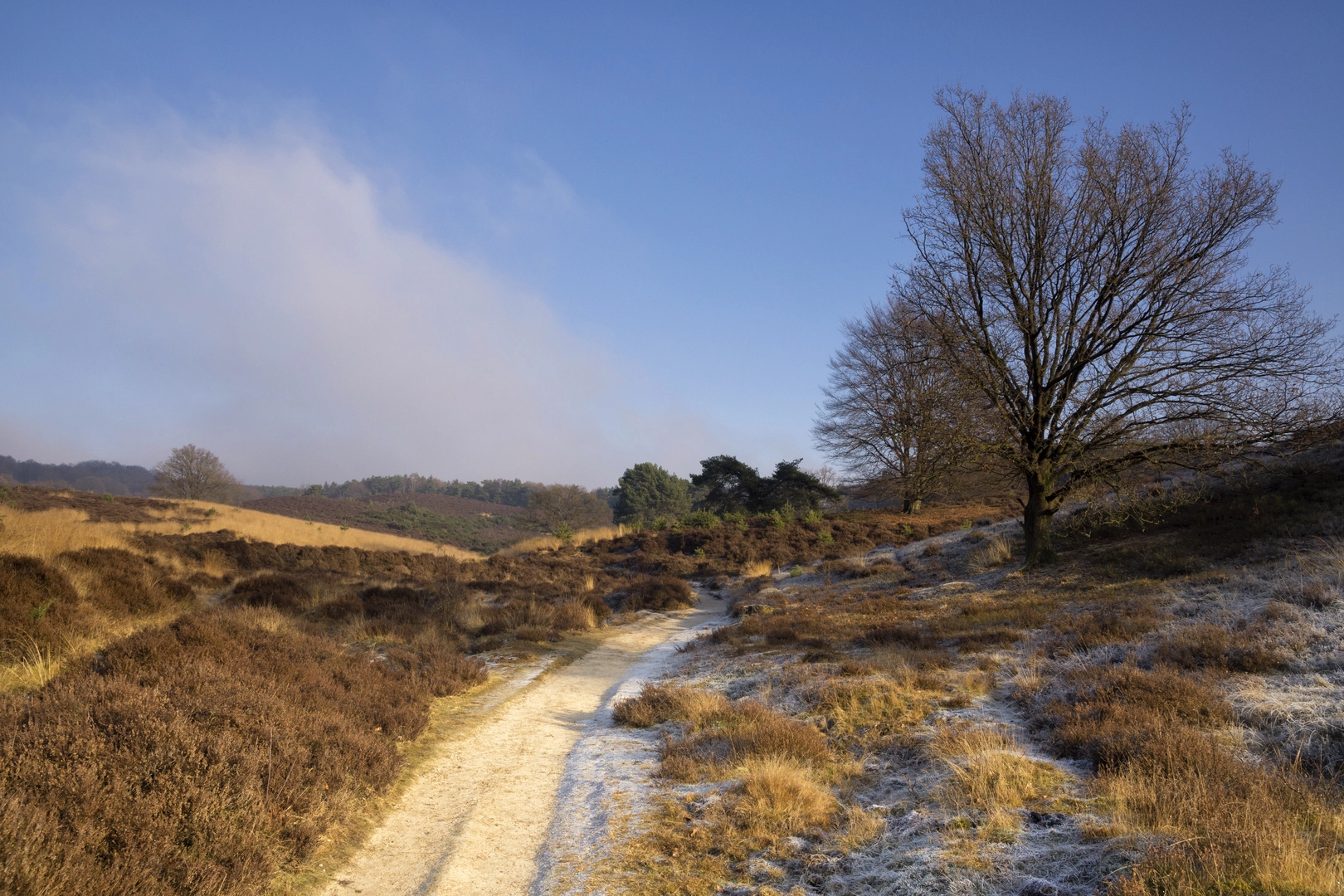
You’ll be walking a big, rolling circuit on the southern Veluwe that stitches together three very different landscapes—open heath on the Rozendaalsche Veld, a higher sandy ridge around Beerenberg, and the broad, wind-swept Herikhuizerveld—with long forest connectors in between. At around 30 km / 18.6 mi with roughly 300 m / 985 ft of total ascent, it’s more of an endurance day than a steep one: the climbs are short and frequent, and the “effort” comes from distance, sand, and exposure on the heaths.
Where the hike starts (nearest landmark / address)
A practical start for this loop is by the iconic fire lookout tower on the Rozendaalsche Veld, a well-known trail landmark and common meeting point:
- Brandtoren Rozendaalse Veld (Fire Tower), near the junction of Brandtorenweg and Koningsweg, Rozendaal (near Arnhem/Velp), Gelderland. (gelderlander.nl)
This is also where you’ll get immediate open views and a clear sense of wind and weather before committing to the longer heath sections.
Getting there (car + public transport)
By car - Navigate to the Brandtoren Rozendaalse Veld area (Rozendaal). Parking is typically along/near the access road by the tower area; arrive early on weekends and during heather bloom season because this part of the Veluwezoom draws heavy foot traffic.
By public transport - The closest rail hubs are Arnhem and Velp (both have frequent connections). From there, you’ll usually need a bus/taxi plus a short walk, or a longer approach walk to reach the fire tower area. If you want, tell me which station you’re coming from (Arnhem Centraal vs. Velp) and I’ll outline the most straightforward approach walk to the start and where to pick up the loop cleanly.
What the terrain feels like over 30 km
Expect a repeating pattern: - Heath and open sand: springy heather, sandy singletrack, and occasional wide, pale sand paths that can feel slow underfoot. - Pine and mixed woodland: faster, shaded walking on compact forest tracks. - Short “Veluwe” climbs: little rises and dips rather than sustained ascents—enough to add up to ~300 m / 985 ft over the day.
Because the route is estimated “Easy,” the technical difficulty is low (no scrambling), but plan it like a full-day hike: 30 km / 18.6 mi is long enough that pacing, food, and foot care matter.
Key sections and what to expect
1) Rozendaalsche Veld: open heath, big sky, and the fire tower
Early on you’ll be on open heathland with broad views and a sense of space that’s rare in the Netherlands. The fire tower is more than a landmark—it’s a piece of 20th-century Veluwe history. It was built for wildfire detection and is notable as the last surviving fire tower of a larger network that once stood across the Veluwe; it has been recognized for its heritage value. (gelderlander.nl)
Underfoot & hazards
- After rain, don’t be surprised by unexpected wet patches on what looks like “dry high ground.” Parts of the Rozendaalsche Veld sit over less-permeable layers, so water can perch near the surface and create soggy stretches. (landschaplopen.com)
- In dry spells, the same area can turn to loose sand, which increases fatigue and can aggravate hot spots on feet.
Distance cue - If you’re starting at the tower, you’ll likely spend the first 3–6 km / 1.9–3.7 mi weaving between heath and forest edge before the loop commits to longer woodland connectors.
2) Beerenberg area: gentle ridge walking and quiet forest miles
“Beerenberg” here refers to a local Veluwe high point/ridge area (not the Arctic volcano with the same name). In this part of the loop, the feel is typically more enclosed: pine stands, sandy lanes, and occasional openings where the land rolls away in shallow valleys.
What to look for - Subtle relief: the Veluwe’s “hills” are modest, but you’ll notice the cumulative up-and-down in your legs over a long day. - Erosion features and cut-through gullies can appear

Surfaces
Concrete
Asphalt
Unknown
Ground
Unpaved
Dirt
Gravel
Comments and Reviews
User comments, reviews and discussions about the Rozendaalsche Veld, Beerenberg and Herikhuizerveld Loop, Netherlands.
average rating out of 5
0 rating(s)