Download
Preview
Add to list
More
20.5 km
~4 hrs 19 min
134 m
Loop
“Follow wide, sandy paths through Veluwezoom’s big-sky heaths and quiet woods, with only gentle rises.”
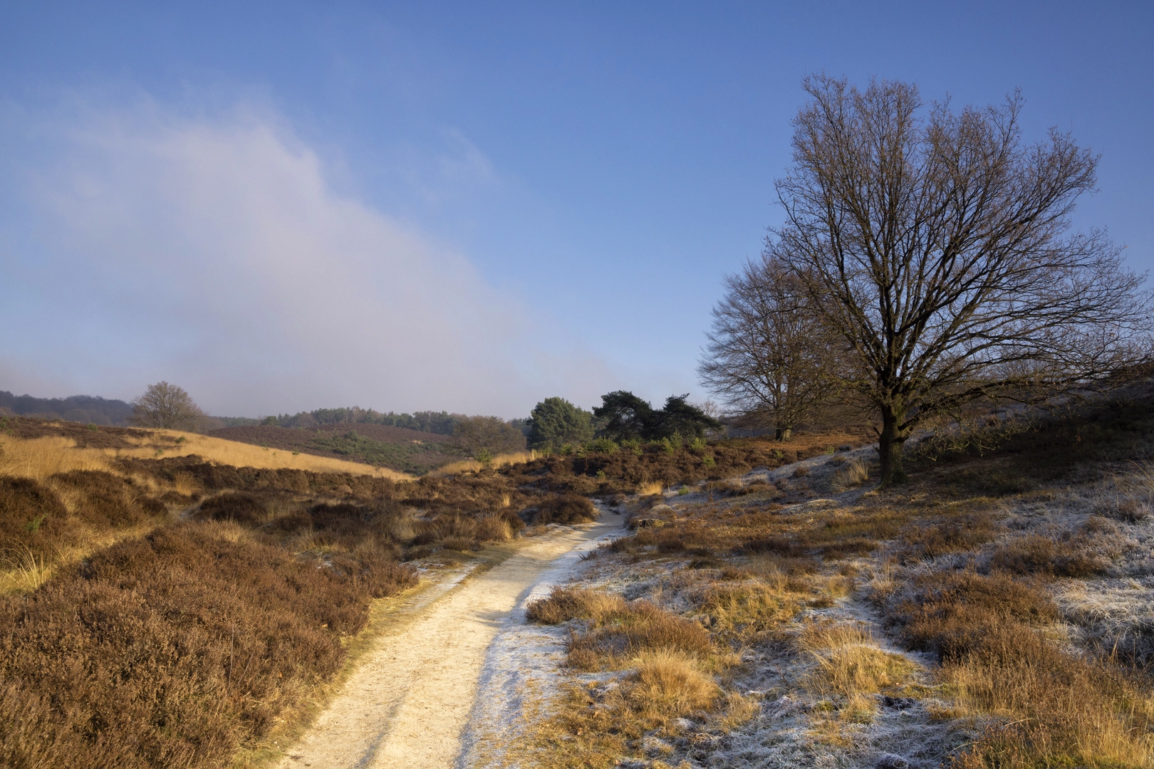
This easy, mostly level loop of about 20 km (12.4 mi) with roughly 100 m (330 ft) of total climbing is a classic “big-sky” walk through the open heathlands and wooded edges of the eastern Netherlands, linking Herikhuizerveld, Worth-Rhederheid, and the Tafelberg area. Expect wide, well-made paths, long sightlines, and only short, gentle rises—more about steady distance than steep effort.
Getting to the start (car + public transport)
Because the start point is listed only as “near,” the most practical way to plan is to anchor your start at the most obvious access hub for this loop: the Posbank / Rheden–De Steeg side of Nationaal Park Veluwezoom (common trailheads and parking areas sit along the Veluwezoom escarpment and heath access points).
- By car: Aim for a main Veluwezoom access point such as the Posbank area near Rheden/De Steeg (a well-known landmark and common place to begin longer loops that touch the surrounding heaths and wooded ridges). Arrive early on weekends and fair-weather days—this region is popular and parking can fill quickly.
- By public transport: The easiest rail access is typically via Rheden (or nearby towns on the Arnhem–Zutphen corridor). From the station area, local buses and/or a short taxi ride can get you close to the heath access points; from there you can walk to your chosen trailhead. When you build your route in HiiKER, set the start at a known Veluwezoom access point (e.g., Posbank/Rheden area) so the app can give you a clean, navigable start pin and turn-by-turn guidance.
If you share the exact start coordinates (or the GPX), I can convert them to the nearest specific landmark/parking area and tailor the directions precisely.
What the terrain feels like (and why it’s “easy”)
Most of the loop rolls across sandy tracks, compacted forest paths, and heathland trails. The ~100 m (330 ft) of gain is typically spread out in small increments—short rises onto slightly higher ground and gentle undulations along the Veluwezoom landscape rather than any sustained climb. Footing is generally straightforward, though you can encounter: - Loose sand in drier stretches (slows pace a bit) - Muddy patches after rain, especially where forest tracks collect water - Heathland singletrack that can narrow and feel more exposed to wind and sun
Plan on 4.5–6 hours moving time for most hikers depending on pace, stops, and surface conditions.
Route flow and key sections (with approximate distances)
0–4 km (0–2.5 mi): Settling in through woodland edges and open heath
The opening kilometers usually alternate between tree cover and open heath, a hallmark of this area. You’ll likely start on broader tracks that make navigation simple, then transition onto more open terrain where junctions can look similar. This is where keeping HiiKER handy helps—heathland intersections can be deceptively uniform.
4–10 km (2.5–6.2 mi): Herikhuizerveld and the wide heath panoramas
Herikhuizerveld is known for its open, airy heath character—expect big horizons, low vegetation, and a sense of space. In late summer, heather can color the landscape; in other seasons it’s more muted but still striking. This section is typically the most “exposed” part of the day:
- Bring a wind layer even when it’s mild elsewhere.
- In sunny weather, there’s less shade—carry enough water and consider sun protection.
10–15 km (6.2–9.3 mi): Worth-Rhederheid and quieter, wilder-feeling stretches
As you arc toward Worth-Rhederheid, the loop often feels more secluded. You may pass through a mix of heath, scrub, and forest margins, with occasional sandy clearings. This is a good place to slow down and scan:
- Roe deer are common at the edges of woodland and open heath.
- Foxes are possible, usually at a distance.
- Birdlife can be excellent—listen for woodland species as you re-enter tree cover and watch for raptors over open ground.
15–20 km (9.3–12.4 mi): Tafelberg area and the gentle return
The Tafelberg portion typically brings you onto slightly higher or more defined ground (still modest in elevation terms), then funnels you back via forest tracks and heath edges. The final kilometers are usually fast underfoot—good surfaces, mild gradients, and a satisfying “cruising” finish.
Landmarks, nature, and what to look out for
- Heathland ecology: Heath is a managed landscape; you may notice transitions between open heather, grassier patches, and young scrub. These shifts often reflect conservation work and grazing/maintenance patterns.
- Forest–heath boundary: This edge habitat is where wildlife sightings are most likely—pause quietly and look along the boundary rather than straight into the trees.
- Sandy soils: The Veluwe region is shaped by ancient sandy deposits; you’ll feel it underfoot in softer sections and see it in pale tracks and small eroded edges.
Historical significance of the region
This part of the Netherlands has a long relationship with heathland use—historically tied to grazing, turf cutting, and land management practices that maintained open heaths rather than allowing full forest regrowth.

Surfaces
Unknown
Sand
Ground
Unpaved
Asphalt
Concrete
Dirt
Grass
Paved
Gravel
Comments and Reviews
User comments, reviews and discussions about the Herikhuizerveld, Worth Rhederheid and Tafelberg Loop, Netherlands.
average rating out of 5
0 rating(s)