Download
3D Flyover
Add to list
More
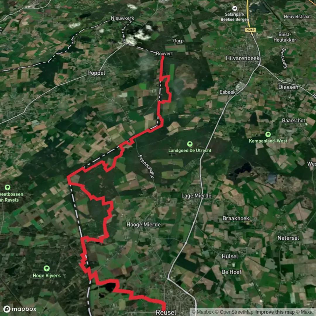
26.3 km
~5 hrs 15 min
0 m
Point-to-Point
“A steady Kempen borderland ramble—quiet lanes, straight forest grids, and Roovertse Leij’s mirror-calm finale.”
This is a long, flat, cross-border-feeling walk through the Kempen/De Kempen landscape: quiet lanes out of Reusel, long stretches of woodland and heath-edge paths, and a finish near the wide, reflective waters of the Roovertse Leij and the estates around Roovert. At roughly 26 km (16.2 mi) with about 0 m (0 ft) of climbing, it’s more about steady pacing, foot comfort, and staying oriented at the many similar-looking forest junctions than about fitness or elevation.
Getting to the start (Reusel area)
By car - Aim for Reusel (North Brabant, Netherlands) town center. The most practical “known landmark” start area for a long-distance route like the Grenslandpad is typically near Reusel’s central facilities (church/square area) where parking and services are easiest to find. In Reusel, look around the village center near the main church and shops for public parking; from there you can pick up signed long-distance footpath markers.
By public transport - Reusel doesn’t have its own train station; most visitors come via a nearby rail hub and then a bus. - Common approaches are: - Train to Eindhoven (major station), then regional bus toward Reusel. - Train to Tilburg (major station), then regional bus toward Reusel. - Once in Reusel, you’ll want to start with full water and snacks—services thin out quickly once you leave the village edge.
If you’re planning point-to-point logistics, it’s worth checking bus timing for your return from the finish area (near Roovert/Hilvarenbeek) before you commit—some rural lines run less frequently outside commuting hours.
You’ll begin on the settled edge of Reusel—brick homes, small farms, and hedged lanes—before the route quickly becomes “Kempen classic”: sandy soils, straight forestry tracks, and patches of heath and wet woodland. The walking is easy underfoot most of the time, but expect a mix of: - compacted dirt and forest road, - short paved connectors through hamlets, - occasional sandy stretches that can feel slower in dry weather.
Because the elevation is essentially flat, the main physical challenge is duration. Many hikers find 26 km (16.2 mi) comfortable if they plan 5.5–7 hours of moving time depending on pace and breaks.
What the landscape feels like (and why it looks this way)
This region sits in the broader Kempen area—historically a mosaic of heath, common grazing land, and later large-scale forestry and reclamation. The long straight tracks you’ll see are a hallmark of managed woodland and former production forests. The “borderland” character of the Grenslandpad reflects centuries of shifting jurisdictions and local land use patterns along the Netherlands–Belgium frontier, where smuggling stories and boundary quirks are part of local folklore even when the modern border is now seamless to cross on foot.
Route flow and pacing (with approximate distances)
0–5 km (0–3.1 mi): Reusel to the rural fringe - You’ll ease out of town on quiet streets and field lanes. Expect open views across pasture and arable land, with drainage ditches and windbreaks. - Good place to settle into a sustainable pace and check footwear—flat routes can still punish feet if socks/shoes aren’t dialed in.
5–15 km (3.1–9.3 mi): Forest grids, heathy edges, and long straight tracks - The route typically threads into larger woodland blocks where junctions can look repetitive. This is where people most often drift off-route by taking the “right-looking” track instead of the correct one. - Use HiiKER to confirm turns at multi-track intersections, especially where two broad forestry roads meet at shallow angles. - Wildlife is often most visible here: roe deer, hares, and a lot of birdlife (woodpeckers, jays, and buzzards are common in these mixed woods). In warmer months, you’ll also notice butterflies along sunny track edges and dragonflies near wetter pockets.
15–22 km (9.3–13.7 mi): Quieter nature corridors and wetter ground - As you approach the Roovert area, the terrain often becomes subtly damper—more alder/willow feel in places, and the path may run near small streams or low-lying meadows. - After rain, watch for muddy ruts and standing water on the most-used tracks. Waterproof shoes aren’t mandatory in dry spells, but they’re helpful in wet seasons.
22–26 km (13.7–16.2 mi): Roovert approach—water, estates, and a calmer finish - The final kilometers tend to feel more “destination-like,” with water features and a more parkland/estate character depending on the exact alignment. - The Roovert area is known for its natural setting around the Roovertse Leij (a small river/stream system) and nearby managed nature lands. Expect reflective water, reed edges, and a cooler, shaded feel near the banks.
Landmarks, nature, and what to look out for
Borderland route character - Even when you don’t obviously “cross” anything dramatic, the Grenslandpad’s identity is tied to the frontier landscape: old lanes, straightened forestry lines, and the sense of moving between villages that historically oriented themselves as much to nearby Belgian settlements as to Dutch ones.
Woodland and heath ecology - Sandy Kempen soils support heathland remnants and pine/oak woodland. Where the canopy opens, look for heather patches and

Surfaces
Unknown
Dirt
Sand
Unpaved
Asphalt
Grass
Ground
Comments and Reviews
User comments, reviews and discussions about the Reusel to Roovert via Grenslandpad, Netherlands.
average rating out of 5
0 rating(s)