Download
3D Flyover
Add to list
More
17.8 km
~3 hrs 35 min
21 m
Loop
“Wander gently beneath Veluwe’s dancing trees, where shadowy beeches and bright clearings soothe unhurried feet.”
This is a relaxed, mostly flat Veluwe forest circuit of about 18 km (11.2 mi) with roughly 0 m (0 ft) of sustained climbing—more “gentle undulation” than true elevation gain. You’ll spend most of the day under tall woodland canopy in the Sprielderbosch and Speulderbosch, two of the Netherlands’ best-known old forest areas, with long straight forestry tracks mixed with narrower, more atmospheric paths through older stands.
A practical, easy-to-find place to aim for at the hike start is the Veluwe Startpunt Speulderbos, Sprielderweg, 6711 JC Drie (near the hamlet of Drie), which is specifically set up as a trailhead/parking start location. (veluwe.nl)
If your route version begins closer to Putten, another common nearby landmark is Buitenplaats Sprielderbosch, Hoorneweg 17B, 3881 NK Putten. (sprielderbosch.nl)
Getting to the start (car + public transport)
By car:
- For the Drie trailhead: navigate to Sprielderweg, 6711 JC Drie (Veluwe Startpunt Speulderbos). It’s a straightforward rural approach from the Ermelo/Speuld/Garderen side, and it’s designed as a visitor starting point with information panels. (veluwe.nl)
- If you prefer to start nearer Garderen facilities, the Speulderbosweg corridor has multiple large, easy navigation anchors like Bilderberg Hotel ’t Speulderbos, Speulderbosweg 54, 3886 AP Garderen and Park Het Speulderbos, Speulderbosweg 57, 3886 AN Garderen—useful for meeting points and nearby parking options. (bilderberg.nl)
By public transport:
This part of the Veluwe is rural, so public transport usually means train to a larger town (often Putten/Ermelo area) and then a bus + short walk or a taxi to Drie/Garderen trailheads. If you’re planning a transit-only day, check the exact stop-to-trailhead walking distance in HiiKER before you commit, because the last few kilometers can be the difference between an 18 km (11.2 mi) hike and a 22 km (13.7 mi) day.
What the walk feels like, kilometer by kilometer
- 0–4 km (0–2.5 mi): settling into the Veluwe woods
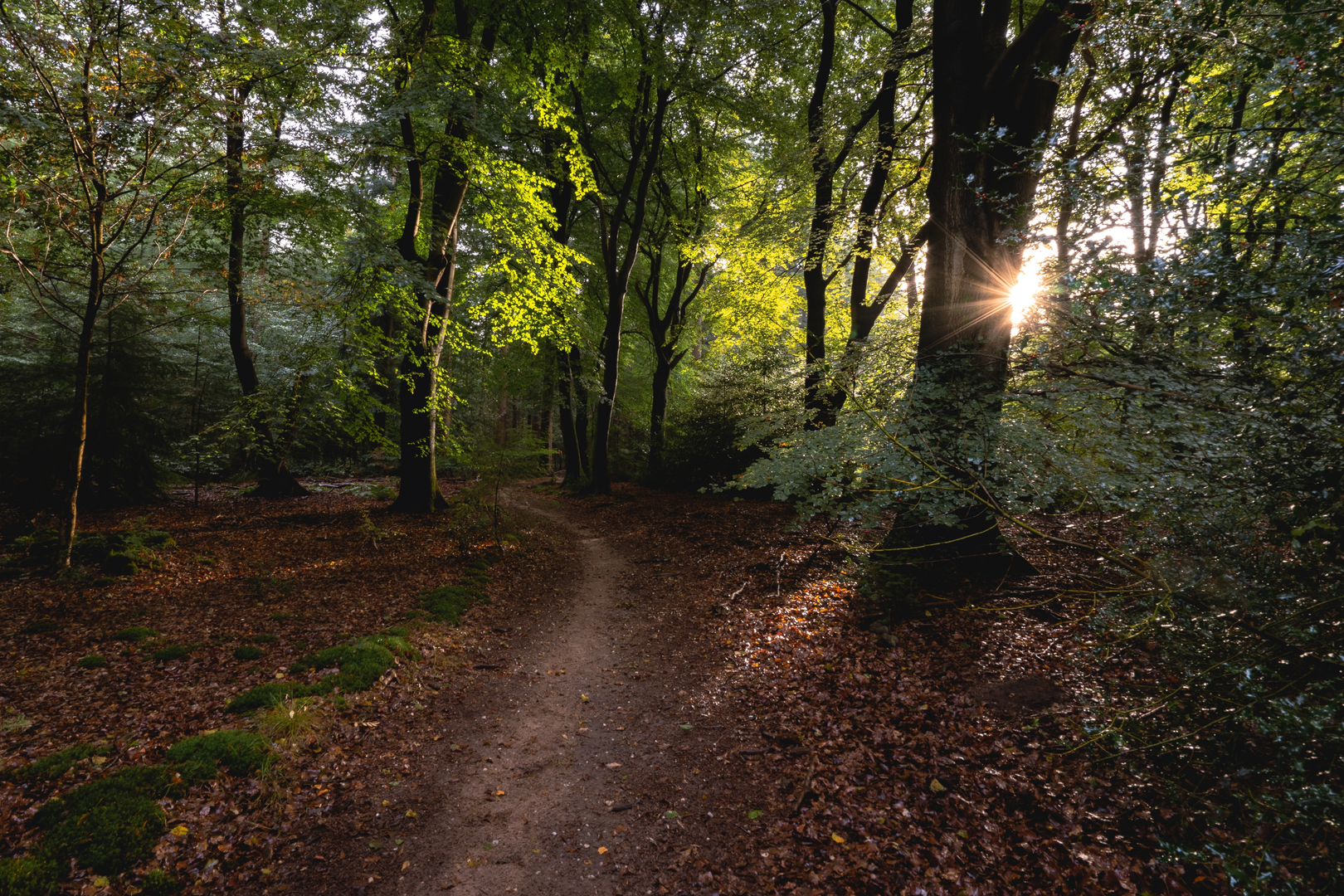
Expect wide, forgiving surfaces—packed sand, firm dirt, and forest road—ideal for an “Easy” rating. The forest here is famous for its character: in parts of the Speulder- and Sprielderbos you’ll notice crooked, twisting trunks that give the area its “dancing trees” reputation. (en.veluwespecialist.nl)
Even though the route is flat overall, the ground can be subtly uneven with roots and soft patches—especially after rain.
4–10 km (2.5–6.2 mi): deeper forest + older stands
This is where the hike becomes more atmospheric. The Speulderbos is known for old beech forest and a more “reserve-like” feel in places, including standing and fallen dead wood as older trees decay—beautiful, but it’s also a reason to stay alert in windier conditions (dead branches can drop). (forestgeo.si.edu)
Tree species you’re likely to recognize along the way include beech, oak, and planted conifers such as Scots pine, with some introduced species present in the broader forest mosaic. (forestgeo.si.edu)10–14 km (6.2–8.7 mi): clearings, long sightlines, and “Veluwe scale”
Many versions of this loop brush the edges of more open Veluwe landscapes (heath/fields) before returning to forest. If your track swings toward Drie, you may pass close to places where the forest feels “higher and lighter,” then drops back into darker beech stands.14–18 km (8.7–11.2 mi): returning through the dancing trees zone
The final stretch is typically easy cruising on broad tracks—great for steady pacing. If you’re

Surfaces
Unknown
Sand
Ground
Concrete
Gravel
Unpaved
Asphalt
Dirt
Comments and Reviews
User comments, reviews and discussions about the Sprielderbosch, Speulderbosch and Bezoekerscentrum Loop, Netherlands.
average rating out of 5
0 rating(s)