Download
3D Flyover
Add to list
More
5.3 km
~1 hrs 3 min
0 m
Loop
“Breathe in Noordwijk’s big-sky coast—easy-going dunes and surf, unless soft sand tests you.”
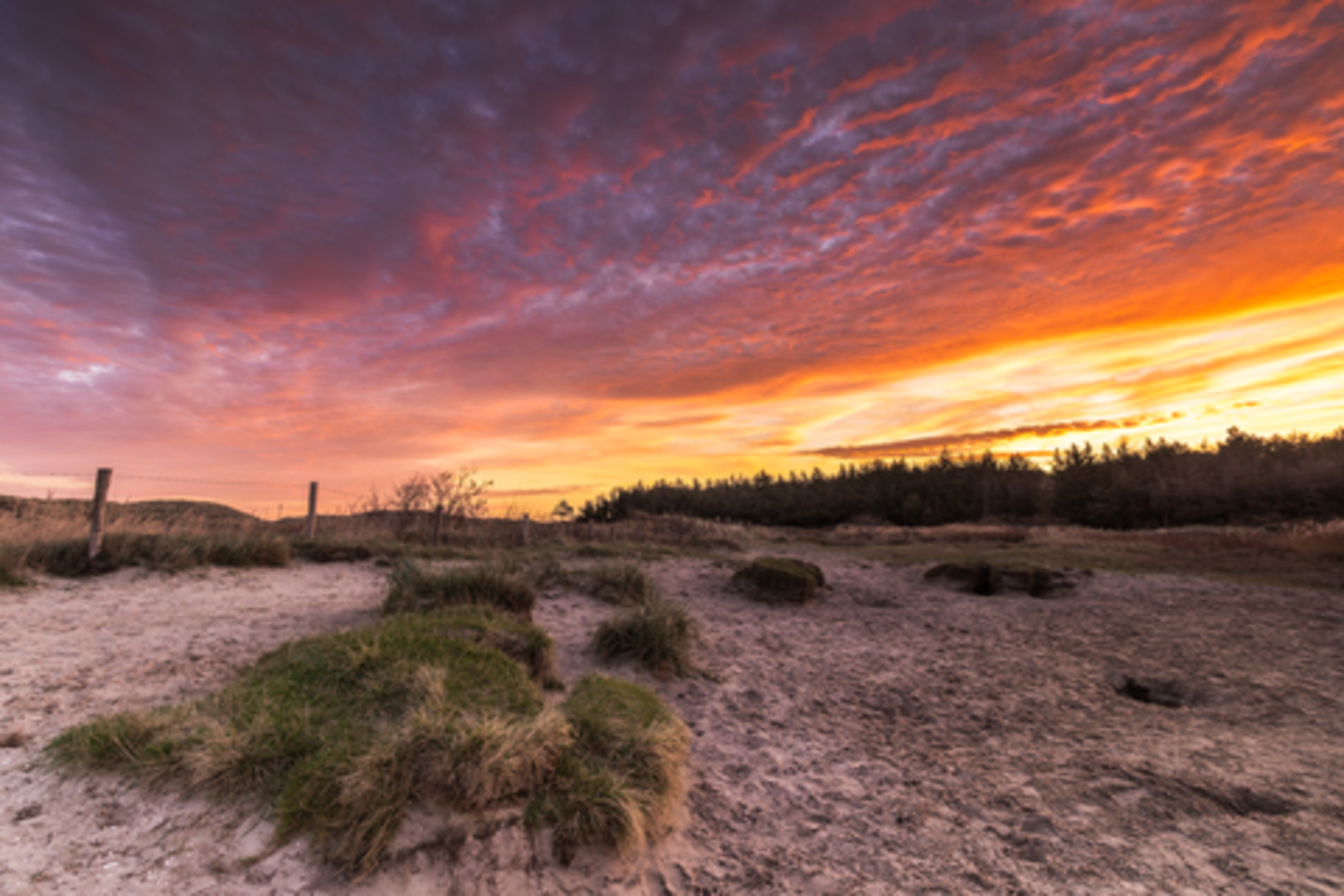
A relaxed, mostly level coastal loop of about 5 km / 3.1 mi with essentially 0 m / 0 ft of climbing, set in the Hollands Duin landscape around Noordwijk: wide beach, wind-shaped dunes, and sheltered dune scrub/woodland pockets. Expect an “easy” effort on paper, but with one variable that can change everything—sand. Firm, damp sand near the waterline feels effortless; soft, dry sand in the upper beach and dune paths can feel surprisingly tiring.
Getting to the start (car + public transport)
By public transport: Noordwijk doesn’t have its own train station; most visitors come via Leiden Centraal and continue by bus. The Noordwijk tourism site notes you can reach Noordwijk aan Zee from Leiden Central Station by bus 20 in about 30 minutes, and from Sassenheim or Voorhout by bus 385 (roughly 15–20 minutes depending on the station). (noordwijk.info)
From the seaside bus stops (often around Vuurtorenplein / Palaceplein), it’s typically a short walk to beach access points and dune entrances.
By car: Noordwijk aan Zee has multiple paid parking areas near the promenade/beach, and the municipality also promotes seasonal park-and-ride style options. In summer periods, Noordwijk has run a free Beach Shuttle with a departure car park at Van Berckelweg 32 (Koninklijke Beuk) and stops near Vuurtorenplein and Palaceplein—useful if you want to avoid the busiest beachfront parking. (Service is seasonal and schedule-dependent.) (noordwijk.nl)
If you’re building the route in HiiKER, set your start near the Noordwijk aan Zee beachfront access around Vuurtorenplein / Palaceplein (promenade area) and keep the loop tight to stay near facilities.
What the loop feels like underfoot
You’ll usually alternate between: - Promenade/firm paths near the built-up beachfront (easy walking, good for warming up). - Beach walking (best on the darker, damp sand closer to the waterline; avoid the soft upper beach if you want to keep it truly easy). - Dune tracks (often sandy, sometimes with shell/gravel sections; wind exposure can be significant even on calm days inland).
Because the elevation change is negligible, the “difficulty” comes from wind and sand resistance, not hills.
Landmarks, scenery, and the “Hollands Duin” character
This part of the Zuid-Holland coast is known for a classic Dutch dune-and-sea profile: broad beaches, rolling dunes, and behind them patches of scrub and dune woodland. Noordwijk’s dune areas to the north are noted for varied flora and fauna, and large sections are protected under Natura 2000. (en.wikipedia.org)
Even on a short loop, you’ll get frequent “big sky” views—sea on one side, dune ridges on the other—plus the constant soundscape of surf and wind.
If your loop swings slightly inland into the dune belt, look for: - Marram grass stabilizing the foredunes - Sea buckthorn and other hardy shrubs in the grey-dune zone - Occasional piney shelterbelts where the wind drops and it suddenly feels warmer
Wildlife you might notice
In the Noordwijk dune areas, walkers commonly encounter signs of deer presence (tracks, browsing) and a wide range of coastal birds depending on season—gulls and terns near the surf, and smaller passerines tucked into scrub. Noordwijk’s dune zone is specifically described as having varied flora and fauna, including deer. (en.wikipedia.org)
Keep dogs leashed where required (rules can vary by zone and season), and give wildlife space—especially at dawn/dusk when animals are more active.
Navigation and practical planning (use HiiKER)
This is the kind of terrain where it’s easy to drift onto the “wrong” parallel track because many paths look similar in the dunes. In HiiKER, download the route for offline use and watch for: - Beach access points (you want one that lines up with your intended return into the dunes) - Parallel dune paths (choose the one that matches your loop direction rather than the most-trodden line) - **Tide and storm

Surfaces
Unknown
Sand
Unpaved
Gravel
Asphalt
Dirt
Wood
Grass
Comments and Reviews
User comments, reviews and discussions about the Het Korfwater Loop, Netherlands.
average rating out of 5
0 rating(s)