Download
3D Flyover
Add to list
More
16.3 km
~3 hrs 15 min
0 m
Loop
“Skim reed-fringed lakes and ruler-flat polders on dike-straight lanes—if the wind cooperates.”
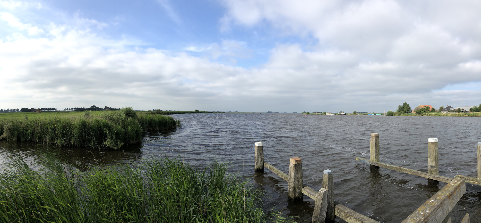
This is a classic Southwest Friesland “brekken & polder” circuit: big open water, ruler-flat pastureland, reed fringes, and long, straight dike roads where the wind is often the main challenge. At roughly 16 km / 10 miles with essentially 0 m / 0 ft of climbing, it’s physically easy, but it rewards a bit of planning—especially around the small ferry crossing and exposed conditions.
Where the hike starts (nearest landmark/address)
A practical start is in Oudega (Súdwest-Fryslân), Netherlands, near the village center by the water and dike roads that lead toward the lake. A commonly used reference point for the area is Aldegeaster Brekken, 8614 AN Oudega SWF. (waterlandvanfriesland.nl)
(If your GPX uses a different trailhead, share the coordinates and I’ll match them to the nearest named place/road.)
Getting to the start (car + public transport)
By car: Oudega (SWF) is a small waterside village in the Frisian lake district. Parking is typically along village streets and near the waterfront/dike roads—arrive a bit early on warm weekends when water-sports traffic increases.
By public transport: The most straightforward approach is usually via Sneek (Sneek station) and then onward by regional bus toward Oudega/Heeg/Gaastmeer. One commonly referenced stop is “Oudega (Swf), Centrum” (bus line information is published by trip-planning services; always verify day/time). (moovitapp.com)
What the route feels like underfoot
Expect a mix of: - Dike-top lanes and narrow rural roads (often paved or hard-packed) - Field-edge paths and reed-lined margins near the lake - Very open terrain with little shelter—sun and wind exposure can be significant
Because the landscape is so flat, the “difficulty” is less about elevation and more about distance, wind, and footing (wet edges, slick grass, and muddy patches after rain).
Route flow and key waypoints (approximate)
Distances vary slightly depending on the exact loop variant, but a typical 16 km / 10 mi day here breaks down well like this:
0.0–4.5 km (0.0–2.8 mi): Oudega → north shore of Aldegeaster Brekken
Leaving the village, you quickly reach the broad water of the Aldegeaster Brekken. The shoreline walking is the highlight early on: wide views across the lake, reed beds, and classic Frisian “waterland” scenery. The north shore is known for a walking/cycling line often referred to as the Brekkenpaad area. (waterlandvanfriesland.nl)
4.5–7.5 km (2.8–4.7 mi): Toward Nijhuizum and the tiny church
As you angle toward Nijhuizum, the landscape becomes even quieter—big skies, scattered farmsteads, and long straight drainage lines. A worthwhile short stop is the Nijhúzumer Tsjerke at Nummer 7, 8775 XD Nijhuizum—widely noted as the smallest church in Friesland, built in 1721 from remnants of an older structure. (friesland.nl)
7.5–8.0 km (4.7–5.0 mi): Ferry crossing over De Grons (critical planning point)
Many loop versions use the small ferry between Nijhuizum and Gaastmeer over De Grons. This is the one part of the day that can make or break your timing. Official municipal info lists seasonal operating windows and the fare (commonly €1.50), with departures from **Grûnspaad (Nijhuizum

Surfaces
Concrete
Unknown
Asphalt
Wood
Paved
Comments and Reviews
User comments, reviews and discussions about the Aldegeaster Brekken and Muntsebuorsterpolder Loop, Netherlands.
average rating out of 5
0 rating(s)