Download
3D Flyover
Add to list
More
24.2 km
~4 hrs 51 min
6 m
Point-to-Point
“A ribbon-thin ramble through Giethoorn’s peatland waters, where wind, bridges, and wet boots shape the day.”
This is a flat, water-shaped walk through the peatland lake district around Giethoorn, where the “land” often feels like a thin ribbon between canals, reed beds, and open water. At roughly 24 km / 15 miles with about 0 m / 0 ft of climbing, the effort is mostly about time on feet, wind exposure, and keeping your feet dry rather than elevation.
Getting to the start (Binnenhof area) and where it is
“Binnenhof” is a common Dutch place-name, so for planning you’ll want to confirm the exact start pin in HiiKER. For this route name and the nearby features (Boonspolder, Giethoornsche Meer, Kerkweg), the practical start area is typically in/near Giethoorn (Overijssel), close to the village core and its canal network.
- By public transport: The usual approach is train to Steenwijk station, then a bus toward Giethoorn (or taxi/bike) to the village area. From there, you can walk to the Binnenhof start point using HiiKER.
- By car: Drive to Giethoorn and use signed public parking areas on the edge of the village (the historic core has limited car access). From parking, it’s a short walk to the start.
If your HiiKER track shows a specific coordinate for “Binnenhof,” share it and I can translate it to the nearest street/address or landmark precisely.
What the terrain feels like (and why it’s so flat)
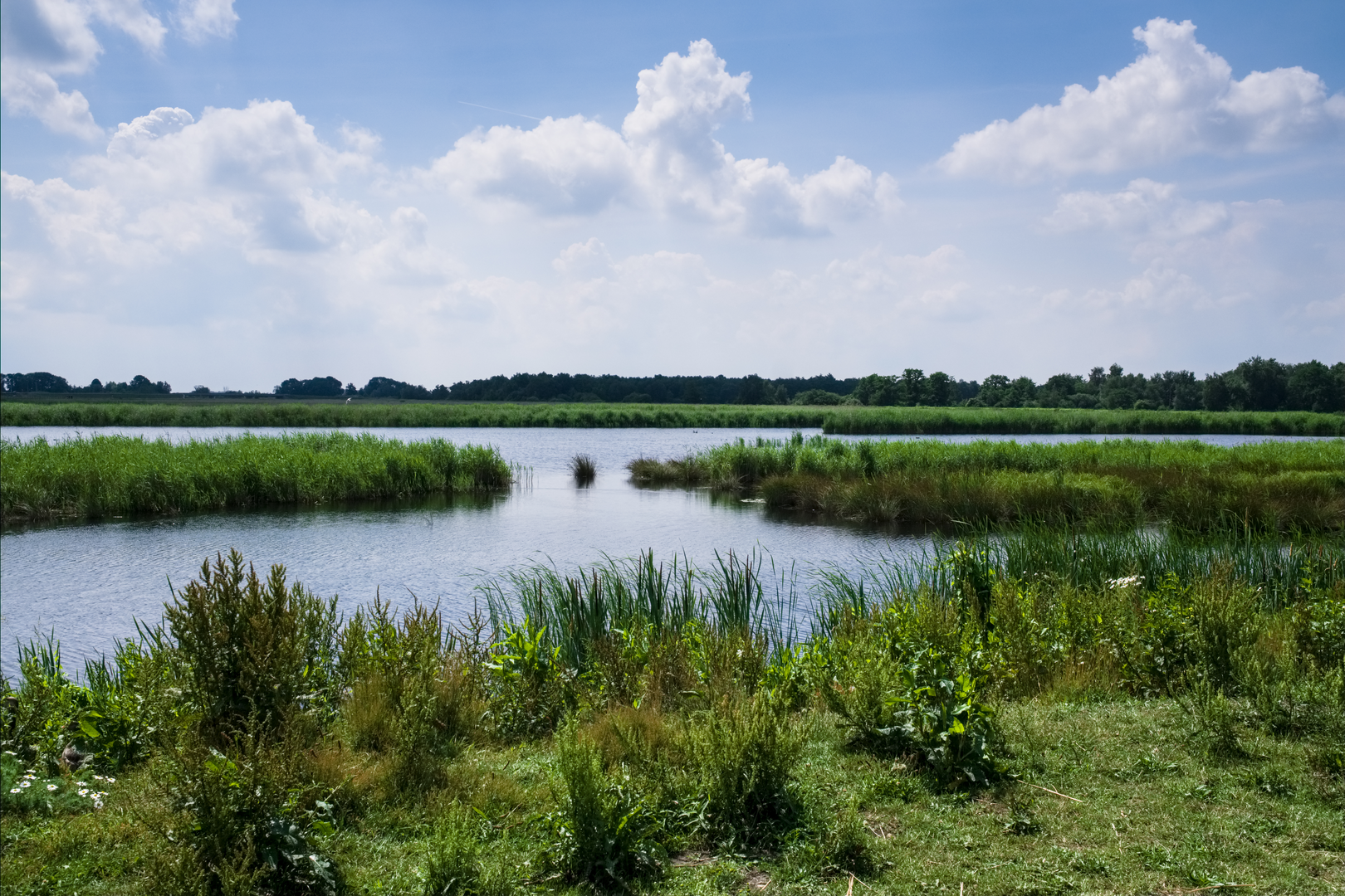
You’re walking in a landscape created by centuries of peat cutting and water management—a patchwork of ditches, canals, reed fields, wet meadows, and shallow lakes. Around Giethoorn and the wider Weerribben–Wieden wetland region, peat extraction historically caused pits to flood and merge into lakes, while reed beds and swampy woodland reclaimed edges over time. That’s why the route can feel like it’s always skirting water, crossing narrow bridges, and following straight, engineered lines that suddenly open into broad, natural-looking water. (nationalparksassociation.org)
On the route: Binnenhof → Boonspolder (approx. 0–8 km / 0–5 mi)
The first third is typically the most “settled”: village edges, small lanes, and waterside paths. Expect: - Firm surfaces (pavement, compacted gravel) mixed with narrow dike-top paths. - Frequent small bridges and canal-side walking, where a slip can mean a wet boot. - In calm weather it’s easy strolling; in wind, exposed stretches can feel surprisingly tiring.
Boonspolder is low-lying polder country—think open horizons, drainage channels, and big skies. Even with no hills, you can feel the Netherlands’ water engineering at work: straight ditches, pumping infrastructure, and fields laid out for drainage.
What to look out for here: - Soft verges: the edge of a path can be undercut by water. - Cyclists: shared paths are common; keep right and stay predictable. - Wind: headwinds across open polder can slow your pace more than you’d expect on an “easy” hike.
Boonspolder → Giethoornsche Meer (approx. 8–17 km / 5–10.5 mi)
This middle section is where the landscape becomes more “wetland” than “village.” As you approach the lake area, the feel shifts to: - Reed beds and wet meadows - Long, straight waterways with occasional wider basins - More birdlife and fewer buildings
Giethoorn sits right by the Weerribben–Wieden wetland system, the Netherlands’ largest freshwater wetland, and the habitats around the lakes and reed fields are especially good for waterbirds and marsh species. (nationalparksassociation.org)
Practical notes: - Footing: even if the path is flat, it can be slick after rain—muddy patches and algae on bridge decking are common near water. - Bugs: in warmer months, mosquitoes and midges can be intense near reeds and still water—pack repellent. - Noise & wake: near popular boating corridors, you may hear boats and see wave action lapping at banks; it can make narrow edges feel less stable.
Giethoornsche Meer → Kerkweg finish (approx. 17–24 km / 10.5–15 mi)
As you arc back toward Giethoorn, you’ll likely re-enter a more built-up waterside environment: canals, footbridges, and the distinctive “water village” character Giethoorn is known for. Historically, parts of Giethoorn were oriented around water transport, with canals and many small bridges linking homes and paths—today it’s a major visitor draw. (en.wikipedia.org)
“Kerkweg” is a real street name in Giethoorn; a useful navigation anchor is

Surfaces
Concrete
Asphalt
Grass
Unknown
Wood
Ground
Comments and Reviews
User comments, reviews and discussions about the Binnenhof to Kerkweg via Boonspolder and Giethoornsche Meer, Netherlands.
average rating out of 5
0 rating(s)