Download
3D Flyover
Add to list
More
21.7 km
~4 hrs 27 min
72 m
Loop
“Wander through blooming heath, ancient woods, and serene lakes, where history and wildlife quietly intertwine.”
Starting from the edge of Leersum, near the well-known Leersumse Plassen parking area, this 22 km (about 13.7 miles) loop offers a gentle elevation gain of around 100 metres (328 feet), making it accessible for most hikers. The trail is well-marked and can be easily navigated using HiiKER, which is recommended for up-to-date route information and wayfinding.
Getting There
For those arriving by public transport, take the train to Veenendaal or Driebergen-Zeist stations. From either station, regular buses connect to Leersum, with a stop at Leersumse Plassen or the village centre, both within walking distance of the trailhead. If driving, parking is available at the Leersumse Plassen car park, located just off the N226, which is clearly signposted from the main road.
Trail Overview and Key Sections
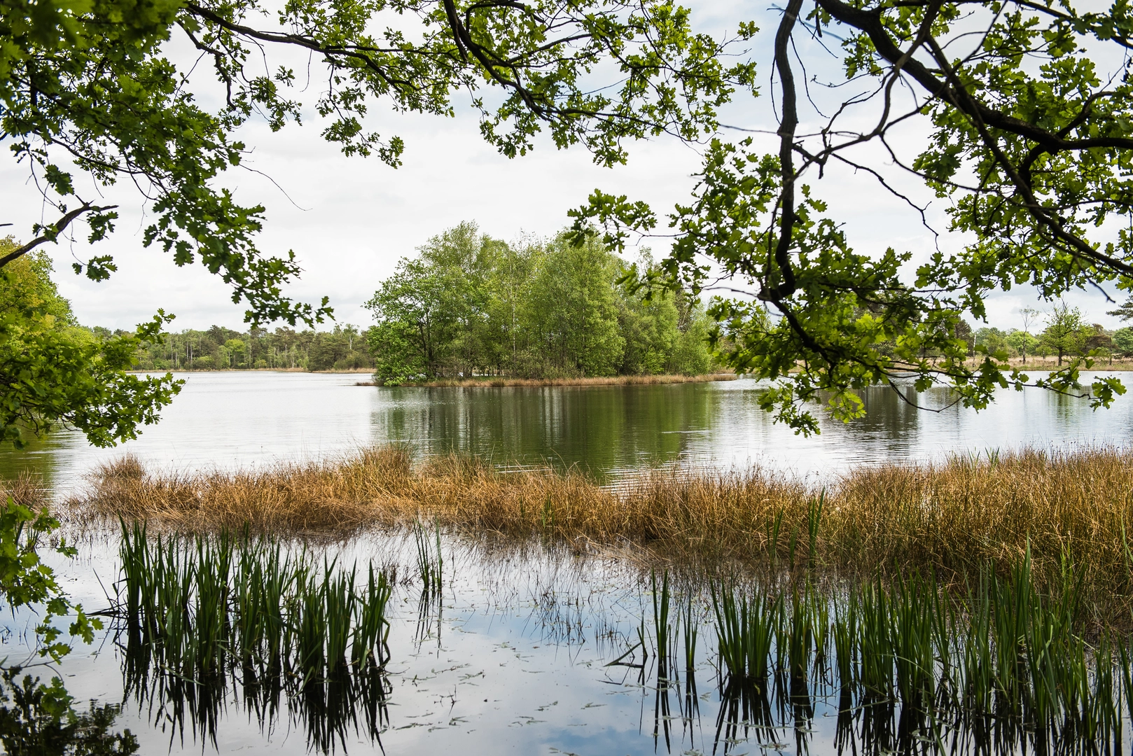
The route begins by skirting the tranquil Leersumse Plassen, a series of serene lakes formed in the 19th century as peat extraction sites. Early in the hike, expect to see waterfowl such as grebes and herons, especially in the morning when the area is quiet. The path meanders through mixed woodland, with Scots pine, oak, and beech providing a shaded canopy.
De Hoge Ginkel and Leersumsche Plassen (0–7 km / 0–4.3 miles)
The first section leads through De Hoge Ginkel, a nature reserve known for its open heathland and scattered juniper bushes. In late summer, the heath blooms with purple heather, attracting butterflies and bees. The terrain here is mostly flat, with sandy paths and occasional boardwalks over wetter ground. Keep an eye out for roe deer and, if you’re lucky, the rare sand lizard basking on sunny patches.
Geerenberg and De Keienberg (7–16 km / 4.3–10 miles)
As the trail ascends gently towards Geerenberg, you’ll notice the landscape shift to higher ground with more pronounced undulations. This area is part of the Utrechtse Heuvelrug, a ridge formed during the last Ice Age, and offers some of the best viewpoints over the surrounding forests and fields. The summit of Geerenberg, though modest at just over 50 metres (164 feet), provides a peaceful spot for a break. Descending towards De Keienberg, the path passes through ancient woodland, where you might spot woodpeckers and hear the calls of nuthatches.
Historical Significance and Landmarks
The region is steeped in history, with remnants of old estates and boundary stones marking former land divisions. Near the midpoint, look for the remains of old field systems and the occasional information board detailing the area’s use as farmland and hunting grounds for local nobility. The Leersumse Plassen themselves are a testament to the area’s industrial past, now reclaimed by nature.
Final Stretch and Return (16–22 km / 10–13.7 miles)
The last section loops back towards Leersum, passing through a mosaic of heath, woodland, and small meadows. In spring and autumn, migratory birds can be seen resting in the open areas. The path is generally wide and well-maintained, with only minor muddy patches after rain. Facilities are limited along the route, so bring sufficient water and snacks.
Preparation and Safety
Given the easy rating and modest elevation, this loop is suitable for most fitness levels, but sturdy footwear is recommended due to occasional sandy or uneven sections. Weather can change quickly, so pack a light rain jacket. Dogs are allowed on most parts of the trail but must be kept on a leash in nature reserves. For navigation, HiiKER provides reliable mapping and trail updates.
This loop offers a varied landscape, rich wildlife, and a glimpse into the cultural history of the Utrechtse Heuvelrug, making it a rewarding day out for nature lovers and history enthusiasts alike.

Surfaces
Unknown
Sand
Dirt
Unpaved
Ground
Gravel
Asphalt
Comments and Reviews
User comments, reviews and discussions about the De Hoge Ginkel, Leersumsche Plassen, Geerenberg and De Keienberg Loop, Netherlands.
average rating out of 5
0 rating(s)