Download
3D Flyover
Add to list
More
6.6 km
~1 hrs 19 min
0 m
Loop
“Stroll beneath ancient willows and past storied fortresses, where riverside meadows burst with life and history.”
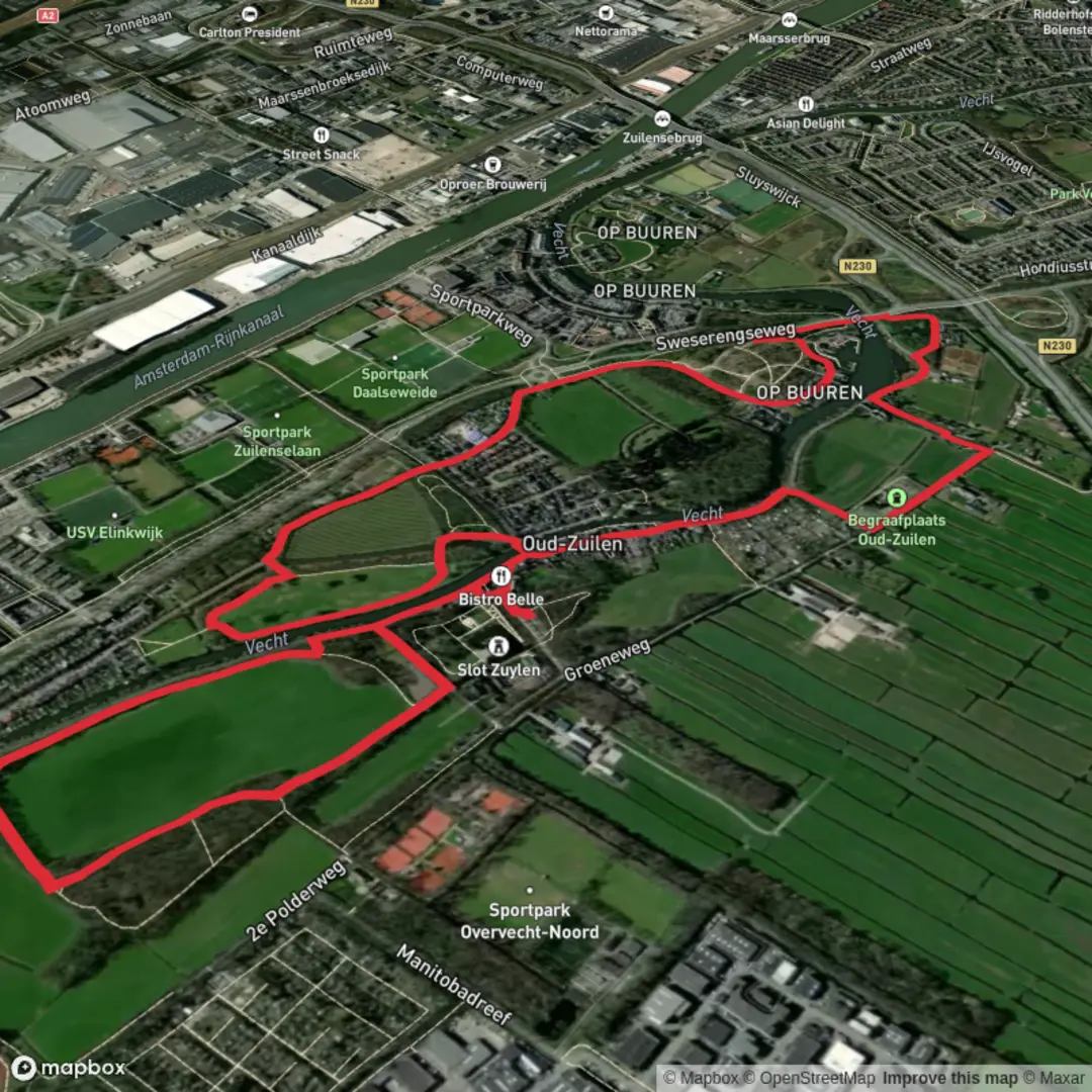
Starting from the outskirts of Utrecht, near the well-known Fort aan de Klop, this 7 km (about 4.3 miles) loop hike offers a flat and accessible route with virtually no elevation gain, making it ideal for beginners or those seeking a leisurely walk. The trailhead is easily reached by public transport—bus lines from Utrecht Centraal stop at Fort aan de Klop, and there is ample parking for those arriving by car.
Navigating the Route
The path follows the scenic banks of the River Vecht, a historic waterway that once played a crucial role in the defense and trade of the region. Using HiiKER for navigation ensures you stay on track, especially as the route weaves through a patchwork of dikes, meadows, and tree-lined avenues. The Daalse Weg section is particularly charming, with its traditional Dutch farmhouses and views across the open polder landscape.
Highlights and Landmarks
At approximately 2 km (1.2 miles) into the hike, you’ll pass close to Fort aan de Klop, a 19th-century fortress that is part of the New Dutch Waterline—a UNESCO World Heritage site. This fortification system was designed to flood large areas to protect the city of Utrecht from invaders. The fort itself is now a cultural venue with a café, making it a pleasant spot for a break.
Continuing along the Waterliniepad, the trail offers glimpses of the Vecht’s tranquil waters, where swans, herons, and other waterfowl are commonly seen. In spring and summer, the meadows are alive with wildflowers and butterflies. The route is also dotted with small bridges and sluices, reminders of the region’s centuries-old relationship with water management.
Nature and Wildlife
The flat, open terrain is home to a variety of birdlife, especially in the early morning or late afternoon. Look out for kingfishers darting along the riverbanks and, in quieter stretches, roe deer grazing at the edge of the fields. The area is also known for its ancient willow trees, some of which are over a century old and provide habitat for woodpeckers and owls.
Historical Significance
The Waterliniepad section of the hike traces part of the New Dutch Waterline, a defensive system built between the 17th and 19th centuries. Information panels along the route explain how the landscape was engineered to be flooded in times of war, turning fields into impassable wetlands. The proximity to Utrecht means you’re walking through a landscape shaped by both military necessity and agricultural tradition.
Getting There
To reach the starting point at Fort aan de Klop, take a bus from Utrecht Centraal Station—several lines serve this area, with stops within a short walk of the fort. For drivers, the fort is located just off the N230 ring road, with parking available on-site or nearby. The trail is well-marked, but using HiiKER will help you follow the loop precisely and discover points of interest along the way.
This easy, flat loop is perfect for a half-day outing, offering a blend of Dutch history, riverside scenery, and abundant wildlife, all within easy reach of Utrecht.

Surfaces
Asphalt
Unknown
Dirt
Grass
Unpaved
Cobblestone
Paved
Comments and Reviews
User comments, reviews and discussions about the Vecht Loop via Daalse Weg and Waterliniepad, Netherlands.
average rating out of 5
0 rating(s)