Download
3D Flyover
Add to list
More
8.7 km
~1 hrs 43 min
0 m
Loop
“Drift through big-sky fields to reed-fringed ponds, with easy paths that may turn muddy.”
A gentle, mostly level loop of about 9 km (5.6 miles) with roughly 0 m (0 ft) of climbing, this walk is ideal for an easy half-day outing. Expect a mix of quiet lanes, wide farm tracks, and waterside paths around small ponds and drainage channels typical of lowland countryside. Underfoot is usually firm (gravel, compacted dirt, short grass), but after rain the lowest sections can hold water and turn slick with mud.
Getting to the start (car + public transport)
Because the start point is only listed as “near” and no coordinates were provided, the best approach is to aim for the nearest practical access point once you confirm the exact trailhead on HiiKER:
- By car: Plan to park at a public car park near the nearest village center, church, or sports complex close to the loop shown on HiiKER. In lowland agricultural areas, roadside parking exists but can be narrow—avoid blocking farm gates and field access.
- By public transport: Look for the closest bus stop or local rail station serving the nearest town/village to the loop. From there, it’s typically a short walk (often 0.5–2 km / 0.3–1.2 miles) along local roads to reach the start. Use HiiKER to identify which side of the loop is closest to a stop so you begin without extra road-walking.
If you share the lon/lat (or a HiiKER link), I can convert it to the nearest known address or prominent landmark and tailor the directions precisely.
You’ll likely begin on a quiet access lane or broad track, with open views across flat fields and hedgerows. The first 1–2 km (0.6–1.2 miles) tends to feel very open and airy—big skies, long sightlines, and a sense of spaciousness that’s characteristic of reclaimed or managed lowland landscapes. With essentially no elevation change, pacing is straightforward; the main “effort” comes from wind exposure if the route crosses open farmland.
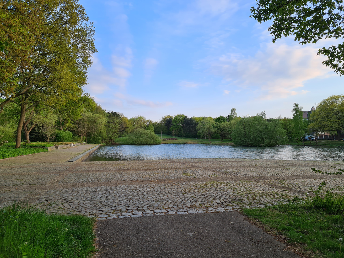
As you approach the Perevijver area (a small pond/lake), the feel often shifts from agricultural to more nature-focused: reeds, willow or alder at the margins, and a cooler, damper microclimate near the water. These pond edges can be a highlight for birdlife—listen for reed-dwelling songbirds and watch for waterfowl moving between open water and cover. In warmer months, insects (including mosquitoes) can be noticeable near still water, especially in the calmer, sheltered corners.
Around the water: Perevijver and wetland edges
The most scenic section is usually the waterside stretch, commonly 2–4 km (1.2–2.5 miles) into the loop depending on where you start. Expect: - Reedbeds and wet margins: Great for wildlife viewing, but the path can narrow and become soft. After wet weather, step carefully where the trail skirts puddles—edges can be undercut. - Bird activity: Early morning and late afternoon are often best for spotting herons/egrets, ducks, coots, and small passerines in the scrub. Bring binoculars if you enjoy birding. - Seasonal hazards: In winter, shaded damp patches can freeze into thin, slick ice even when nearby ground is fine. In summer, sun exposure can be strong on open banks—carry water despite the easy grade.
Leaving the pond area, the route typically transitions back onto straighter tracks and field boundaries. These sections can feel repetitive in the best way—easy navigation, steady footing, and a calm rhythm. If the loop passes any working farmyards, keep dogs leashed and give machinery plenty of space.
Hazenakker area: fields, tracks, and rural heritage
“Hazenakker” suggests an agricultural setting (an “akker” is a field), and this part of the loop often showcases the region’s long relationship with farming and land management. In many lowland European landscapes, the “history” is written into the geometry: straight drainage lines, raised trackbeds, and field patterns shaped by centuries of cultivation and water control. Even without big climbs or dramatic peaks, these routes can be historically significant as examples of how communities engineered livable, productive land—especially where ponds, ditches, and managed waterways are present.
Expect the final 2–3 km (1.2–1.9 miles) to be straightforward, often on wider tracks that make for quick walking back toward the start. Wind can pick up here; a light shell can be useful even on mild days.
Navigation: The loop is generally easy to follow, but lowland trail networks can have frequent junctions with similar-looking farm tracks. Keep HiiKER handy at intersections, especially where multiple parallel tracks run along field edges.
What to pack for an easy, flat 9 km (5.6 mile) loop - Comfortable walking shoes or light hikers; after rain, consider footwear with better mud grip. - A light waterproof layer (weather can change quickly in open country). - Water and a snack—easy terrain still takes time, typically 2–2.5 hours at a relaxed pace with stops. - Sun protection in exposed sections; insect repellent near still water in warm months.
If you provide the start lon/lat (or the nearest town name), I’ll pin it to the closest address/landmark, suggest the most sensible direction to walk the loop (clockwise vs counterclockwise for best scenery), and note any likely gates, bridges, or muddy pinch points along the exact line.

Surfaces
Unknown
Asphalt
Gravel
Unpaved
Sand
Paved
Comments and Reviews
User comments, reviews and discussions about the Perevijver and Hazenakker Loop, Netherlands.
average rating out of 5
0 rating(s)