Download
3D Flyover
Add to list
More
7.3 km
~1 hrs 27 min
0 m
Loop
“A breezy Oosterend loop of dunes and dike-top horizons, where birds and big skies steal the show.”
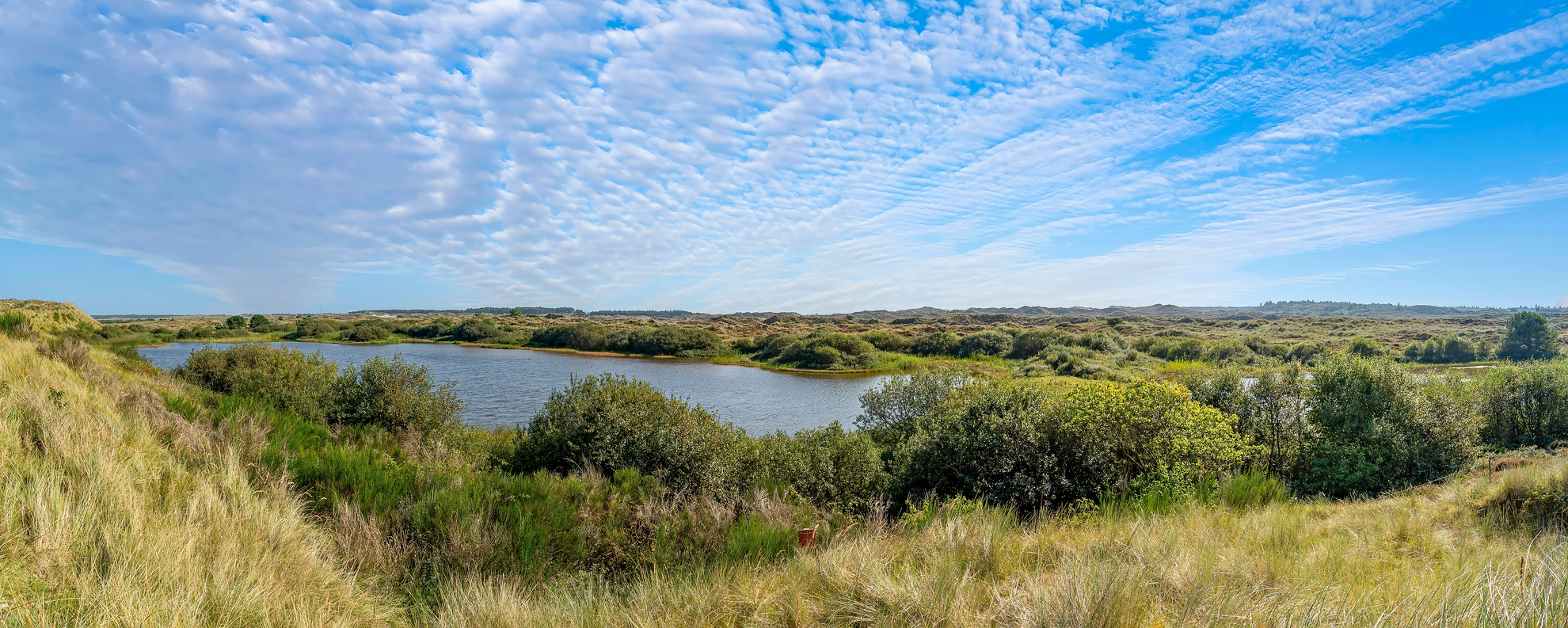
This easy, mostly level loop of about 7 km / 4.3 mi with roughly 0 m / 0 ft of elevation gain is a classic “big-sky” Wadden Islands walk: dunes, dike-top views, and wide-open coastal nature where the weather and wildlife are the main event. The route sits by Oosterend on Terschelling (Friesland, Netherlands), skirting the Torduinen (Tordunen dune area) and the edge of De Boschplaat, the protected eastern wilderness of the island. De Boschplaat is a ~10 km-long reserve of dunes, salt marsh, mudflats, and beaches with major importance for breeding and migratory birds. (coe.int)
Getting to the start (car + public transport)
By car (from the mainland): 1. Drive to the ferry port at Harlingen Haven (Friesland). 2. Take the ferry to West-Terschelling. 3. From West-Terschelling, drive east across the island toward Oosterend (the island’s eastern village area). Parking is typically easiest near the village edge or near the dune access points.
By public transport: - Take the ferry to West-Terschelling, then use the island bus network toward Oosterend. For the eastern dune/Boschplaat side, a practical landmark stop used for access is “De Wierschuur” (Oosterend); from there, you can walk onward to dune and dike paths. (terschelling.org)
Nearest clear landmark for the “Tordunen” area: - The dune area is commonly referenced around Torduinen / Tordunen near Oosterend, immediately bordering De Boschplaat. (tordune.nl)
Plan the exact start pin and keep it on-track with HiiKER, because the area has multiple parallel tracks (dune paths, dike paths, and sandy connectors) that can look interchangeable in flat light or strong wind.
What the walk feels like, kilometer by kilometer
0.0–1.5 km (0.0–0.9 mi): village edge to dunes You’ll typically begin on firm paths or quiet lanes leaving Oosterend, quickly trading buildings for low vegetation and dune contours. Even though the elevation gain is negligible overall, you’ll feel gentle “up-and-over” dune undulations—short rises that never last long. Expect wind exposure to increase as you approach the open dune line.
1.5–3.5 km (0.9–2.2 mi): Torduinen (Tordunen) dune belt
This section is the heart of the loop: sandy soils, dune grasses, and open viewpoints. The Torduinen/Tordunen are a compact dune area (locally described as about ~2 km wide) with a modest high point (reported around 16.4 m / 54 ft), so the views come more from openness than height. (tordune.nl)
Underfoot can alternate between packed sand and softer patches—easy walking, but you’ll notice it more if the sand is dry and churned.
3.5–5.5 km (2.2–3.4 mi): dike and salt-marsh outlooks toward De Boschplaat As you angle toward the Wadden side, the landscape flattens further and the horizon widens. This is where the route starts to feel distinctly “Wadden”: dike lines, salt-marsh textures, and big tidal skies. De Boschplaat is one of the largest salt-marsh areas in the Wadden Sea region and supports dozens of breeding bird species; during migration, huge numbers of birds can be present.

Surfaces
Unknown
Asphalt
Concrete
Comments and Reviews
User comments, reviews and discussions about the Tordunen and Badweg Ossterend Loop, Netherlands.
average rating out of 5
0 rating(s)