Download
3D Flyover
Add to list
More
20.7 km
~4 hrs 8 min
6 m
Loop
“A near-level Vechtdal loop where forest hush, drifting sands, and meadow edges keep each step surprising.”
You’re looking at a long, very flat (≈21 km / 13.0 mi, ~0 m / 0 ft gain) loop through the Vechtdal landscape east of Ommen, where forest blocks, sandy “belten” (drift-sand ridges), old river-meander terrain, and estate farmland sit side-by-side. Even though the elevation profile barely moves, the underfoot feel changes constantly—firm forest track, soft sand, grassy edges, and occasional muddier stretches near low-lying areas.
A practical, easy start point that matches this area well is P-plaats Steile Oever, Bergsteeg, 7731 AJ Ommen (Netherlands)—a well-known parking area used for routes in Boswachterij Ommen. (staatsbosbeheer.nl)
If your GPX for this loop begins elsewhere, share the lon/lat and I’ll translate it to the nearest recognizable address/landmark.
Getting to the start (car + public transport)
By car: Navigate to Bergsteeg, 7731 AJ Ommen for P-plaats Steile Oever. It’s a straightforward trailhead-style car park on the edge of the forest, ideal for a full-day loop. (staatsbosbeheer.nl)
By public transport: The easiest hub is Ommen Station (train) and/or buses into Ommen. From the station area you can either take a local taxi/bus connection closer to the Bergsteeg side, or plan a short warm-up walk to reach the forest edge depending on your exact route line. Ommen is a common walking base with established startpoints and connections. (pieterpad.nl)
What the loop feels like on the ground (distance-based expectations)
0–5 km (0–3.1 mi): settling into Boswachterij Ommen forest
You’ll typically begin on wide, well-used forest paths that make the “Easy” rating feel accurate right away. Expect mixed woodland and long straight sections—classic managed-forest geometry—broken up by smaller, more winding side paths. In places, the surface becomes sandy and looser, especially where the forest opens and wind has room to move sand around. Staatsbosbeheer-run areas here are known for mixed forest and occasional small forest pools/“vennen,” which can mean damp edges after wet weather. (staatsbosbeheer.nl)
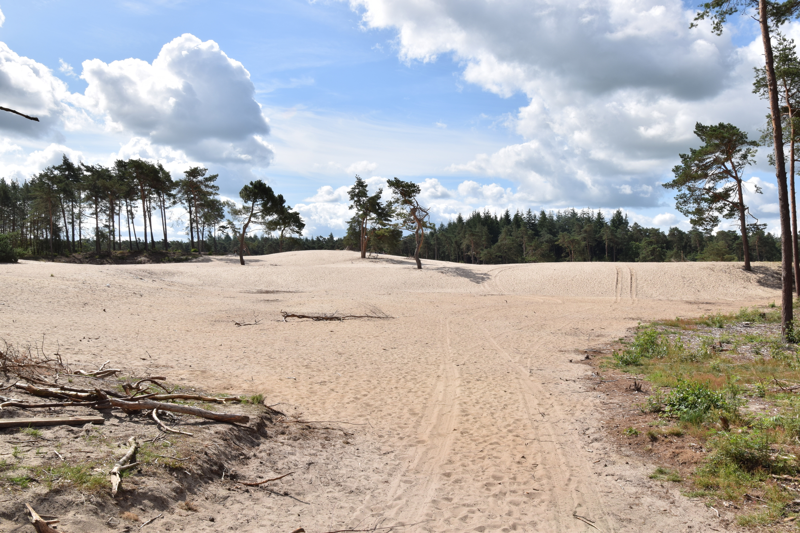
5–12 km (3.1–7.5 mi): Junnerbelten—sand ridges, open patches, and big-sky edges
This is where the landscape’s history becomes visible. The Junnerbelten are remnants of historic drift-sand activity: low sandy mounds/ridges and open sandy flats that persisted into the 20th century due to grazing and sod-cutting practices. You’re not climbing hills, but you may feel the effort increase because soft sand can slow pace and work calves/ankles more than the map suggests. (landgoed-junne.nl)
Vegetation often shifts here: more light, more scrubby edges, and a “heath-and-sand” character in places rather than closed-canopy forest. If it’s windy and dry, sand can blow across the track; if it’s been wet, the sand firms up but low spots can hold water.
12–17 km (7.5–10.6 mi): toward Junne/Vecht-meander country—fields, forest margins, and wildlife corridors
As you arc toward the Junne side of the landscape, you’re moving through an area shaped by the Vecht’s old river dynamics—meanders, former channels, and low-lying grassland pockets. Landgoed Junne describes this as an ancient landscape in the Vecht valley with cultural-historical elements like farmsteads, “es” fields (raised arable grounds), hedgerows, and small heath/sand features. (landgoed-junne.nl)
Wildlife watching improves along these transitions (forest-to-field, field-to-wet edge). Birdlife can be especially notable in the broader Junne/Vecht area; nearby reserves are known for species such as woodlark and red-backed shrike in suitable seasons/habitats (viewing is often best from designated edges/hides where access is restricted). (birdingplaces.eu)
17–21 km (10.6–13.0 mi): returning through Boswachterij Ommen—long, easy run-in
The final leg

Surfaces
Unknown
Concrete
Sand
Asphalt
Unpaved
Grass
Gravel
Ground
Comments and Reviews
User comments, reviews and discussions about the Zeesserbosch, Junnerbelten and Boswachterij Ommen Loop, Netherlands.
average rating out of 5
0 rating(s)