
Download
3D Flyover
Add to list
More
957.5 km
42 days
4565 m
Multi Day
“A wind-swept ribbon from Baltic beaches to border marshes, rewarding endurance more than steep climbing.”
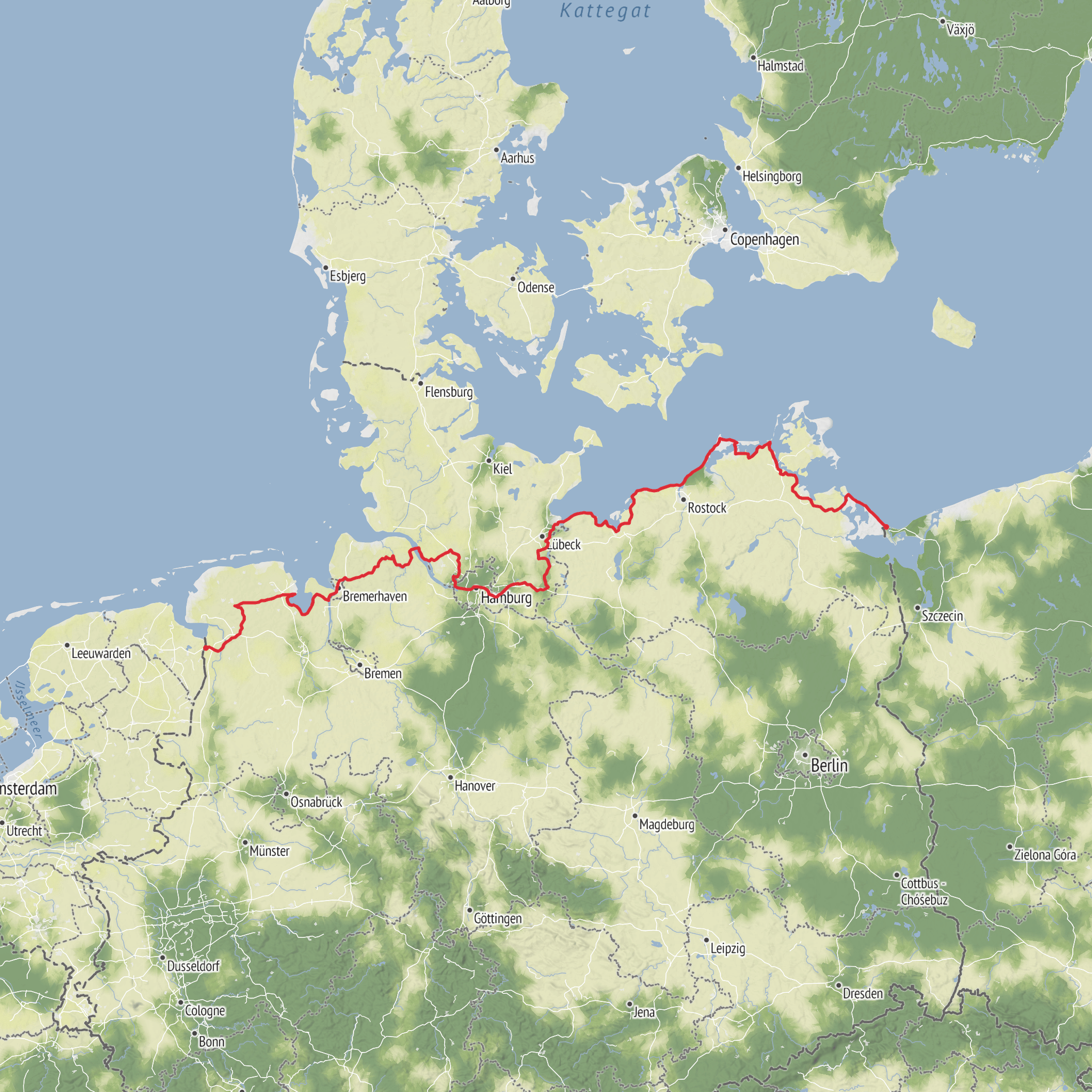
This long German section of the E9 is best understood as a low-gradient coast-and-lowlands crossing rather than a mountain trek: roughly 955 km / 593 miles with about 4,600 m / 15,090 ft of cumulative ascent, spread so gently across the route that most days feel more like sustained walking than climbing. The overall difficulty is usually easy, but the real challenge is endurance, exposure to wind, and the logistics of a very long point-to-point route. In Germany, the E9 runs from the Baltic coast on Usedom westward across Mecklenburg and Schleswig-Holstein, then on through Hamburg, the lower Elbe, and East Frisia to the German–Dutch border near Bunde/Bad Nieuweschans. Official German hiking sources describe the route as Germany’s coastal long-distance path and note that, despite its length, it has very few significant climbs. (wanderbares-deutschland.de)
For planning purposes, the eastern trailhead is best associated with Karlshagen on the island of Usedom, a known Baltic resort near the Polish border, while the western end is near Charlottenpolder/Bunde at the Dutch border, close to Bad Nieuweschans. Some tourism material highlights the Baltic subsection from Travemünde to Ahlbeck, but the broader German E9 continues far beyond that to the northwest borderlands. (germany.travel)
Getting to the start is straightforward by public transport if you begin on the Baltic side. If you choose the classic eastern start on Usedom/Karlshagen, the practical gateway is the island rail network via Züssow from the German mainline, then onward by regional train toward the coast; if you instead begin at the well-known Baltic subsection start in Travemünde, Lübeck-Travemünde Strand station sits right by the seaside resort area and is served from Lübeck, with onward connections from Hamburg and the wider German rail network. By car, Baltic starts are easiest via the A20 corridor and regional roads onto Usedom or into Lübeck/Travemünde, depending on which start you choose. At the western end near Bunde/Bad Nieuweschans, rail connections into the Dutch and German networks make a finish or reverse-direction start practical as well. For day-to-day route planning, accommodation spacing, and live navigation, HiiKER is the tool to rely on. (germany.travel)
What the route feels like
Expect a constantly changing mix of beaches, sea dikes, cliff-top paths, pine woods, reed-fringed lagoons, harbor towns, canal-side tracks, farmland, and quiet inland greenways. Surfaces vary widely: on the Baltic section alone, official tourism information describes a blend of unmade paths, asphalt, and farm tracks, and that pattern broadly continues across the country. (germany.travel)
Because the elevation is modest, daily mileage can be generous. Many hikers break the route into stages of about 20 to 30 km / 12 to 19 miles per day, though stronger walkers may comfortably push farther on the flatter inland sections. The main physical factors are usually headwinds, sun exposure on open dikes, wet ground after rain, and sand underfoot on beach stretches rather than steep terrain. Waterproof footwear is useful, but many hikers prefer breathable trail shoes in settled weather because the route is so non-technical.
The weather can shape the experience more than the topography. Along the Baltic and North Sea-influenced sections, conditions can shift quickly from calm sunshine to strong wind and showers. Even in warmer months, exposed coastal stretches can feel cool. Pack for layered walking rather than alpine conditions: windproof shell, light insulation, sun protection, and enough water capacity for longer rural sections.
Landmarks, landscapes, and notable sections
On the eastern side, the route begins with the Baltic character many hikers picture when they think of the German E9: seaside resorts, dunes, beaches, and old fishing villages. From Usedom the trail works west toward Greifswald and Stralsund, then onward through the coastal landscapes of Mecklenburg-Vorpommern. (wanderbares-deutschland.de)
One of the most memorable natural areas on or near the route corridor is the Western Pomerania Lagoon Area National Park around the Darß and Bodden landscapes. This is a broad mosaic of shallow
AI Planner
Days planned around your pace, with somewhere to stay each night.
Comments and Reviews
User comments, reviews and discussions about the E9 Germany, Netherlands.
average rating out of 5
0 rating(s)



