
Download
3D Flyover
Add to list
More
17.8 km
~3 hrs 37 min
35 m
Loop
“Meandering through whispering pines, blooming heather, and tranquil fens, this walk captures Drenthe’s peaceful, timeless charm.”
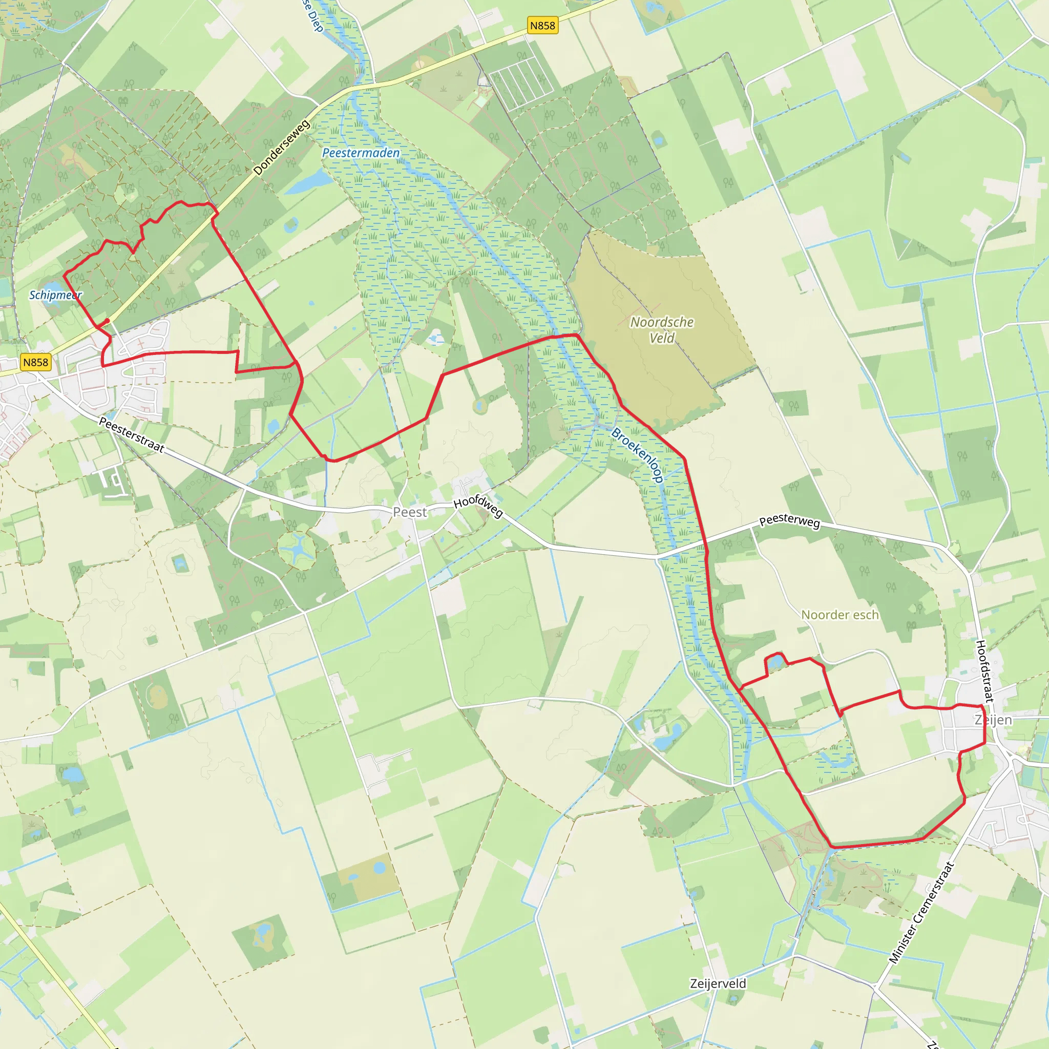
Starting from the tranquil outskirts of Norg, a charming village in the Drenthe province of the Netherlands, this 18 km (about 11.2 miles) circular walk offers a gentle, flat route with virtually no elevation gain, making it accessible for hikers of all abilities. The trailhead is conveniently located near the Oosterduinen, a well-known forested area just east of Norg, easily reached by car with parking available at the Oosterduinen parking lot. For those using public transport, buses from Assen or Groningen stop at Norg, from where it’s a short walk to the trail’s starting point.
Woodlands and Heaths: Oosterduinen and Schipmeer
The first section leads you through the Oosterduinen, a serene pine forest interspersed with patches of birch and oak. The forest floor is often carpeted with moss and heather, and in spring and summer, the air is filled with birdsong from species like the chiffchaff and great spotted woodpecker. After about 3 km (1.9 miles), the path opens up to the Schipmeer, a small, tranquil fen surrounded by reeds and wildflowers. This area is a haven for dragonflies and amphibians, and you may spot roe deer grazing at the forest edge in the early morning.
Historic Landscapes: Zuideresch and Bollenveen
Continuing south, the route passes through Zuideresch, a traditional Dutch ‘esdorp’ landscape. These ancient communal fields, once used for agriculture by medieval villagers, are now a patchwork of meadows and hedgerows. At around 8 km (5 miles), you’ll reach Bollenveen, a picturesque heathland dotted with juniper bushes and scattered birch trees. The Bollenveen is particularly striking in late summer when the heather blooms in vibrant purple. This area is also notable for its glacial history, with subtle undulations in the landscape left by retreating ice sheets thousands of years ago.
Wildlife and Points of Interest
Throughout the hike, keep an eye out for buzzards circling overhead and listen for the distinctive calls of the Eurasian jay. The wetlands and ponds attract frogs and newts, and in autumn, mushrooms flourish along the shaded paths. The route is well-marked, but for added confidence, use HiiKER for navigation, as it provides up-to-date trail information and offline maps.
Access and Amenities
The trail is mostly on well-maintained dirt paths and sandy tracks, with occasional sections on quiet rural roads. There are several benches along the way, especially near the Schipmeer and Bollenveen, perfect for a picnic or a rest. Norg itself offers a selection of cafés and shops for refreshments before or after your walk. Public toilets are available in the village center.
This easy, scenic loop is ideal for those seeking a peaceful day out immersed in Drenthe’s natural beauty and rural heritage, with plenty of opportunities to observe local wildlife and enjoy the changing landscapes.
AI Planner
Days planned around your pace, with somewhere to stay each night.
Surfaces
Unknown
Sand
Gravel
Asphalt
Ground
Dirt
Grass
Comments and Reviews
User comments, reviews and discussions about the Schipmeer and Bollenveen via Oosterduinen and Zuideresch, Netherlands.
average rating out of 5
0 rating(s)


