Download
3D Flyover
Add to list
More
27.3 km
~5 hrs 27 min
6 m
Loop
“Wander wind-sculpted dunes to a hidden lake, where sea-breeze effort meets quiet, sandy calm.”
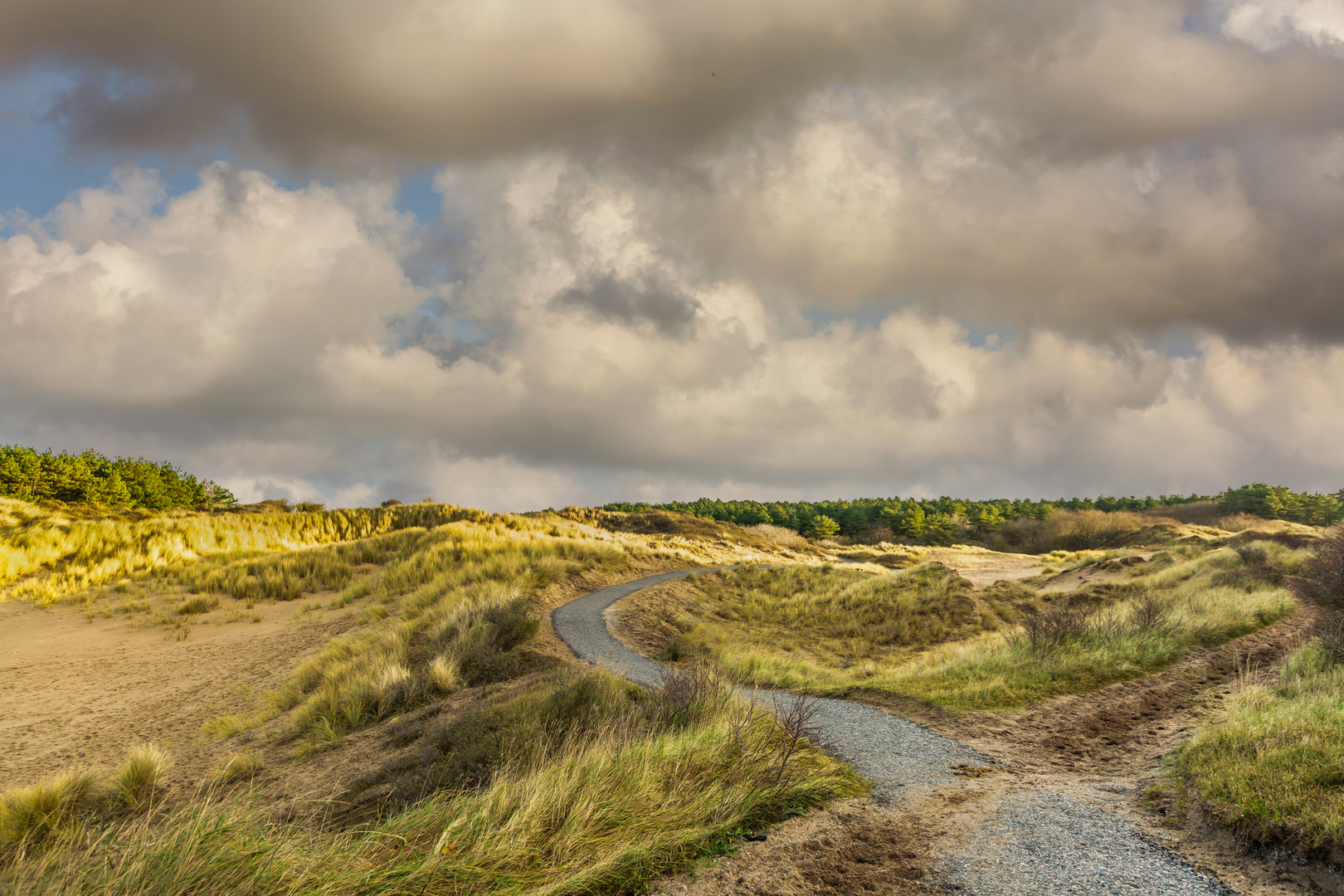
This is a long, low-lying coastal loop of roughly 27 km (16.8 mi) with essentially 0 m (0 ft) of sustained climbing—expect gentle undulations from dune ridges rather than “elevation gain.” Underfoot you’ll move through a mix of compact sand paths, dune tracks, and firm coastal trails, with a few softer sandy stretches that can feel slower despite the easy grade.
Start location (nearest landmark/address) “Vinkenburg / Zeeduinen / Paardenkerkhof / Oosterduinse Meer” strongly points to the Noordwijk–Katwijk dune belt in South Holland (Netherlands). A practical, well-known place to start this kind of loop is near the main dune access by the sea at Noordwijk aan Zee, around Koningin Astrid Boulevard / the Noordwijk beach entrances (a prominent, easy-to-find seafront boulevard with multiple signed dune trailheads). If you share the exact lon/lat for “Hike head,” I can pin it to the nearest specific street address or trail gate.
Getting to the start (car + public transport)
- By car: Aim for Noordwijk aan Zee seafront parking (large public car parks along/near Koningin Astrid Boulevard and adjacent beach access points). Arrive early on fair-weather weekends—coastal parking fills quickly.
- By public transport: The most common approach is train to Leiden Centraal, then a regional bus toward Noordwijk aan Zee (buses typically terminate near the seafront or central Noordwijk stops). From there it’s a short walk to the dune entrances. Check the day’s bus routing/times before you go.
You’ll want to have the route loaded in HiiKER before setting off; dune networks can be dense with intersecting tracks, and wind-blown sand can obscure footprints and minor junction signage.
You’ll begin by leaving the built-up seafront and slipping into the first band of dunes. The opening 3–5 km (1.9–3.1 mi) is usually the most “urban-adjacent”: you may hear the sea and see beach access paths, but within minutes the landscape becomes classic Dutch coastal dune—low shrubs, marram grass, and sandy hollows. Even on an “easy” loop, the wind is the real effort multiplier here: a headwind off the North Sea can make flat terrain feel deceptively taxing.
As you arc inland toward Zeeduinen (literally “sea dunes”), the trail often alternates between: - Firm, compacted dune paths (fast walking) - Short soft-sand patches (slower, more calf/ankle work) - Sheltered hollows where the air can feel suddenly still compared to exposed ridgelines
Keep an eye out for dune slack vegetation—lower, wetter pockets between dune ridges that support different plant communities than the dry crests. These areas can be seasonally damp, and after rain you may find puddled sections even when the rest of the route is dry.
Landmarks, nature, and what to look out for
Over the middle third—roughly km 6 to km 18 (mi 3.7 to 11.2)—the loop typically strings together its named features:
- Vinkenburg: Often used locally for a dune area/section name. Expect a slightly more sheltered feel with scrub and small rises. This is a good place to pause out of the wind.
- Paardenkerkhof (“horse cemetery”): The name is a reminder that these dunes have long been working landscapes—historically tied to transport, agriculture, and coastal livelihoods. Even when no obvious “cemetery” marker is present, the toponym itself is a cultural landmark. Treat any fenced or signed areas as sensitive habitat or protected zones.
- Oosterduinse Meer: A dune lake is a standout feature in an otherwise sandy system. Approaching water, you’ll often notice a shift in birdlife and plant density. Expect reed edges, wetter ground near the margins, and more insects in warm months.
Wildlife you’re likely to encounter - Birds: Gulls and terns nearer the coast; farther in, look for marsh and reed-edge birds around the lake and wetter slacks. Raptors sometimes patrol the dune line on breezy days. - Mammals: Rabbits are common in dune systems; you may also see fox sign. In some Dutch dune reserves, large grazers (like cattle/ponies) are used for habitat management—if present, give them space and pass calmly. - Insects: On still, sunny days near water, mosquitoes/gnats can be noticeable—pack repellent in warmer seasons.
Key hazards and comfort factors - Wind exposure: Bring a windproof layer even if temperatures look mild. - Sun reflection: Sand and water amplify UV—sunglasses and sunscreen matter. - Soft sand: If you’re prone to ankle tweaks, consider supportive footwear; trekking poles can help on looser sections (especially if the route includes steeper dune faces, even if short). - Navigation in dune mazes: Trails braid and rejoin; rely on HiiKER at junction clusters rather than assuming the “main” track is correct.
The final 8–10 km (5–6.2 mi) usually trends back toward the coastal edge and then returns to the seafront access area. This is often the most open-feeling segment: broader skies, more wind, and long sightlines across dune ridges. If you time it late in the day

Surfaces
Unknown
Paved
Asphalt
Unpaved
Sand
Dirt
Gravel
Comments and Reviews
User comments, reviews and discussions about the Vinkenburg, Zeeduinen, Paardenkerkhof and Oosterduinse Meer Loop, Netherlands.
average rating out of 5
0 rating(s)