
Download
3D Flyover
Add to list
More
17.0 km
~3 hrs 24 min
8 m
Loop
“Meandering through meadows, canals, and quiet lanes, this scenic loop unveils Salland’s rural charm and seasonal wonders.”
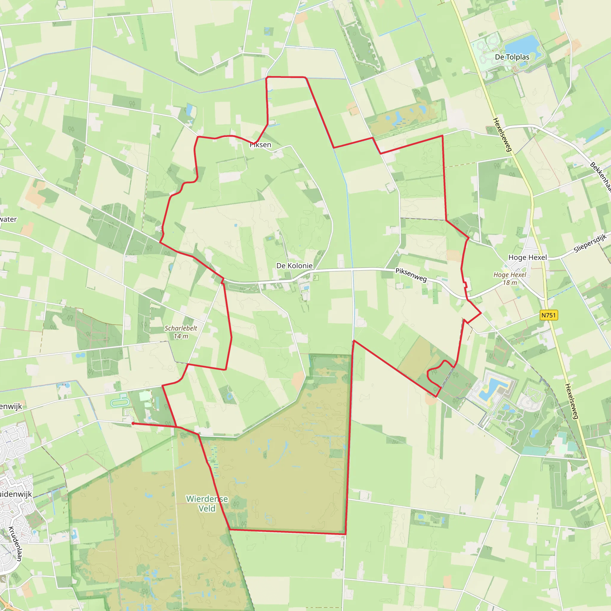
Starting from the outskirts of Nijverdal, the trailhead for this 17 km (about 10.5 miles) loop is conveniently located near the Piksenweg, a quiet rural road just north of the town center. The area is easily accessible by car, with parking available near the Piksenweg and Wulpenweg intersection. For those arriving by public transport, Nijverdal railway station is the closest major stop, with local buses connecting to the trailhead area—plan for a short walk or cycle from the station to reach the start.
Trail Overview and Navigation
This route is a gentle, flat walk with virtually no elevation gain (0 metres/0 feet), making it suitable for hikers of all abilities, including families and those seeking a leisurely day outdoors. The trail follows a mix of well-maintained gravel paths, farm tracks, and quiet country lanes, weaving through the scenic Salland countryside. Navigation is straightforward, but for added confidence and real-time route tracking, HiiKER provides detailed mapping and waypoints for the entire loop.
Landscapes and Natural Highlights
The hike traverses a patchwork of open meadows, small woodlands, and agricultural fields typical of Overijssel’s rural heartland. Early in the walk, you’ll pass alongside the Hoogelaarsleiding, a historic drainage canal that has shaped the landscape for centuries, supporting both agriculture and local biodiversity. The canal’s banks are lined with reeds and wildflowers in spring and summer, attracting a variety of birdlife—look out for herons, swans, and the occasional kingfisher darting over the water.
As you continue along Piksenweg, the route skirts the edge of the Sallandse Heuvelrug National Park’s northern boundary. While this hike remains on the flatter lowlands, the distant views of the park’s wooded hills provide a striking backdrop. The trail then turns onto Wulpenweg, a quiet lane bordered by hedgerows and scattered farmsteads, where you may spot grazing sheep and horses.
Cultural and Historical Points
The region around Nijverdal has a rich agricultural history, with many of the farms along the route dating back to the 19th century. The Hoogelaarsleiding canal itself is a testament to Dutch ingenuity in water management, constructed to drain the once-marshy land and make it suitable for farming. Along the way, you’ll notice traditional Dutch barns and windbreaks, as well as small bridges crossing the canal—ideal spots for a rest or picnic.
Wildlife and Seasonal Interest
Spring and early summer are particularly rewarding, with wildflowers blooming along the canal and in the meadows. The area is home to hares, roe deer, and a variety of songbirds. In autumn, the woodlands along the route display vibrant foliage, and the fields are often busy with migrating geese.
Facilities and Preparation
There are limited facilities directly on the trail, so bring sufficient water and snacks. Nijverdal offers shops, cafes, and restrooms before or after your hike. The flat, well-marked paths are suitable for sturdy walking shoes or lightweight boots, and the open landscape means weather can change quickly—pack a rain jacket and sun protection as needed.
For navigation, download the route to your phone using HiiKER, which provides offline maps and live GPS tracking to keep you on course throughout the hike.
AI Planner
Days planned around your pace, with somewhere to stay each night.
Surfaces
Asphalt
Unknown
Sand
Grass
Ground
Comments and Reviews
User comments, reviews and discussions about the Hoogelaarsleiding via Piksen Weg and Wulpen Weg, Netherlands.
average rating out of 5
0 rating(s)
