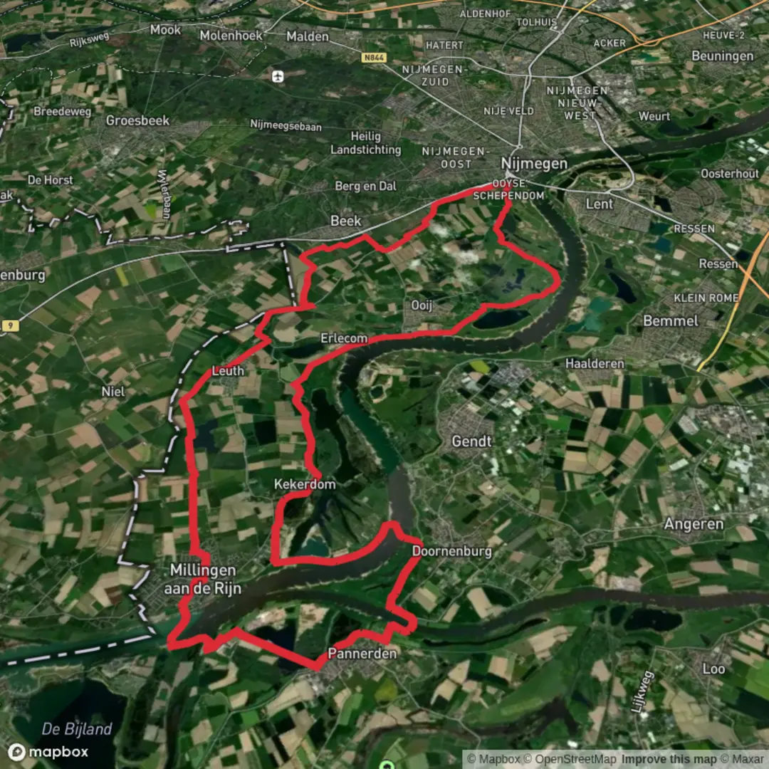
Groenlanden, Kekerdomsche Waard, Lobberdensche Waard and Wylerbergmeer Loop
Download
3D Flyover
Add to list
More
42.5 km
~2 days
6 m
Point-to-Point
“A big-sky Gelderse Poort loop of dikes, reedbeds, and grazing plains—steady, wind-exposed, all-day.”
You’re looking at a big, flat river-landscape loop of about 42 km / 26 mi with essentially 0 m / 0 ft of climbing, stitched together from several classic “waard” floodplains in the Gelderse Poort region east of Nijmegen, right up against the German border. Expect long horizons, big skies, dikes, side channels, reedbeds, and open grazing areas—more “keep moving steadily all day” than “tough terrain.”
A practical start/finish anchor for this loop is the Wylerbergmeer recreation area near Alde Weteringweg, 6573 CP Beek-Ubbergen (municipality of Berg en Dal), Netherlands, a well-known local landmark and access point for paths around the lake and into the Ooijpolder/Duffelt area. (commons.wikimedia.org)
Getting to the start (car + public transport)
- By car: Navigate (in HiiKER) to Recreatiegebied Wylerbergmeer, Beek-Ubbergen (near Alde Weteringweg). This area is set up for day recreation, so access and parking are typically straightforward compared with tiny dike pull-offs. (commons.wikimedia.org)
- By public transport: The nearest major rail hub is Nijmegen (frequent trains from across the Netherlands). From Nijmegen, you’ll typically continue by regional bus toward Beek/Ubbbergen and then walk the last stretch to Wylerbergmeer. Because bus routes/stops can change seasonally, check the current stop locations and walking approach in HiiKER before you commit to a timetable.
You’ll want to plan this as a full-day outing: even on easy ground, 42 km / 26 mi is a long time on feet. A steady pace with short breaks often puts most hikers in the 8–11 hour range depending on surfaces and wind.
What the terrain feels like (and why it’s “easy” but still serious)
Most of the loop is on: - Dike-top paths (often paved or hard-packed) - Gravel farm tracks - Narrower floodplain footpaths that can be muddy after rain or high water
The difficulty is “easy” because there’s no real climbing and the navigation is generally linear along dikes and obvious tracks—but the distance, exposure to wind, and variable underfoot conditions are what make it demanding.
Key things to look out for: - Wind off the Waal/Rhine system: headwinds can slow you dramatically on open dikes. - Seasonal mud: clay-rich floodplain soils can turn slick; traction matters. - High-water closures/diversions: these are working floodplains; after high river levels, some low paths can be temporarily inaccessible. Use HiiKER to confirm alternates along higher dikes.
The loop, section by section (approximate distances)
Because exact line choices vary (there are many parallel dike/inner paths), treat these as planning distances rather than precise splits.
1) Wylerbergmeer to the Ooijpolder edge (about 6–9 km / 4–6 mi)
Starting near Wylerbergmeer, you’ll quickly transition from the lake’s recreation setting into the wider Ooijpolder/Duffelt landscape—flat fields, drainage ditches, and long dike lines. The feeling here is “big and open,” and in clear weather you’ll notice how close you are to the Nijmegen stuwwal (the low ridge/higher ground) while you remain down on the floodplain.
Wildlife is often immediate: expect geese, ducks, and waders in wetter patches, especially in migration and winter.
2) Groenlanden and the “river nature” core (about 10–14 km / 6–9 mi)
As you swing into De Groenlanden (part of

Surfaces
Asphalt
Unknown
Concrete
Paved
Comments and Reviews
User comments, reviews and discussions about the Groenlanden, Kekerdomsche Waard, Lobberdensche Waard and Wylerbergmeer Loop, Netherlands.
average rating out of 5
0 rating(s)