Download
3D Flyover
Add to list
More
10.6 km
~2 hrs 7 min
0 m
Loop
“Wander through willow-lined paths, tranquil lakes, and centuries of Dutch heritage on this peaceful countryside loop.”
Starting from the outskirts of Langeraar, a small village in South Holland, the Geer Weg, Langeraarse Weg and Kerkpad Loop offers a gentle 11 km (about 6.8 miles) circuit with virtually no elevation gain, making it accessible for hikers of all abilities. The trailhead is conveniently located near the intersection of Geerweg and Langeraarseweg, just north of the village center, and is easily reached by car or public transport. For those arriving by train, the nearest major station is Alphen aan den Rijn; from there, local buses connect to Langeraar, with stops within a short walk of the trailhead.
Navigating the Route
The loop follows a combination of quiet country lanes, canal-side paths, and traditional Dutch kerkpad (church paths), which historically connected rural communities to their local churches. Hikers can rely on HiiKER for up-to-date navigation and wayfinding, ensuring a smooth journey through the region’s patchwork of fields and waterways.
Landmarks and Points of Interest
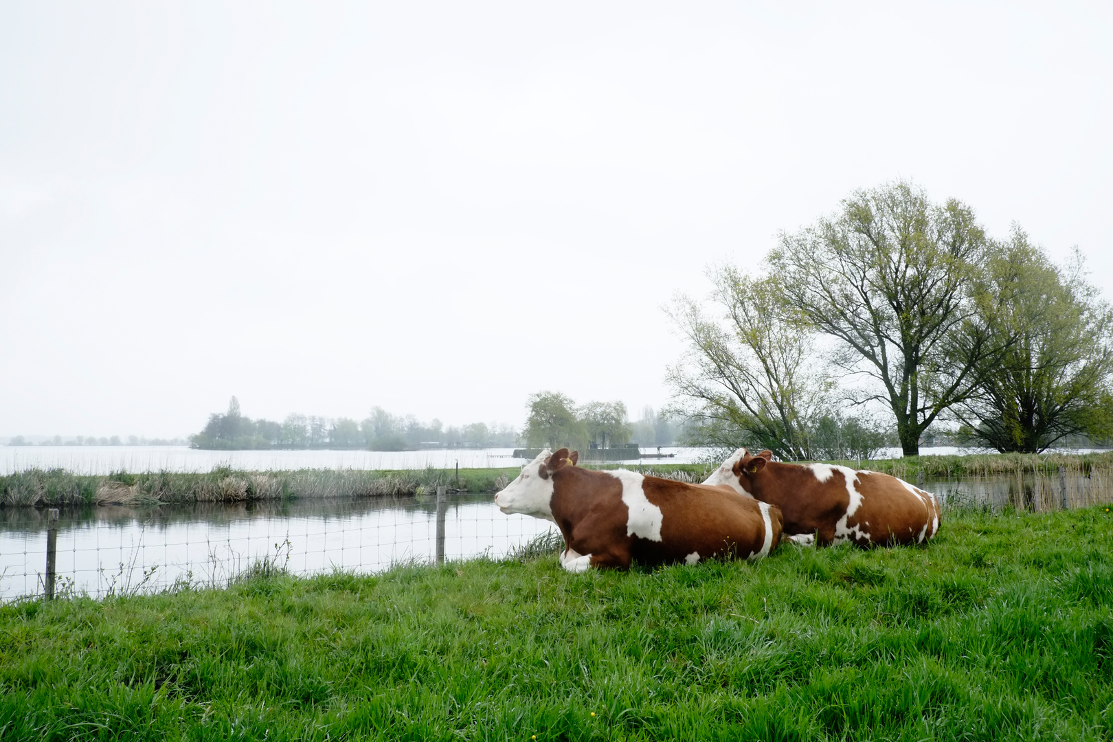
At approximately 2 km (1.2 miles) into the hike, the route passes the Langeraarse Plassen, a series of interconnected lakes formed by peat extraction centuries ago. These waters are now a haven for birdlife, including herons, grebes, and, in spring and autumn, migratory waterfowl. The trail skirts the lakeshore, offering open views across the water and opportunities for birdwatching.
Continuing along Langeraarseweg, the path leads through the heart of Langeraar, where the 19th-century Sint Adrianuskerk stands as a focal point. This neo-Gothic church, with its distinctive spire, is a reminder of the area’s deep-rooted Catholic heritage. The kerkpad section of the loop, traditionally used by parishioners walking to Sunday services, is lined with willows and wildflowers in the warmer months.
Nature and Wildlife
The surrounding polder landscape is quintessentially Dutch, with flat, open meadows crisscrossed by drainage ditches and canals. In spring and summer, the fields are alive with lapwings, godwits, and hares. The absence of significant elevation (total gain is negligible, less than 10 feet or 3 meters) means the route is suitable year-round, though waterproof footwear is recommended in wetter months due to occasional muddy stretches.
Historical Context
The region’s history is closely tied to water management and agriculture. The network of dikes, canals, and windmills—some of which can be glimpsed from the trail—reflects centuries of Dutch ingenuity in reclaiming and protecting land from the encroaching lakes. The kerkpad itself is a living relic of rural life, once essential for connecting isolated farmsteads to the social and spiritual heart of the community.
Getting There and Practical Tips
Parking is available near the intersection of Geerweg and Langeraarseweg, with clear signage marking the start of the loop. For those using public transport, buses from Alphen aan den Rijn or Nieuwkoop stop at Langeraar Dorp, a few minutes’ walk from the trailhead. Facilities are limited along the route, so bring water and snacks. The nearest cafés and shops are in Langeraar village, ideal for a post-hike refreshment.
Hikers are encouraged to use HiiKER for real-time trail updates and navigation, especially as some sections may be rerouted during agricultural activities or maintenance. The flat, easy terrain and rich natural and cultural heritage make this loop a rewarding outing for families, birdwatchers, and anyone seeking a peaceful walk through the Dutch countryside.

Surfaces
Unknown
Asphalt
Grass
Comments and Reviews
User comments, reviews and discussions about the Geer Weg, Langeraarse Weg and Kerkpad Loop, Netherlands.
average rating out of 5
0 rating(s)