Download
3D Flyover
Add to list
More
18.1 km
~3 hrs 37 min
0 m
Point-to-Point
“Stroll between two countries on a peaceful path where wildflowers, history, and border tales entwine.”
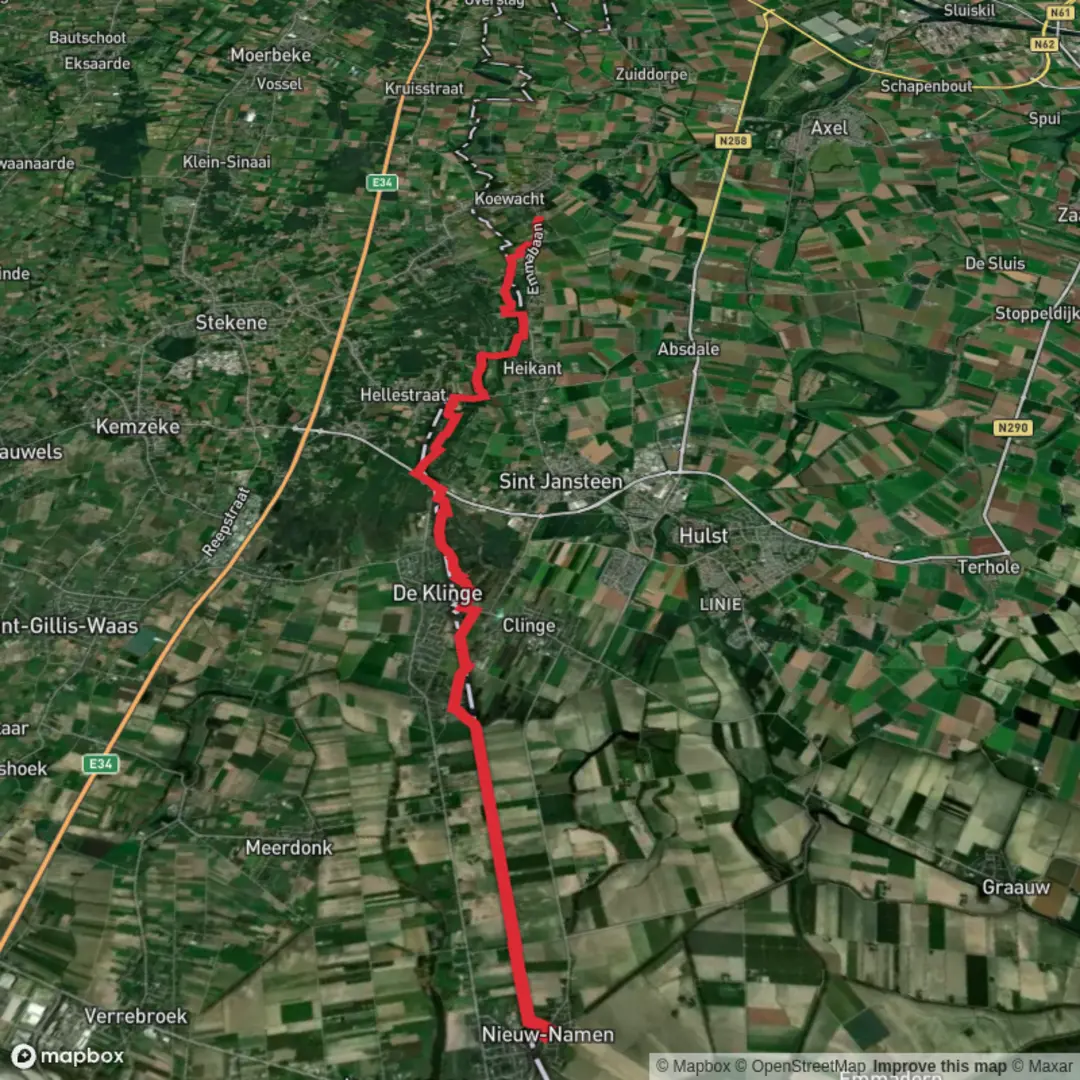
Starting near the small Dutch village of Nieuw-Namen, this 18 km (about 11.2 miles) point-to-point walk follows the Tweelanden Route, a unique cross-border trail that weaves through the tranquil landscapes of the Netherlands and Belgium. With virtually no elevation gain, this easy hike is perfect for those seeking a leisurely day outdoors, whether you’re a seasoned walker or a beginner.
Getting There
Nieuw-Namen is accessible by public transport, with the nearest major hub being the city of Hulst. From Hulst, local buses connect to Nieuw-Namen, with the closest stop at Dorpsstraat, Nieuw-Namen. If arriving by car, parking is available near the village center, close to the intersection of Dorpsstraat and Nieuw-Namenstraat, which is just a short walk from the trailhead.
Trail Experience and Navigation
The route begins at the edge of Nieuw-Namen, a village known for its proximity to the Dutch-Belgian border and its peaceful rural charm. The trail is well-marked, but for added confidence and real-time navigation, HiiKER is recommended for up-to-date maps and waypoints.
Landscapes and Nature
The first few kilometers lead you through open farmland and polder landscapes, typical of Zeelandic Flanders. Expect wide, flat vistas dotted with windbreaks and drainage ditches, a testament to centuries of land reclamation. In spring and summer, the fields are alive with wildflowers and the calls of lapwings and skylarks. Watch for hares darting across the fields and, in wetter areas, the occasional stork.
Crossing Borders and Historical Context
Around the halfway mark, you’ll skirt the border with Belgium, passing through the hamlet of Clinge. This region has a rich history as a smuggling route, especially during times of war and economic hardship. Old border posts and customs houses can still be spotted along the way, silent witnesses to the area’s turbulent past.
Villages and Landmarks
As you approach the village of Koewacht, about 18 km (11.2 miles) from your starting point, the landscape shifts to include more wooded areas and small lakes, remnants of historical peat extraction. Koewacht itself straddles the border, with both Dutch and Belgian sections. The village church, Sint-Filippus en Jakobuskerk, is a notable landmark, and the local museum offers insights into the region’s textile history.
Wildlife and Seasonal Highlights
Throughout the year, the route offers excellent birdwatching opportunities, especially in the marshy areas near Koewacht. In autumn, migrating geese fill the skies, while in winter, the flat terrain can be windswept but atmospheric, with frost glistening on the fields.
Practical Tips
With no significant elevation gain, the trail is accessible to most walkers, but be prepared for potentially muddy sections after rain, especially in the low-lying polders. There are limited facilities along the route, so bring water and snacks. Public transport options are available at both ends, with bus stops in Nieuw-Namen and Koewacht, making it easy to return to your starting point.
For navigation, trail updates, and offline maps, HiiKER is the best tool to ensure you stay on track and make the most of your journey through this unique borderland.

Surfaces
Unknown
Asphalt
Sand
Ground
Cobblestone
Dirt
Paved
Comments and Reviews
User comments, reviews and discussions about the Nieuw Namen to Koewacht via Tweelanden Route, Netherlands.
average rating out of 5
0 rating(s)