Download
3D Flyover
Add to list
More
8.7 km
~1 hrs 44 min
0 m
Loop
“Step back in time along Naarden’s storied ramparts, where tranquil waters and history embrace at every turn.”
Embarking on the approximately 9 km (5.6 miles) Vesting Museum via Lange Bedekte Weg hike offers a unique blend of historical exploration and scenic beauty, with virtually no elevation gain, making it accessible to hikers of all levels.
Starting Point and Access
The trail begins near the Het Nederlands Vestingmuseum, located on Bastion Turfpoort in Naarden-Vesting, a well-preserved 17th-century fortified town in the Netherlands. For those arriving by car, free parking is available on-site. If using public transport, take a train to Naarden-Bussum station, followed by a local bus that stops near the historic center. From there, it's a short walk across the moat into the heart of Naarden-Vesting. (realjourneytravels.com)
Trail Overview
The route follows the Lange Bedekte Weg, translating to "Long Covered Way," a historic path that encircles the town's fortifications. As you traverse this path, you'll be enveloped by the town's rich military heritage, with panoramic views of the surrounding moats and bastions.
Key Landmarks Along the Route
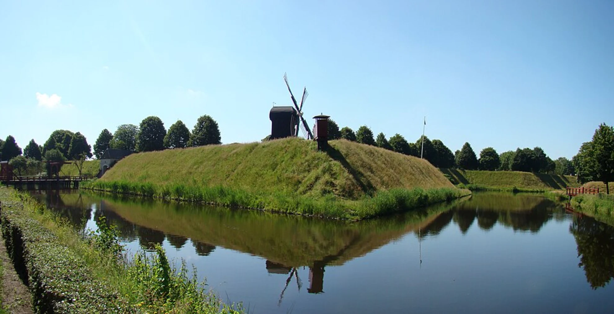
Bastion Turfpoort: Approximately 1 km (0.6 miles) into the hike, you'll encounter this bastion housing the Vestingmuseum. The museum's exhibits, set within original casemates, delve into military life, fort construction, and the Hollandse Waterlinies defense system. The outdoor ramparts offer excellent photo opportunities. (realjourneytravels.com)
Bastion Oranje: Around the 3 km (1.9 miles) mark, this bastion provides insights into the town's strategic design and offers a serene spot to rest while overlooking the water defenses.
Bastion Promers: At approximately 5 km (3.1 miles), this area showcases the intricate network of moats and dikes that played a crucial role in the town's defense strategy.
Flora and Fauna
The trail is lined with mature trees and well-maintained grassy areas, providing habitat for various bird species. Keep an eye out for waterfowl in the moats and songbirds in the wooded sections.
Historical Significance
Naarden-Vesting is a prime example of a star fort, a design prevalent in the 16th and 17th centuries. The town's fortifications were integral to the Dutch Waterline defense system, which utilized controlled flooding to protect against invasions. Walking this trail offers a tangible connection to the Netherlands' military engineering prowess and its historical significance in European defense strategies.
Navigation and Safety
The path is well-marked and maintained, making navigation straightforward. For enhanced route guidance, consider using the HiiKER app, which provides detailed maps and real-time updates. The trail is predominantly flat, but it's advisable to wear comfortable walking shoes, as some sections may be uneven.
Amenities and Facilities
Restrooms and a café are available at the Vestingmuseum, making it a convenient spot to start or end your hike. Benches are strategically placed along the route, offering places to rest and enjoy the views.
Getting There
By Car: Set your GPS to Het Nederlands Vestingmuseum, Bastion Turfpoort, Naarden-Vesting. Free parking is available on-site.
By Public Transport: Take a train to Naarden-Bussum station. From there, local buses run regularly to the historic center. It's advisable to check the latest schedules before your trip.
This hike offers a harmonious blend of history, nature, and accessibility, making it a rewarding experience for those interested in the Netherlands' rich past and scenic landscapes.

Surfaces
Unknown
Asphalt
Dirt
Unpaved
Cobblestone
Grass
Ground
Wood
Concrete
Comments and Reviews
User comments, reviews and discussions about the Vesting museum via Lange Bedekte Weg, Netherlands.
average rating out of 5
0 rating(s)