Download
3D Flyover
Add to list
More
22.9 km
~4 hrs 34 min
6 m
Loop
“A big-sky polder loop through reed-fringed peat lakes—flat, windswept, and sometimes boot-muddy.”
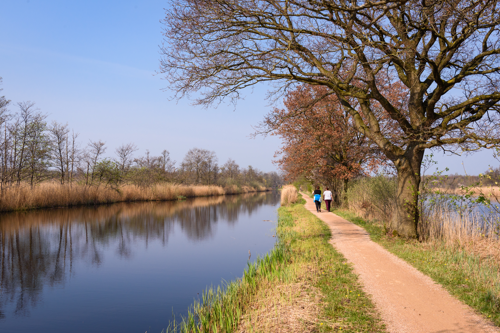
Expect a classic lowland “plassen & polders” day: long, ruler-flat paths (about 23 km / 14.3 mi with roughly 0 m / 0 ft of climbing), big skies, reedbeds, peat lakes, and a patchwork of meadows and ditches. Underfoot is a mix of paved dike-top lanes, farm tracks, and soft, sometimes muddy grass paths—easy on the lungs, but it can be surprisingly demanding on footwear if it’s been wet.
For a practical start point, aim for Bezoekerscentrum Gooi en Vechtstreek (Natuurmonumenten), Noordereinde 54b, 1243 JJ ’s‑Graveland—a well-known landmark right on the edge of the area and a common gateway to both the ’s‑Graveland estates and the Ankeveense Plassen. (natuurmonumenten.nl)
Getting to the trailhead (car + public transport)
- By car: Navigate to Bezoekerscentrum Gooi en Vechtstreek, Noordereinde 54b, ’s‑Graveland. There’s a visitor-area parking setup associated with the Natuurmonumenten site (note that parking policies can apply). (natuurmonumenten.nl)
- By public transport: The most straightforward approach is typically via Hilversum / Bussum / Weesp and then a local bus toward ’s‑Graveland (the visitor center sits on the Noordereinde road). Because bus routes and stop names can change, check the exact stop-to-walk connection in HiiKER when you set your date and time.
Once you’re on the loop, the navigation is generally intuitive—straight dikes, long drainage lines, and obvious water boundaries—but the area has many similar-looking junctions. Keep HiiKER handy for confirming which dike or meadow path you’re meant to take when multiple parallel tracks appear.
What the route feels like, section by section
0–5 km (0–3.1 mi): estate edges, lanes, and the first open water
From the ’s‑Graveland side you’ll quickly notice the transition from leafy estate margins into open polder. This region is famous for its historic “buitenplaatsen” (country estates) landscape—wooded parkland alternating with open fields in a tight mosaic. (discovernl.nl)
Early on, you’ll likely be on firmer surfaces (paved or compacted) before the route commits to wetter ground nearer the plassen.
5–13 km (3.1–8.1 mi): Ankeveensche Plassen—reedbeds, legakkers, and peat-water patterns
This is the signature middle of the day: narrow dikes and grassy embankments threading between peat lakes and reed fringes. The landscape here is not “natural” in the untouched sense—it’s strongly shaped by centuries of peat (turf) extraction, already active in the Middle Ages. The distinctive legakker pattern (long, thin strips and pits) is a direct legacy of that work and is still clearly visible in the layout of water and land. (natuurmonumenten.nl)
In places, paths function like a laarzenpad (boot path): expect soft ground, puddles, and sections that can be very boggy after rain. (natuurmonumenten.nl)
13–18 km (8.1–11.2 mi): polder meadows and big-sky walking
As you arc away from the densest water maze, the walking often becomes more open and linear again—meadows, drainage ditches, and long sightlines. This is where wind can be the main “elevation”: if it’s breezy, you’ll feel it. In spring and early summer, these grasslands can be lively with bird activity.
18–23 km (11.2–14.3 mi): returning via dikes and settlement edges
The final stretch typically strings together firmer dike paths and quiet lanes back toward the ’s‑Graveland/Ankeveen edge. If your loop touches the Hilversumse Meent / Bovenmeent side, you’re skirting landscapes tied into the broader Naardermeer system—low, wet ground managed for nature values and water control. (tgooi.info)

Surfaces
Unknown
Grass
Asphalt
Dirt
Ground
Concrete
Paved
Gravel
Wood
Comments and Reviews
User comments, reviews and discussions about the Bovenmeent and Ankeveensche Plassen Loop, Netherlands.
average rating out of 5
0 rating(s)