Download
3D Flyover
Add to list
More
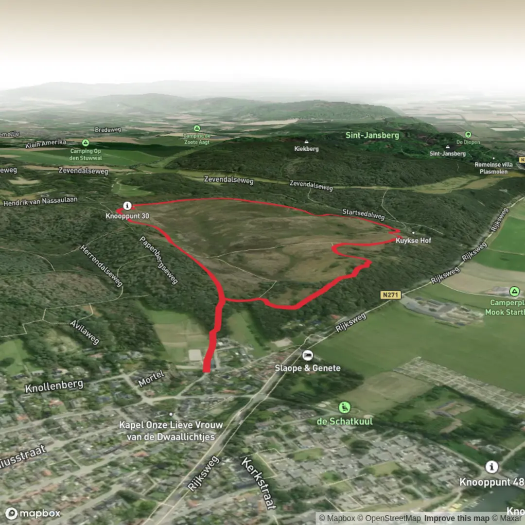
3.0 km
~40 min
40 m
Loop
“A gentle heath-and-woodland loop with sandy tracks, birdsong, and mud-by-rain surprises for some.”
I’m missing a few key pieces of information needed to write this accurately (especially the start location). Please send either:
1) the start coordinates (lat, lon) for the trailhead (or a GPX/AllTrails/HiiKER link), or
2) the nearest town/parking area name where you plan to start.
Right now, “Hike head: near” is incomplete, and without coordinates I can’t convert lon/lat to the nearest known address/landmark or give reliable public-transport directions.
While you grab that, here’s what you can generally expect from an easy ~3 km / ~1.9 mi loop with ~0 m / ~0 ft gain like the Mookerheide Loop (I’ll tailor all of this to the exact place once you share the start point):
What the route typically feels like
A flat, short loop like this is usually ideal for a relaxed walk, families, and birdwatching. Expect a steady, conversational pace: 45–75 minutes for most hikers depending on stops. With essentially no climbing, the main “effort” tends to come from surface conditions (sand, mud, boardwalk, or compact gravel) rather than elevation.
Underfoot conditions and what to watch for
- Mud and soft ground: Even flat routes can be slow after rain if they cross low-lying ground. Waterproof shoes help more than trekking poles on a 0 m gain loop.
- Narrow pinch points: Short nature loops often have gates, stiles, or narrow bridges/boardwalks—be ready to yield to oncoming walkers.
- Ticks and biting insects (seasonal): If the loop passes through heath, scrub, or tall grass, long socks and a quick tick check afterward are smart.
- Dogs and shared-use etiquette: Easy loops near towns are commonly popular with dog walkers and casual strollers—expect frequent passing.
Landmarks, nature, and wildlife (what I’ll confirm once I know the exact location)
“Mookerheide” strongly suggests heathland (“heide”) terrain in parts of Europe, which often means: - Open heath and sandy paths with low shrubs and seasonal wildflowers - Pine or mixed woodland edges that provide shelter and bird habitat - Birdlife such as finches, tits, woodpeckers, and raptors overhead; in heathland areas you may also see ground-nesting birds (important to stay on-path) - Mammals like rabbits/hares and occasional deer at quieter times
If there are any viewpoints, memorials, old estate boundaries, wartime remnants, or historic land-use features (common in heath/commons landscapes), I’ll describe them with approximate distances along the loop once I have the start point and route line.
Navigation (using HiiKER)
For a short loop, navigation is usually straightforward, but it’s still worth: - Downloading the route in HiiKER for offline use (especially if tree cover affects signal) - Watching for unsigned junctions where multiple sandy tracks braid together—flat heathland can be surprisingly easy to drift off-route without noticing
Getting to the start (car + public transport)
As soon as you provide the trailhead coordinates or the nearest named parking area, I’ll give: - The nearest recognizable address/landmark to aim for - Typical parking options (formal lot vs roadside pull-ins) and any access restrictions - The most practical public transport approach (nearest station/stop + walking distance to the trailhead)
Send the lat/lon (even just one point for the trailhead) and I’ll turn this into a complete, location-specific hike description with distances in km and miles, plus any local historical context tied to the exact Mookerheide area.

Surfaces
Unknown
Sand
Asphalt
Comments and Reviews
User comments, reviews and discussions about the Mookerheide Loop, Netherlands.
average rating out of 5
0 rating(s)