Download
3D Flyover
Add to list
More
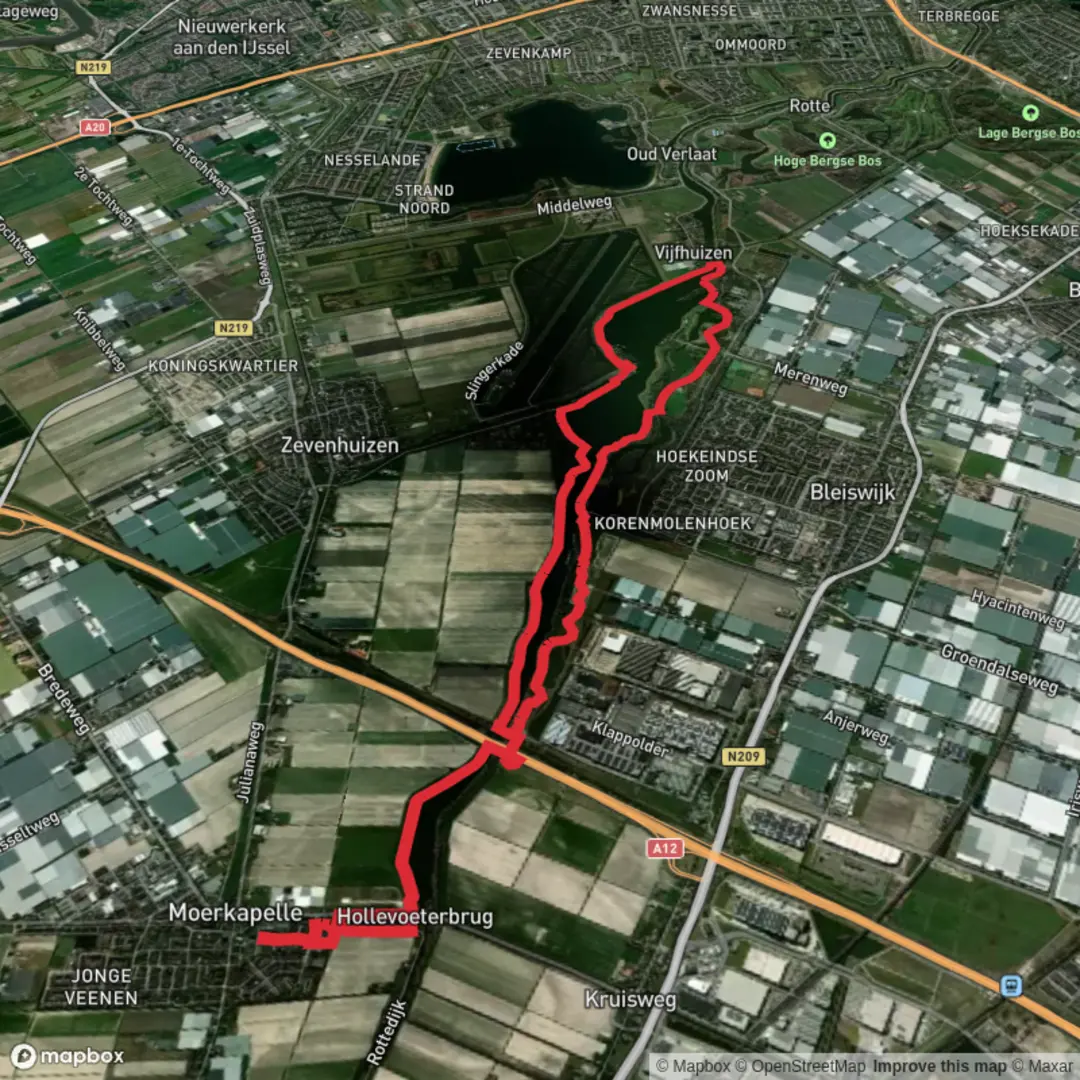
16.2 km
~3 hrs 14 min
0 m
Loop
“Wander through serene lakes, wildflower meadows, and timeless dikes, where Dutch nature and history shine.”
Starting from the leafy outskirts of Bleiswijk, just north of Rotterdam, this 16 km (about 10 miles) loop hike offers a flat and accessible route through the scenic Rottemeren area, following the Rottedijk and sections of the renowned Grote Rivierenpad. With virtually no elevation gain, this trail is ideal for hikers of all abilities, including families and those seeking a leisurely day outdoors.
Getting There
The trailhead is conveniently located near the Rottemeren recreational area, with the closest significant landmark being the Bleiswijkse Zoom, a popular lakeside park. For those arriving by public transport, take the train to Rotterdam Alexander station, then transfer to bus 173 towards Zoetermeer, alighting at the “Bleiswijk, Rottemeren” stop. Drivers can park at the Bleiswijkse Zoom car park, which offers ample space and direct access to the lakeside paths.
Trail Overview and Navigation
The route is well-marked and maintained, making navigation straightforward. For precise wayfinding and up-to-date trail conditions, use HiiKER, which provides detailed maps and GPS guidance for the entire loop.
Highlights Along the Route
Rottemeren Lakes and Wetlands
The first section skirts the tranquil Rottemeren lakes, a haven for waterfowl and migratory birds. Early mornings often reveal herons, grebes, and cormorants fishing in the shallows. The flat, open landscape is punctuated by reed beds and willow groves, offering excellent opportunities for birdwatching and photography.
Rottedijk and Polder Scenery
Continuing along the Rottedijk, the trail follows a historic dike that once protected the surrounding polders from flooding. This area is quintessential Dutch countryside, with wide views over green meadows, grazing cattle, and traditional windmills in the distance. The dike itself is a reminder of the Netherlands’ centuries-long battle with water, and interpretive signs along the way explain the engineering feats that shaped the landscape.
Grote Rivierenpad Section
Joining the Grote Rivierenpad, one of the Netherlands’ long-distance hiking trails, the route passes through a mosaic of farmland, orchards, and small woodlands. At around the halfway point (8 km/5 miles), you’ll cross the Rotte River via a charming pedestrian bridge, offering panoramic views back towards Rotterdam’s skyline. The riverbanks are lined with wildflowers in spring and summer, and benches provide restful spots to enjoy a picnic.
Nature and Wildlife
The Rottemeren area is part of a larger network of nature reserves, supporting a rich diversity of flora and fauna. In addition to birdlife, look for hares darting through the fields and, in late summer, dragonflies hovering above the water. The wetlands are also home to rare orchids and marsh plants, especially in less-trodden sections near the Zevenhuizerplas.
Facilities and Refreshments
Several lakeside cafés and picnic areas are dotted along the route, particularly near the Bleiswijkse Zoom and Zevenhuizerplas. Public toilets and water refill stations are available at main entry points. Cyclists and dog walkers also frequent the area, so expect a friendly, shared-use atmosphere.
Historical Notes
The Rottemeren region has a deep connection to Rotterdam’s origins—the city’s name derives from the Rotte River, which you’ll follow for part of the hike. The dikes and polders you traverse are products of medieval land reclamation, and the windmills you see are part of the Dutch tradition of water management that made this landscape habitable.
With its easy terrain, abundant wildlife, and blend of natural and cultural history, this hike is a quintessential Dutch countryside experience, easily accessible from Rotterdam and the surrounding Randstad cities.

Surfaces
Unknown
Asphalt
Gravel
Wood
Grass
Comments and Reviews
User comments, reviews and discussions about the Rottemeren via Rottedijk and Grote Rivierenpad, Netherlands.
average rating out of 5
0 rating(s)