Download
3D Flyover
Add to list
More
11.7 km
~2 hrs 20 min
0 m
Loop
“Follow sandy dikes through reedbeds and grazing herds, where the river rewrites the horizon.”
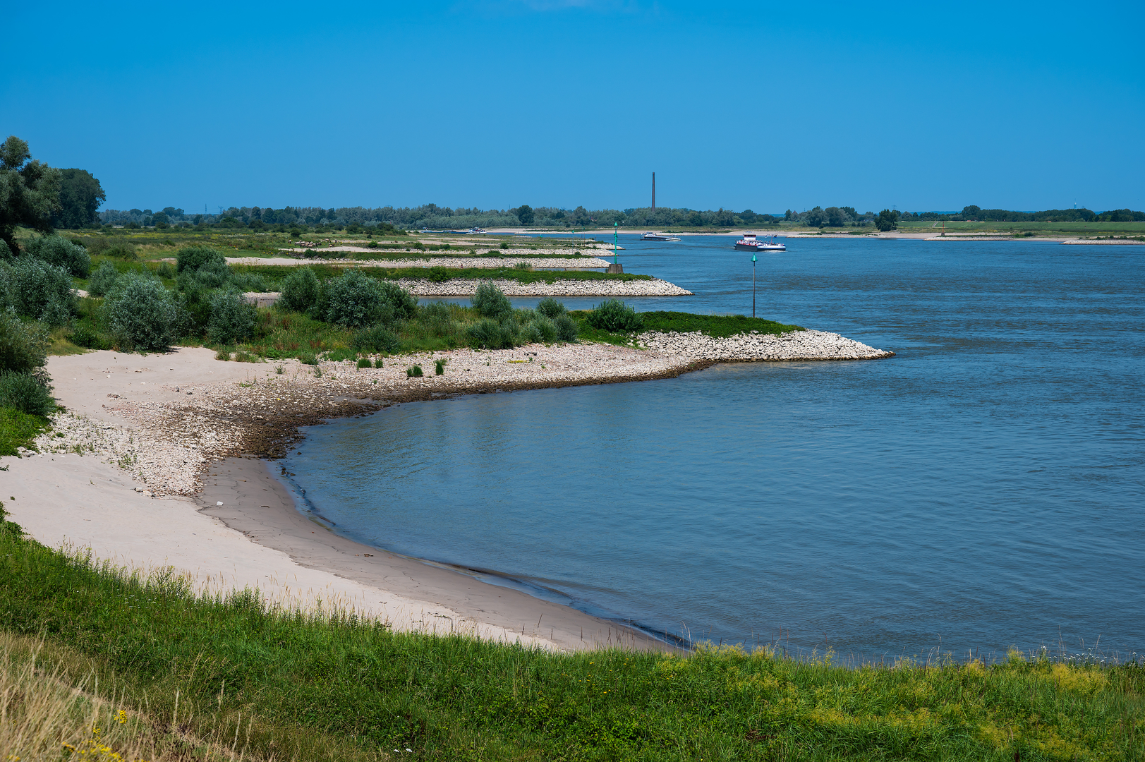
Expect a wide-open, river-shaped landscape that feels more like a living floodplain than a “park”: big skies, flat horizons, side channels, reedbeds, and grazed grasslands stitched together by dikes and sandy tracks. At around 12 km / 7.5 mi with roughly 0 m / 0 ft of climbing, the effort stays easy, but conditions can change quickly with weather and river levels—this is a place where water is part of the design.
Where to start (nearest landmark/address)
A practical trailhead is by the village of Kekerdom (municipality of Berg en Dal, east of Nijmegen). A commonly used access point is the parking area near Weverstraat in Kekerdom (often referenced around Weverstraat 96B, 6579 AG Kekerdom) which puts you right by the dike and the main entrances into the Millingerwaard floodplain. (msimons.nl)
Another well-known access/parking option is “De Lange Paol” car park on the dike between Kekerdom and Millingen aan de Rijn (also used for the seasonal foot/bike ferry area). (millingertheetuin.nl)
Getting there
- By public transport: From Nijmegen Centraal, buses (commonly line 80/82) run toward Kekerdom, from where you can walk straight onto the dike and into the reserve. Check times and the best stop in HiiKER before you go. (millingertheetuin.nl)
- By car: Aim for Kekerdom and park either near the church area (paid parking is common there) or at De Lange Paol (often free). From both, you’ll be on foot immediately—motor vehicles are not allowed into the nature area itself. (millingertheetuin.nl)
You’ll want HiiKER for staying on permitted paths and for quick reroutes if sections are wet or temporarily inaccessible.
What the route feels like underfoot
Most of the loop is flat and exposed. Surfaces typically alternate between: - Dike-top paths (firm, breezy, great views) - Sandy/gravelly floodplain tracks - Grass and earth paths that can turn slick after rain - Occasional narrower trods near reeds and side channels
Even with minimal elevation gain, the “difficulty” can jump a notch in strong wind, heavy rain, or when the floodplain is saturated.
Kilometer-by-kilometer expectations (approximate)
0–2 km / 0–1.2 mi:
From Kekerdom’s edge and the dike, you quickly step into the Millingerwaard’s open floodplain character—broad meadows and water features that look deliberately “unfinished,” because they’re meant to shift with the river. This early stretch is ideal for getting your bearings in HiiKER and noting any wet patches that might influence your return line.
2–6 km / 1.2–3.7 mi:
You’ll spend the middle miles weaving between side channels, marshy pockets, and grazed grassland. The landscape here is a mosaic created by rewilding and river dynamics—riparian woodland patches, reedbeds, and open flats. Millingerwaard is known for free-roaming grazers such as Konik horses and Galloway cattle, which help maintain that varied structure. Give them space, don’t approach for photos, and be especially cautious if you’re hiking with a dog (keep dogs leashed where required and whenever livestock are near). (rewildingeurope.com)
Wildlife watching can be excellent: the area is noted for birds such as great egrets, black terns, bluethroats, and sometimes large raptors like white-tailed eagles and osprey; beavers are also a signature species, with lodges and gnawed trunks often visible along quieter water. (rewildingeurope.com)
6–9 km / 3.7–5.6 mi:
This portion often feels the most “river-made”: wider views to the Waal and more obvious floodplain engineering—channels and low areas that are designed to take water when levels rise. If the river

Surfaces
Asphalt
Unknown
Dirt
Concrete
Paved
Sand
Grass
Unpaved
Comments and Reviews
User comments, reviews and discussions about the Millingerwaard Loop, Netherlands.
average rating out of 5
0 rating(s)