Download
3D Flyover
Add to list
More
35.8 km
~7 hrs 13 min
44 m
Multi-Day
“A long, flat polder loop of big skies, canal rhythms, and wind-sculpted solitude—best savoured steadily.”
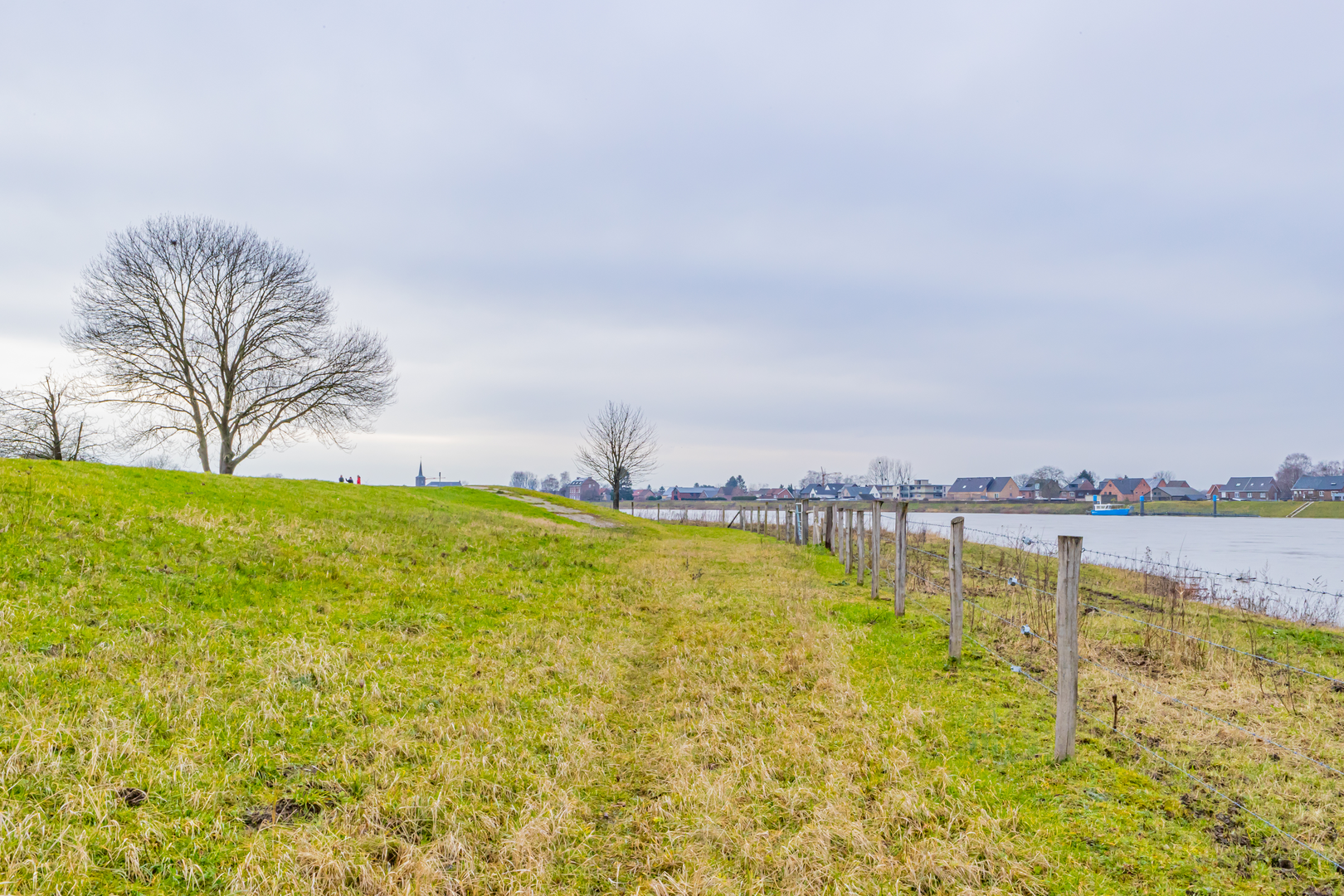
This is a long, low-lying loop of roughly 36 km (22.4 mi) with essentially 0 m (0 ft) of climbing—ideal for steady pacing, big skies, and classic Dutch polder scenery. Expect a mix of quiet village streets, canal-side paths, farm tracks, and long straight sections where wind can be the main “difficulty,” even when the terrain is flat.
Getting to the start (car + public transport)
Because the start point is listed only as “near” (with no town name or coordinates), the best way to plan access is to anchor your start at a practical, well-known local reference once you have the exact pin:
- By car: plan to park near a village center (kerk/church square) or a marina/harbor if the loop touches a waterside settlement. In much of the Netherlands, free or time-limited parking is common near sports fields (“Sportpark”), community centers, or larger supermarkets. Use HiiKER to identify the nearest obvious parking cluster to the route line.
- By public transport: most flatland loops like this are easiest via train to the nearest larger town, then a regional bus to a village stop (often “Dorpsstraat,” “Centrum,” or “Haven”). From there it’s typically a short walk to the route. Again, once you have the exact start pin, HiiKER will let you match the closest stop to the trailhead.
If you share the start lon/lat (or a HiiKER link), I can convert it to the nearest known address/landmark and tailor the access instructions precisely.
What to expect underfoot and on the horizon - Surface: predominantly paved cycle paths, brick village lanes, and compacted gravel/dirt farm tracks. After rain, unpaved sections can be slick with a thin film of mud, and grassy verges may be waterlogged. - Exposure: very open. With few trees, you’ll feel sun and wind more than you would on a forest trail. Bring layers even in mild forecasts. - Wayfinding: the landscape can look repetitive—straight canals, straight roads, repeating bridges—so keep HiiKER handy for confirming you’re on the correct bank of a canal and taking the right bridge at junctions.
Pacing and distance breakdown (approximate) At 36 km (22.4 mi), this is a full-day walk for most hikers. A practical way to think about it:
- 0–8 km (0–5 mi): settling into the rhythm—often village edge, then out into open fields. You’ll likely pass drainage ditches and the first long canal-side segment.
- 8–18 km (5–11 mi): the “big middle” where the scenery is at its most expansive. This is where wind management matters most; a headwind can slow you noticeably.
- 18–28 km (11–17.4 mi): typically the most psychologically demanding section because it can be very straight and uniform. Plan a deliberate snack/water stop here.
- 28–36 km (17.4–22.4 mi): returning toward settlement—more houses, more intersections, and usually more opportunities to buy food or hop on transit if needed.
Even with negligible elevation gain, your feet will feel the distance on hard surfaces. Consider cushioned footwear and socks you trust for long road-style mileage.
Landmarks, landscape character, and regional history
The names suggest a route threading through streets (“Meerstraat”) and possibly a waterside or maritime-themed corridor (“Fregatweg,” literally “frigate way”)—common in Dutch towns where neighborhoods and roads reference ships, trade, or naval history.
You’ll likely encounter: - Canals, dikes, and pumping infrastructure: the defining landmarks of the region. Look for pumping stations (gemaal), sluices, and small lift bridges—functional engineering that made settlement and farming possible on reclaimed or managed land. - Polder farmland: wide fields divided by drainage ditches. Depending on season, you may see grazing cattle and sheep, or fields of grass, potatoes, sugar beet, or other rotation crops. - Village cores: compact centers with a church, a few cafés, and older brick buildings. These are your best resupply points.
Historical significance in this kind of landscape is tightly tied to Dutch water management: centuries of land reclamation, dike building, and coordinated drainage turned wetlands and flood-prone areas into productive farmland and livable towns. Even when you’re “just walking a flat path,” you’re moving through a human-made landscape shaped by engineering, local water boards, and long-running adaptation to the sea and rivers.
Nature and wildlife you’re likely to see This is prime habitat for water and field birds, especially along canals, reed edges, and wet meadows:
- Common sightings: ducks, geese, coots, moorhens, swans, and gulls; in open fields, you may spot lapwings and other meadow birds depending on season.
- Raptors: kestrels and buzzards often hover or perch on poles scanning the verges.
- Small mammals: hares and rabbits are common in open farmland margins; you may also see signs of muskrat or other waterside burrowers along canal banks.
Be mindful during spring and early summer: some meadow birds nest on the ground, and certain paths may have seasonal guidance to keep dogs leashed or to stay strictly on the track.
Practical planning: food, water, and timing
- Water: don’t rely on canals/ditches. Carry what you need and top up in villages (cafés, supermarkets,

Surfaces
Asphalt
Unknown
Concrete
Cobblestone
Comments and Reviews
User comments, reviews and discussions about the Fregatweg and Meerstraat Loop, Netherlands.
average rating out of 5
0 rating(s)