Download
3D Flyover
Add to list
More
27.3 km
~5 hrs 48 min
213 m
Point-to-Point
“A steady Meuse-side ramble from Maastricht to Jupille, weaving floodplains, farm lanes, and village history.”
This is a long, mostly flat-to-gently-rolling point-to-point walk of about 27 km (16.8 mi) with roughly 200 m (656 ft) of total ascent—ideal for a steady day on riverside paths, farm lanes, and village streets. Expect a mix of paved cycleways, compacted gravel towpaths, and short stretches of quiet road, with frequent opportunities to shorten or pause the day using nearby towns and transit.
Getting to the start (Binnen, Maastricht area)
Because “Binnen” can refer to a central/inner-city area rather than a single trailhead, the most practical start point for this route is typically in central Maastricht (Binnenstad) near the river and main transit links—think the area around Maastricht Station (Stationsplein) or Maastricht city centre by the Maas (Meuse) river quays as the easiest “known landmark” to navigate to.
- By train/bus: Travel to Maastricht (NL) railway station (major hub for regional trains and buses). From there, local buses and a short walk can put you onto riverside paths quickly.
- By car: Aim for city-centre parking garages in Maastricht (signed “Centrum”), then walk to the riverfront to pick up the route. If you want to avoid city driving, park near Maastricht Station and start from there.
What the route feels like (surface, gradients, pacing)
With only ~200 m / 656 ft of climbing spread across 27 km / 16.8 mi, the elevation changes are subtle—small rises over bridges, embankments, and gentle undulations through fields. The main challenge is distance and time on feet, not steepness.
- Typical time: Many hikers will take 6–8 hours depending on breaks and pace.
- Footwear: Light hiking shoes are usually enough; after rain, towpaths and field edges can be slick.
- Resupply: You’ll pass through or near built-up areas often enough that water/snacks are usually manageable, but still start with at least 1.5–2 L in warm weather.
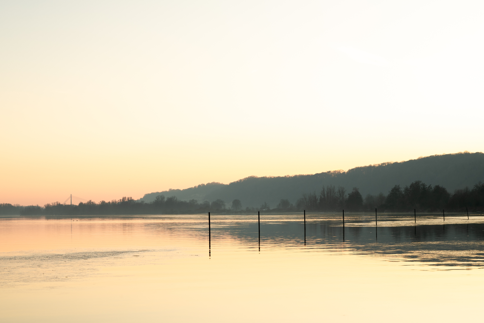
Hooge Weerd: river landscapes and floodplain nature
As you move toward Hooge Weerd, you’re essentially walking through a landscape shaped by the Maas/Meuse river system—a classic lowland river corridor where water management, floodplains, and human settlement have been intertwined for centuries.
- Terrain & scenery: Expect open views across water, side channels, and low-lying meadows. Paths here can be exposed—sun and wind are bigger factors than hills.
- Wildlife to look for: This kind of riverine mosaic often supports waterfowl (ducks, geese, swans), waders in shallows, and raptors hunting over fields. In warmer months, insects are active—bring repellent if you’re sensitive.
- What to watch out for:
- High water/flood conditions can temporarily reroute riverside paths. Check your route on HiiKER before you set off and be ready to detour onto higher streets if a section is closed or muddy.
- Cyclists: many Maas-side paths double as cycle routes—stay predictable, keep right, and listen for bells.
- High water/flood conditions can temporarily reroute riverside paths. Check your route on HiiKER before you set off and be ready to detour onto higher streets if a section is closed or muddy.
Oosterweg and the agricultural edge: quiet lanes, hedgerows, and villages
The middle portion around Oosterweg tends to feel more rural and structured—fields, drainage ditches, hedgerows, and farm access lanes. This is where you’ll likely notice the route’s “easy” character: long, steady walking with minimal elevation change.
- Surfaces: More hardpack and pavement here; road crossings are usually straightforward but stay alert at junctions where cars move faster than you expect in open country.
- Landmarks: Small chapels, roadside crosses, and older farmsteads are common in this region, reflecting long-settled land and the historic importance of agriculture and river trade.
- Seasonal notes:
- Spring: soft ground at field margins; birdsong and nesting activity—give hedgerows space.
- Summer: heat exposure on open lanes; plan shade breaks in villages.
- Autumn/winter: shorter daylight and damp surfaces; bring a light and a windproof layer.
- Spring: soft ground at field margins; birdsong and nesting activity—give hedgerows space.
Historical context: a borderland shaped by the Meuse
This walk sits in a culturally layered part of the Meuse valley, where Dutch and Belgian influences meet. Maastricht and the surrounding settlements have long been strategic because the river corridor is a natural route for trade, movement, and defense. You’ll feel that history in the density of towns, the engineered riverbanks, and the way paths thread between old centres and newer infrastructure.
Navigation and logistics (point-to-point)
Because you’re finishing at Jupille Place Havert, plan your end-of-hike logistics before you start:
- Navigation: Load the full line on HiiKER and download offline maps. In built-up areas, the “correct” turn can be easy to miss among parallel streets and cycleways.
- Bailout options: One advantage of this corridor is frequent proximity to towns—if weather turns or someone in your group tires, you can often shorten the day by heading to the nearest busier road or settlement and using public transport.
- Road awareness near the finish: Approaches into villages/towns often involve more intersections, driveways, and faster bikes—fatigue is when attention slips, so keep the group tight and crossings deliberate.
Distances you can plan around (approximate)
Use these as mental checkpoints for pacing and breaks: - **0–9

Surfaces
Unknown
Asphalt
Gravel
Concrete
Dirt
Ground
Cobblestone
Unpaved
Paved
Comments and Reviews
User comments, reviews and discussions about the Binnen to Jupille Place Havert via Hooge Weerd and Oosterweg, Netherlands.
average rating out of 5
0 rating(s)