
Download
3D Flyover
Add to list
More
25.2 km
~5 hrs 4 min
15 m
Point to Point
“A big-sky delta ramble of dikes and waterways, ending on Brielse Gatdam’s stark “line in sand.””
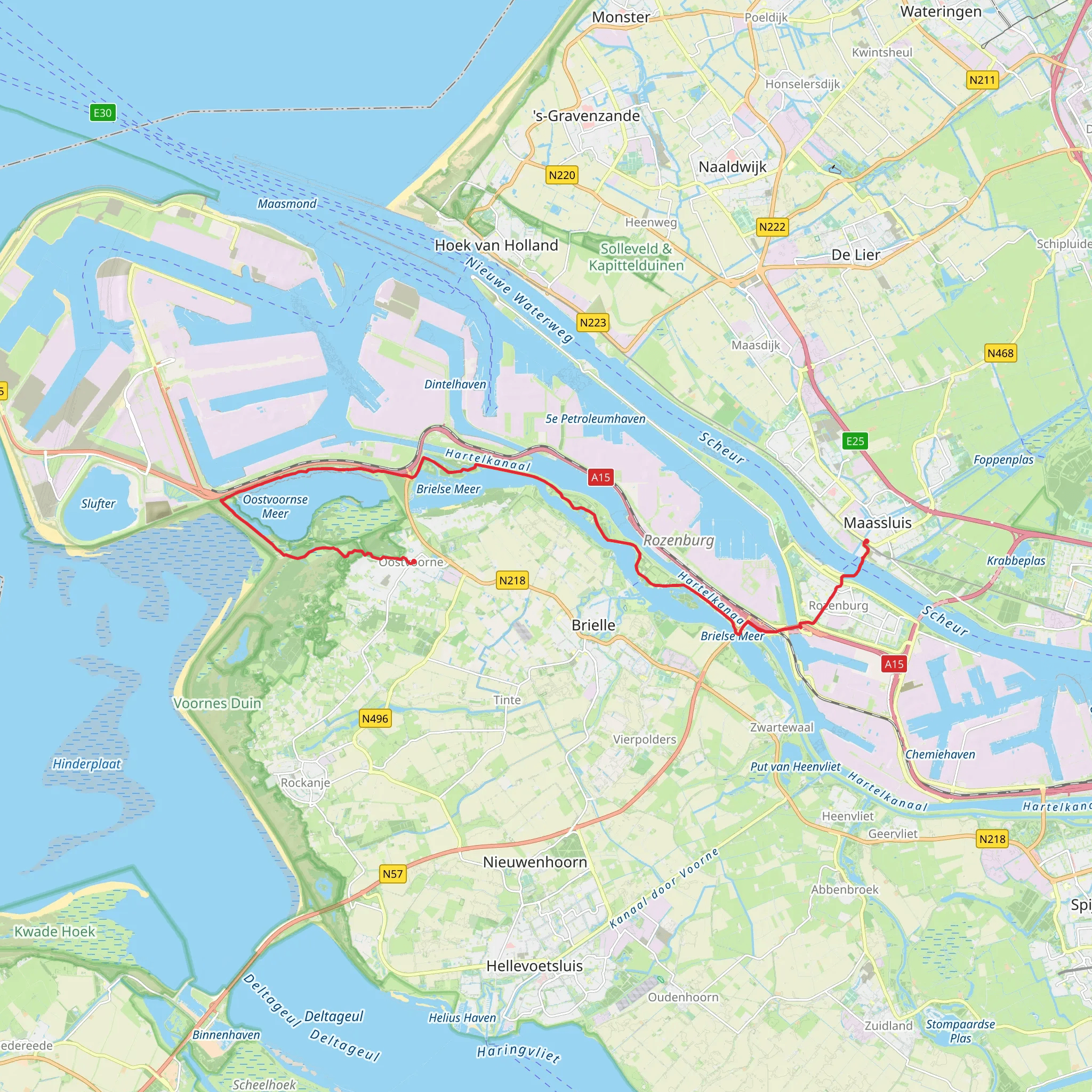
This is a flat, sea-level walk across the Rijnmond/Voorne-Putten delta landscape: big skies, engineered waterways, dikes, and long straight farm roads, finishing with the dramatic “line in the sand” feel of the Brielse Gatdam between the North Sea and the Oostvoornse Meer. Expect ~25 km / ~15.5 mi with ~0 m / ~0 ft of climbing—any “ups and downs” are really just dike crests and underpasses.
Getting to the start (Maassluis) and back from Oostvoorne
- By public transport (start): Maassluis is on Rotterdam’s metro network (Hoekse Lijn). A practical arrival point is Maassluis Centrum metro station (opened as part of the Hoekse Lijn conversion). (ervaarmaassluis.nl)
- By car (start): Aim for parking around Maassluis town center/harbor area (near the ferry landing and old town). Maassluis developed around a lock (“sluis”) and waterworks, so the historic core is compact and walkable. (en.wikipedia.org)
- Return from Oostvoorne: Oostvoorne is served by regional buses connecting via Brielle and Spijkenisse; one key corridor is R-net/EBS line 403 that runs through Oostvoorne and links toward Spijkenisse Metro Centrum (from where you can continue by metro). (ebs-ov.nl)
Start point and the first kilometers: Maassluis to the ferry (≈0–3 km / 0–1.9 mi)
From the Maassluis side, you’ll quickly feel the town’s relationship with shipping and water management—canals, quays, and the broad Nieuwe Waterweg corridor nearby. Keep an eye out for: - Busy road crossings and cycle traffic near the metro and town center. - Wind exposure: even on calm days inland, the open water and polders can create a steady headwind.
Navigation is straightforward on paved paths and dike-top routes, but it’s worth having HiiKER ready because the area has many parallel service roads and dike tracks that look similar.
Crossing the Nieuwe Waterweg: Maassluis–Rozenburg ferry (≈3–4 km / 1.9–2.5 mi including approaches)
A key logistical feature of this hike is the Maassluis–Rozenburg foot/bike ferry. It’s a long-running crossing and remains an important link for non-motorized travel across the shipping channel. (ervaarmaassluis.nl)
What to plan for:
- Check the day’s sailing times before you commit (service can be affected by maintenance and operational changes). The operator posts updates and schedules. (veermaassluisrozenburg.nl)
- Allow buffer time: if you arrive just after a departure, waiting can add a noticeable chunk to your day.
- Stay alert at the landings: ramps can be slick in rain, and there’s often a mix of walkers and cyclists funneling into a narrow space.
Rozenburg and Volgerweg: industrial edges and dike-country (≈4–16 km / 2.5–10 mi)
Once on the Rozenburg side, the character shifts: you’re on the edge of the Europoort/Rotterdam port-industrial sphere, but still moving through managed green corridors, dikes, and straight polder roads. Along Volgerweg, expect: - Long, ruler-straight stretches with very little shade—sun and wind management matter more than elevation. - Truck/industrial traffic nearby on larger roads: even if your route stays on quieter lanes, you’ll hear and sometimes cross access roads. Use extra caution at junctions and roundabouts. - Birdlife: canals, reed edges, and wet fields often hold geese, ducks, and waders; in spring and autumn, migration can be noticeable in the open delta.
Because the terrain is so flat, pacing is easy—but the monotony can sneak up on people. Break the day into segments (for example: ferry → mid-polder → lake/dam) and keep hydration steady.
Brielse Meer, Oostvoornse Meer, and the Brielse Gatdam (≈16–23 km / 10–14.3 mi)
As you approach the lake
AI Planner
Days planned around your pace, with somewhere to stay each night.
Surfaces
Unknown
Asphalt
Concrete
Sand
Dirt
Cobblestone
Gravel
Paved
Comments and Reviews
User comments, reviews and discussions about the Maassluis to Oostvoorne via Volgerweg and Brielse Gatdam, Netherlands.
average rating out of 5
0 rating(s)



