Download
3D Flyover
Add to list
More
25.4 km
~5 hrs 25 min
202 m
Point-to-Point
“From Maarn’s forest lanes to Leersumsche Veld’s shimmering heath, this rolling loop rewards steady walkers.”
This is a mostly flat-to-gently-rolling 25 km (15.5 mi) loop with about 200 m (656 ft) of total ascent, linking quiet village edges, heath and wetland at Leersumsche Veld, and the forested high point of Amerongse Berg on the Utrechtse Heuvelrug. Even though it’s rated Easy, the length makes it a solid full-day walk—plan for 5.5–7 hours of moving time depending on stops and surface conditions.
Getting to the start (Maarn)
Nearest well-known start landmark: Maarn railway station (Station Maarn), Stationsweg, Maarn (Utrecht), Netherlands. This is the simplest “pin” to aim for and a practical place to begin/end a loop.
- By public transport: Take the train to Station Maarn (on the Utrecht–Arnhem corridor). From the platforms you’re immediately on the village edge with easy access to paths leading into the Heuvelrug forests.
- By car: Navigate to Station Maarn, Stationsweg, 3951 Maarn (use the station as the destination). There is typically parking in the station area and nearby streets; check local signage for time limits and permitted zones.
Bring HiiKER for turn-by-turn confidence where multiple sandy tracks intersect in the forest, especially around Amerongse Berg where paths braid together.
What the route feels like underfoot
Expect a mix of: - Firm forest tracks (often compacted sand/gravel) - Sandy singletrack in pine and mixed woodland (can feel slower) - Heath and wetland edges near Leersumsche Veld (can be muddy after rain) - Short paved connectors near villages and road crossings
Because the total climb is modest (200 m / 656 ft), the “ups” come as short, gentle rises rather than sustained hills. The most noticeable undulations are on and around Amerongse Berg, where you’ll gain much of the day’s elevation in a few rolling pushes.
Segment-by-segment expectations (approximate)
0–6 km (0–3.7 mi): Maarn to the Heuvelrug woods You’ll leave the built-up edge quickly and enter the characteristic Utrechtse Heuvelrug landscape: straight forest lanes, softer side paths, and occasional open clearings. Elevation change is minimal here—think 30–60 m (100–200 ft) of gradual rise spread out, barely noticeable unless you’re watching your stats.
Look out for: - Deer tracks in sandy sections (roe deer are common in these woods) - Woodpeckers and other forest birds; early morning is best for sightings - Cyclists on wider tracks—keep right and be predictable at junctions
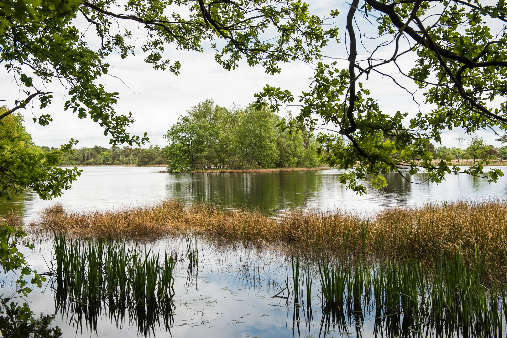
6–13 km (3.7–8.1 mi): Leersumsche Veld (heath + wetland) This is the most distinctive nature section. Leersumsche Veld is known for heathland, small pools, and wetter hollows that contrast with the surrounding forest. After wet weather, this is where you’re most likely to encounter muddy patches and soft ground.
What to watch for: - Seasonal wetness: even in drier months, low spots can hold water; waterproof shoes or at least quick-drying trail runners help. - Ground-nesting birds: in open heath, stay on established paths. - Ticks: common in heath/edge habitat—long socks and a post-hike check are smart.
Landmarks and scenery: - Open heath views with scattered pines and birch - Small water features that attract dragonflies in warmer months
13–19 km (8.1–11.8 mi): Amerongse Berg (the “high point” feel) You’ll transition back into denser forest and begin the day’s most noticeable climbing. Amerongse Berg isn’t a mountain in the alpine sense, but it’s one of the higher bumps on the ridge and gives the route its most “hilly” character. Expect roughly 100–140 m (330–460 ft) of the total ascent to accumulate across this middle stretch via a series of gentle rises.
Navigation note: this area has many intersecting tracks; HiiKER is especially useful here to avoid accidentally following a parallel path that looks identical.
What to watch for: - Sandy climbs/descents: short, sometimes loose underfoot; trekking poles can help if you’re prone to slipping. - Shared-use paths: you may meet runners and mountain bikers—listen for bikes approaching from behind.
19–25 km (11.8–15.5 mi): Return toward Veenendaal and back to Maarn The final third tends to feel easier again: longer, straighter forest lanes and gradual descents/flat stretches that help you cruise home. Fatigue is the main factor—this is where blisters and hot spots show up if footwear isn’t dialed in.
If the loop swings close to Veenendaal, you’ll notice a more urban edge and busier crossings before you re-enter quieter green corridors. Plan for at least one or two road crossings where you’ll want to pause and cross deliberately.
Nature, wildlife, and seasonal highlights
- Heathland bloom (late summer): heather can color the open areas, making Leersumsche Veld the visual highlight.
- Autumn: beech and oak tones in the forest; also peak time for slippery leaves on hardpack.
- Winter/early spring: wetter ground in low areas; expect more mud and puddles.

Surfaces
Unknown
Sand
Dirt
Unpaved
Gravel
Asphalt
Ground
Concrete
Comments and Reviews
User comments, reviews and discussions about the Maarn to Veenendaal via Leersumsche Veld and Amerongse Berg Loop, Netherlands.
average rating out of 5
0 rating(s)