Download
3D Flyover
Add to list
More
9.6 km
~1 hrs 55 min
0 m
Loop
“Wander lush meadows and timeless villages, where history whispers and nature paints the Gelderse Valley’s heart.”
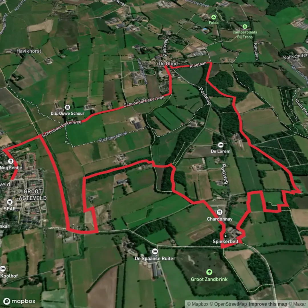
The Snorrenhoefpad is a circular hiking trail of approximately 10 kilometers (6.2 miles) located near Achterveld in the province of Utrecht, Netherlands. With minimal elevation gain, it offers an easy and accessible route for hikers of all levels.
Getting to the Trailhead
The trail begins at Café-Restaurant De Roskam, situated at Hessenweg 212, 3791 PN Achterveld. For those traveling by car, parking is available at this location. If you're using public transport, Achterveld is accessible by bus services from nearby cities; check local schedules for the most current information.
Trail Overview
Starting from De Roskam, the Snorrenhoefpad leads you through the picturesque Gelderse Valley, characterized by its expansive meadows, traditional farmyards, and meandering streams. The route is well-marked with red wooden shoe symbols, guiding you along narrow paths and over occasional fences. The trail is predominantly unpaved, offering a genuine countryside experience.
Notable Landmarks and Natural Features
De Glind: Approximately 3 kilometers (1.9 miles) into the hike, you'll pass through the charming village of De Glind, known for its community-focused initiatives and serene environment.
Landgoed De Boom: Around the 5-kilometer (3.1-mile) mark, the trail takes you through Landgoed De Boom, an impressive estate featuring lush forests and historic architecture.
Modderbeek Stream: As you approach the 7-kilometer (4.3-mile) point, you'll encounter the Modderbeek, a stream that has been restored to its natural meandering state, providing a habitat for various aquatic species.
Flora and Fauna
The Gelderse Valley is home to diverse wildlife. In the spring, keep an eye out for the northern lapwing (kievit), especially during mating season when males perform impressive aerial displays. The meadows and streams also support a variety of waterfowl and plant species, making it a delightful area for nature enthusiasts.
Historical Significance
The Hessenweg, where the trail begins, is historically significant. It was named after traders from the German region of Hesse who transported goods such as carpets, pots, and spices along this route. These traders often used large, broad wagons that required sturdy, elevated roads, leading to the development of the Hessenweg on ancient sand ridges formed during the Ice Age. Additionally, the nearby hamlet of Snorrenhoef, which lends its name to the trail, is believed to have been a refuge for itinerants and beggars in the past.
Navigation and Preparation
While the trail is well-marked, it's advisable to use the HiiKER app for detailed maps and real-time navigation assistance. Given the unpaved nature of the path, wearing sturdy hiking boots is recommended. Be prepared for potentially muddy sections, especially after rainfall. Always check local weather conditions before setting out and carry sufficient water and snacks for the journey.
This hike offers a serene journey through the Dutch countryside, blending natural beauty with historical insights, making it a rewarding experience for those seeking a leisurely outdoor adventure.

Surfaces
Unknown
Asphalt
Unpaved
Grass
Concrete
Dirt
Comments and Reviews
User comments, reviews and discussions about the Snorrenhoefpad Loop, Netherlands.
average rating out of 5
0 rating(s)