Download
3D Flyover
Add to list
More
10.2 km
~2 hrs 2 min
0 m
Loop
“Drift from Ommen’s river bridges into wide, wind-brushed fields and quiet lanes on an easy loop.”
A relaxed, mostly level loop of about 10 km (6.2 miles) with essentially 0 m (0 ft) of climbing, this walk is ideal for an easy half-day outing—expect a mix of quiet lanes, riverside or canal-side stretches, and open Dutch countryside around Ommen (Overijssel, Netherlands). Underfoot is typically firm (paved paths, compacted gravel, and short grassy sections), so it’s a good choice year-round, though some low-lying path edges can be damp after rain.
Getting to the start (nearest landmark / address)
Because “near” wasn’t fully provided, the most reliable start reference for this loop is Ommen town centre, close to the Brug over de Vecht (Vecht Bridge) and the Ommen railway station area—a practical meeting point with clear navigation and services nearby.
- By train (public transport): Take the train to Ommen Station (Station Ommen). From the station area, you can walk a short distance to the river/bridge area to begin the loop. Ommen is served by regional rail connections within Overijssel.
- By car: Aim for parking near Ommen centrum (town centre) or near the Vecht riverfront. In Dutch towns, signed public car parks (“P”) are common and usually the simplest option. If you want the closest “significant landmark” target for navigation, use Ommen Station or the Vecht bridge in Ommen as your anchor point, then follow the loop from there.
For on-trail navigation, load the route in HiiKER before you arrive and download it for offline use—useful if you dip onto quieter rural lanes where signage can be intermittent.
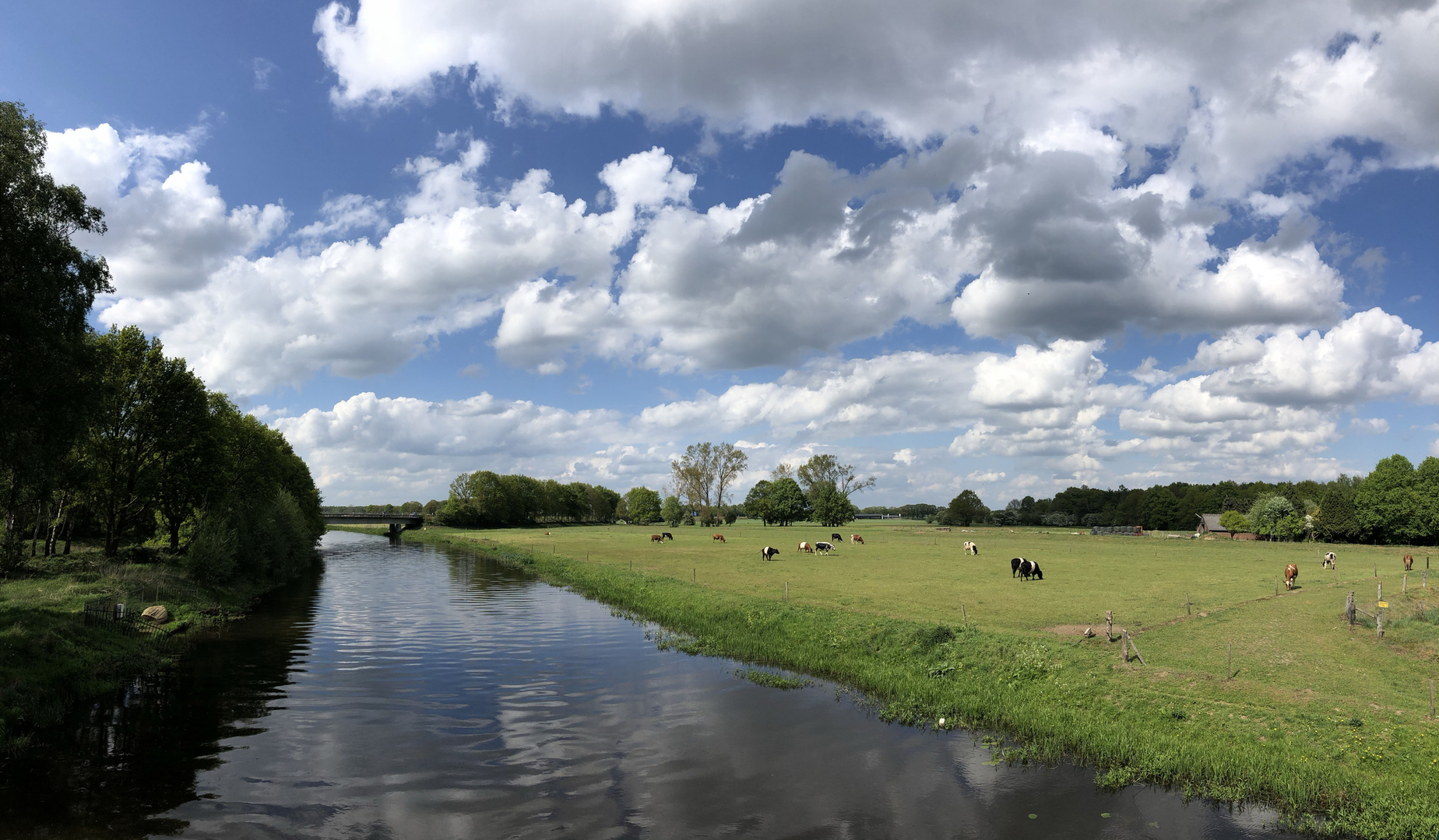
What you’ll see and what to expect along the way - Early kilometres (0–2 km / 0–1.2 mi): You’ll likely begin on tidy town-edge paths and calm streets as you leave central Ommen. Expect cyclists, dog walkers, and local foot traffic. Surfaces are usually paved here, and wayfinding is straightforward with frequent junctions and clear sightlines. - Middle stretch (2–7 km / 1.2–4.3 mi): The character shifts to open fields, hedgerows, and water-adjacent paths. This is classic Overijssel lowland scenery—flat horizons, drainage ditches, and long straight segments broken up by small bridges and farm access tracks. Wind can be the biggest “difficulty” factor on an otherwise easy route, especially in exposed sections. - Return leg (7–10 km / 4.3–6.2 mi): You’ll gradually arc back toward Ommen, often rejoining more maintained paths as you approach town. Expect a gentle reintroduction of houses, small parks or green verges, and more frequent crossings.
Landmarks, landscape, and local character
- Water crossings and bridges: The “brug” element of the route name points to a bridge feature—around Ommen, bridges are often tied to the River Vecht and its associated waterways. Even when you’re not directly on the main riverbank, you’ll notice how the landscape is shaped by water management: canals, ditches, and small sluice-like structures.
- Ommen and the Vecht region: Ommen sits in a historically important river corridor. The Vecht has long been a transport and trade artery, and settlements here developed around crossings and navigable stretches. While this loop is easy and modern in feel, you’re walking through a landscape that has been engineered and farmed for centuries—fields, embankments, and straightened watercourses reflect that long relationship between people and water.
- Rural architecture: Farmsteads, barns, and neatly ordered plots are common. Please keep to public rights of way—some tracks look inviting but are private access roads.
Nature and wildlife (what to look out for)
Even on a short, flat loop, the biodiversity can be surprisingly good—especially along field margins and waterways.
- Birdlife: Expect waterfowl (mallards, coots, moorhens), herons, and seasonal migrants using canals and wet fields. In open farmland you may spot lapwings and other meadow birds depending on the season.
- Mammals: Hares are a classic sight in open fields. Near water and reedier edges, you may see signs of muskrat or other small mammals (often noticed by burrows or disturbed banks).
- Plants: Look for reeds, sedges, and willow along wetter edges, with hawthorn/blackthorn hedges and wildflowers along sunny verges in spring and summer.
Wildlife etiquette matters here: keep dogs under control near livestock and ground-nesting birds, and give cyclists space on shared paths.
Practical planning: timing, surfaces, and easy-route hazards
- Time needed: Most hikers will take 2–3 hours for 10 km (6.2 mi) at an easy pace with stops for photos and birdwatching.
- Footwear: Light hiking shoes or trainers are usually fine. After wet weather, consider shoes with a bit more grip—mud can collect at path edges and near gates/bridges.
- Navigation: The terrain is flat and visibility is good, but rural junctions can be repetitive. Use HiiKER to confirm turns, especially where multiple farm tracks run parallel.
- Road crossings & shared-use paths: The main things to “look out for” are cyclists (often fast and quiet) and occasional narrow road sections without a dedicated footpath.

Surfaces
Unknown
Concrete
Asphalt
Sand
Ground
Grass
Wood
Dirt
Comments and Reviews
User comments, reviews and discussions about the Archemerbrug and Ommen Loop, Netherlands.
average rating out of 5
0 rating(s)