Download
3D Flyover
Add to list
More
13.2 km
~2 hrs 37 min
0 m
Loop
“Drift along a gentle Dutch lowland loop of woods, fields and ditches, pausing for birdsong.”
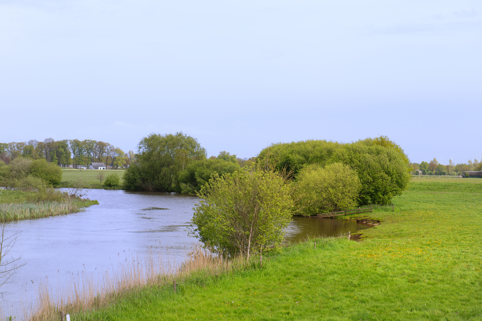
A gentle, mostly level loop of about 13 km (8.1 mi) with ~0 m / ~0 ft of climbing, this walk is all about easy-going paths through a classic Dutch lowland landscape—woodland edges, open fields, drainage ditches, and quiet lanes—where the “interest” comes from changing scenery, birdsong, and the occasional historic farmstead rather than steep gradients. Expect a relaxed pace, frequent opportunities to pause for photos, and surfaces that can range from firm gravel to muddy track after rain.
Getting to the start (car + public transport)
Because the start point you provided is incomplete (“near …”), the most reliable way to plan is to use HiiKER to open the route and identify the exact trailhead pin. Once you have the pin, you can match it to the nearest village street and parking area.
That said, for a loop named Overijsselse Hout and Buitenhof, you’ll typically be in Overijssel (Netherlands) and starting near a small settlement or woodland access point with informal parking (common near Dutch “hout/bos” areas). Practical approaches:
- By car: Aim for the nearest signed woodland entrance/parking area (“P” signs) close to the route’s trailhead. In this region, parking is often a small gravel pull-in near a forest edge, farm track, or recreation access road. Arrive earlier on weekends if the area is popular with dog walkers and cyclists.
- By public transport: The usual pattern in Overijssel is train to a larger town (e.g., Zwolle/Deventer/Almelo area depending on where the pin sits), then a regional bus to the nearest village stop, followed by a 1–3 km (0.6–1.9 mi) walk to the trailhead. Use HiiKER to measure the walk-in distance from the closest bus stop once you know the exact start.
If you share the lon/lat (or a HiiKER link), I can convert it to the nearest known address or landmark and give precise car parking and transit stop suggestions.
What the route feels like underfoot
With essentially no elevation gain, the main “difficulty” factors are surface conditions and exposure to wind/rain. You’ll likely encounter a mix of:
- Compact gravel or crushed-stone paths through managed woodland sections
- Farm tracks (sometimes concrete slabs or hard-packed dirt)
- Short paved connectors on quiet rural roads
- Grassier margins along fields or ditches (can be wet and soft)
After rainfall, lowland routes can develop standing water in ruts and at field-edge pinch points. Waterproof footwear isn’t mandatory in dry spells, but it’s a big comfort upgrade in wetter months.
Landmarks, landscape, and the “Overijsselse Hout” character
“Hout” in Dutch place-names often points to historic managed woodland—not wilderness, but working woods shaped by centuries of coppicing, timber use, and boundary planting. On a loop like this, expect:
- Woodland blocks and shelterbelts: Straight-ish edges, drainage ditches, and planted stands are common. You may notice transitions between darker conifer patches and lighter deciduous areas.
- Field-and-ditch scenery: Overijssel’s lowlands are defined by water management—ditches, small canals, and culverts that keep farmland workable. These features also concentrate wildlife.
- Farmsteads and rural lanes: The “Buitenhof” element suggests an “outer court/estate” feel—often associated with older farm complexes, estate lands, or outlying holdings. Even when buildings aren’t on the route, the pattern of lanes, hedges, and tree lines often reflects older land divisions.
Wildlife you’re likely to notice
Even on an easy, human-shaped landscape loop, wildlife can be excellent—especially birds:
- Water and ditch edges: mallard, coot, moorhen, grey heron; in quieter stretches you may spot egrets depending on season.
- Open fields: lapwing and other meadow birds in suitable habitat; buzzards are common overhead in many parts of the Netherlands.
- Woodland edges: great spotted woodpecker, tits, and finches; roe deer can appear at dawn/dusk near cover.
Ticks can be present in grassy margins and woodland edge vegetation in warmer months—long socks and a quick check after the hike are sensible.
Navigation and wayfinding (keep it easy)
This is the kind of loop where junctions can look similar—a farm track here, a woodland spur there—so it’s worth having the route loaded on HiiKER. Common wayfinding moments to watch for:
- Multiple parallel tracks along field edges (one may be a private farm access)
- Woodland intersections where a wider main track continues straight but the route turns onto a narrower side path
- Bridges/culverts over ditches that act as key “confirmation points” you’re on the right line
If you meet a closed gate or a “private” sign, don’t force it—use HiiKER to backtrack to the last confirmed point and pick up the correct public right of way.
Distance breakdown (approximate) so you can pace the day
For a 13 km (8.1 mi) easy loop, a comfortable plan looks like:
- 0–3 km (0–1.9 mi): Settling in—often the most “built” feeling section if you start near a lane or village edge, then easing into woodland or field paths.

Surfaces
Concrete
Unknown
Asphalt
Paved
Wood
Comments and Reviews
User comments, reviews and discussions about the Overijsselse Hout and Buitenhof Loop, Netherlands.
average rating out of 5
0 rating(s)