Download
3D Flyover
Add to list
More
13.5 km
~2 hrs 41 min
0 m
Loop
“A flat Kotterbos–Vaartplas loop of poplar shade, reedbed skies, and wind-kissed, sometimes muddy tracks.”
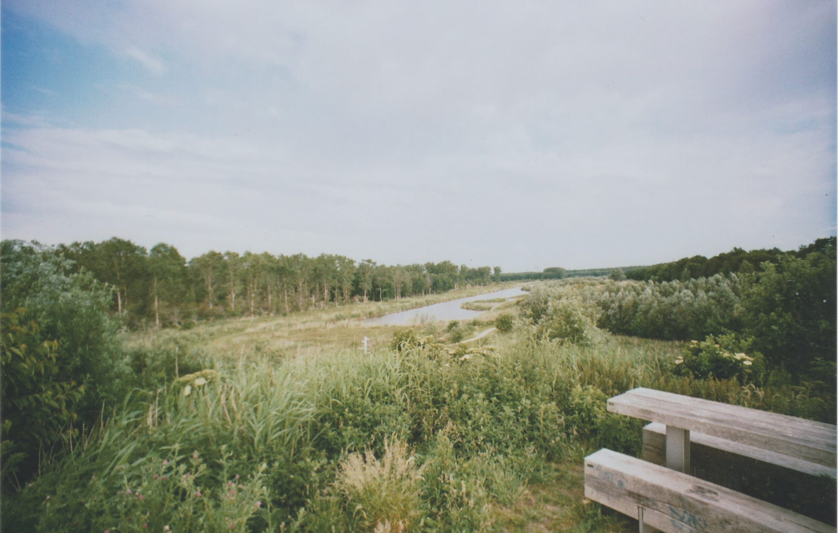
You’ll be walking a flat, water-and-woodland loop of about 13 km / 8.1 mi with essentially 0 m / 0 ft of climbing—classic Flevoland terrain where the “effort” comes more from wind exposure, soft ground after rain, and long straight paths than from hills. The route threads through Kotterbos (a poplar-and-wetland woodland) and skirts the Vaartplas (a broad waterbody by the Vaart canal system), right on the edge of the wider Oostvaardersplassen landscape.
Getting to the start (car + public transport)
A practical, easy-to-find place to begin is by Kotterbos woods at Kotterbosweg 97, 8218 AD Lelystad (Netherlands)—a commonly used access point for walking routes in the area and a clear landmark for navigation. (visitflevoland.nl)
- By car: Aim for Kotterbosweg 97, Lelystad and park near the Kotterbos access. Roads here are straightforward polder roads; expect narrow shoulders and occasional cyclists.
- By public transport: The broader area is served via Lelystad (nearest city) and Almere Buiten (district to the west of Vaartplas). From either, you typically finish with a short taxi ride or a bike connection to the Kotterbosweg access, depending on the day’s bus routing. (Use HiiKER to pin the exact trailhead you choose and to confirm the closest stop-to-start walking link.)
What the walk feels like underfoot
Most of this loop is on wide forestry tracks, canal-side paths, and compacted dirt/gravel. Because the region is reclaimed land with clay soils, sections can turn slick and sticky after rain, and puddling can linger in low spots. If it’s been wet, plan on waterproof footwear and expect your pace to slow slightly on muddier stretches.
Wind is the other big factor: open edges near water and straight canal corridors can feel surprisingly brisk, even on mild days—bring a light shell layer.
Route flow and key waypoints (approximate)
0.0–3.5 km (0.0–2.2 mi): Kotterbos entry + poplar woodland
From the Kotterbos access, you’ll settle into easy walking on broad tracks through poplar stands and wetter woodland pockets. Kotterbos is known for a mix of poplars and wetlands with reed marsh and willow copses, so you’ll often see water in ditches and side channels close to the path. (visitflevoland.nl)
What to look for:
- Deer and fox are regularly noted in the area, and the habitat also supports hares and even beavers (often more evident by gnawed wood and water-edge activity than by sightings). (visitflevoland.nl)
- In calm weather, listen for woodland birds at the forest–reed transitions.
3.5–7.5 km (2.2–4.7 mi): Vaart corridor + Vaartplas shoreline feel
As you angle toward the water, the landscape opens. The Vaartplas sits near Kotterbos and close to features like the Ibisbrug bridge, so you may pass or glimpse bridge infrastructure depending on the exact line your loop takes. (mapcarta.com)
This middle portion is where you’ll feel the wind most and where the walking can become very rhythmic: long, flat lines with big skies, water to one side, and reedbeds fringing the edges.
Practical notes: - If you’re sharing any segments with multi-use tracks, be alert for cyclists (the wider region includes marked routes). Keep right on blind bends and listen for bells.
7.5–10.5 km (4.7–6.5 mi): Edge-of-wetland atmosphere (Oostvaardersplassen influence) Kotterbos lies adjacent to the Oostvaardersplassen nature reserve, a major wetland/rewilding area in Flevoland. (visitflevoland.nl) Even if your loop stays outside the core reserve, the “feel” of the landscape—reedbeds, open water, and big-bird country—is unmistakable.
Wildlife expectations here are often strongest for birds. Oostvaardersplassen is recognized for rich birdlife (including large waterbirds and raptors), and the surrounding mosaic of water, reed, and open ground supports frequent sightings and flyovers. (en.wikipedia.org)
Bring binoculars if you have them; even a short pause at a clear water view can be rewarding.
10.5–13.0 km (6.5–8.1 mi): Return through woodland lanes The final stretch typically tucks back into more sheltered tracks as you arc toward the Kotterbos access again. After the open water

Surfaces
Ground
Unknown
Unpaved
Asphalt
Concrete
Gravel
Grass
Sand
Comments and Reviews
User comments, reviews and discussions about the Kotterbos and Vaartplas Loop, Netherlands.
average rating out of 5
0 rating(s)