Download
3D Flyover
Add to list
More
7.1 km
~1 hrs 25 min
0 m
Loop
“Wander tranquil lakesides, blooming woodlands, and marshy vistas where birds and Dutch ingenuity thrive together.”
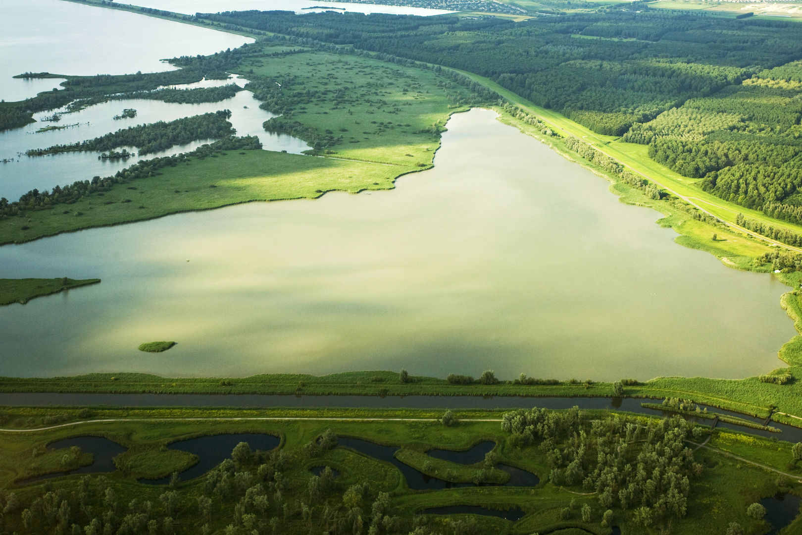
Starting from the vicinity of Keersluisplas, a tranquil lake near Almere, this loop trail covers approximately 7 km (about 4.3 miles) with virtually no elevation gain, making it accessible for hikers of all abilities. The trailhead is easily reached by public transport from Almere Centrum station, with local buses stopping near the Keersluisplas area, or by car with parking available at the nearby marina or recreational area.
Keersluisplas and Wetland Scenery
The route begins along the shores of Keersluisplas, a serene body of water popular with birdwatchers and anglers. The flat, well-maintained paths wind through open grasslands and reed beds, offering panoramic views across the water. Early in the hike, look for waterfowl such as grebes, herons, and cormorants, especially in the morning when the area is quietest.
Praambos Woodland and Wildlife
After about 2 km (1.2 miles), the trail enters the Praambos, a mixed woodland area known for its biodiversity. The forest floor is carpeted with wildflowers in spring, and the canopy provides shade in summer. Roe deer, foxes, and a variety of songbirds are commonly spotted here. The paths are wide and mostly unpaved, but remain easy to follow. Hikers should keep an eye out for interpretive signs detailing the local flora and fauna.
Observatiepunt Loop and Birdwatching
Roughly halfway through the loop, at around 3.5 km (2.2 miles), you’ll reach the Observatiepunt, a designated observation point overlooking a marshy expanse. This is a prime spot for birdwatching, with benches and a small shelter. Bring binoculars for the best chance to spot marsh harriers, kingfishers, and sometimes even osprey during migration seasons.
Navigation and Trail Conditions
The entire loop is well-marked, but for added confidence, use HiiKER to track your progress and ensure you stay on the correct path. The terrain is flat throughout, with a mix of gravel, dirt, and grassy tracks. After rain, some sections near the water can become muddy, so waterproof footwear is recommended.
Historical and Regional Context
The area around Keersluisplas and Praambos is part of the Flevoland polder, land reclaimed from the IJsselmeer in the mid-20th century. The landscape is a testament to Dutch engineering, with dikes, sluices, and canals shaping the environment. The Keersluis (sluice) itself is a reminder of the ongoing relationship between land and water in this region.
Access and Facilities
Public transport from Almere Centrum is frequent, with buses stopping within a short walk of the trailhead. For drivers, parking is available at the Keersluisplas recreational area. There are picnic tables and rest areas along the route, but no cafes or shops directly on the trail, so bring water and snacks. Toilets are available at the main parking area.
This easy, scenic loop is ideal for families, casual walkers, and anyone interested in the unique blend of Dutch nature and water management history.

Surfaces
Unknown
Unpaved
Concrete
Grass
Asphalt
Gravel
Paved
Dirt
Comments and Reviews
User comments, reviews and discussions about the Keersluisplas, Praambos and and Observatiepunt Loop, Netherlands.
average rating out of 5
0 rating(s)