Download
3D Flyover
Add to list
More
25.3 km
~5 hrs 3 min
0 m
Loop
“Wander through emerald meadows, royal roads, and lakeside vistas on a Dutch countryside journey steeped in history.”
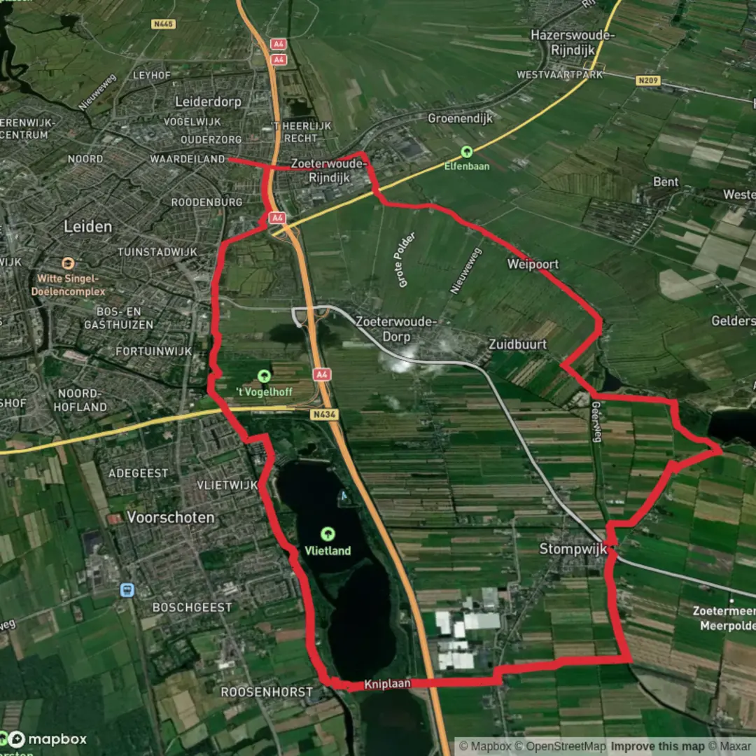
Embarking on a 25-kilometer (approximately 15.5 miles) journey through the serene landscapes of South Holland, this hike seamlessly integrates sections of the Groene Hartpad, Koninklijke Weg, and Oostvliet Weg, culminating in the picturesque Vlietland recreational area. With virtually no elevation gain, this easy trail offers a delightful exploration of the Dutch countryside, rich in natural beauty and historical significance.
Starting Point and Access
The hike commences near the town of Voorschoten, conveniently accessible by both public transport and car. For those traveling by train, Voorschoten Station serves as a suitable starting point, with regular services connecting from major cities like The Hague and Leiden. If arriving by car, parking facilities are available in Voorschoten, providing easy access to the trailhead.
Trail Overview
- Groene Hartpad Segment
Beginning in Voorschoten, the route follows a segment of the Groene Hartpad, a long-distance path that traverses the "Green Heart" of the Netherlands. This section meanders through lush meadows and along tranquil waterways, offering hikers a glimpse into the traditional Dutch polder landscape. The flat terrain and well-maintained paths make for comfortable walking conditions.
- Koninklijke Weg
Transitioning onto the Koninklijke Weg, or "Royal Road," the trail leads through areas steeped in history. This path is known for its connection to the Dutch royal family and passes by several notable landmarks. Hikers will encounter charming villages and may catch sight of historic estates that dot the countryside. The route continues to be predominantly flat, with clear signage guiding the way.
- Oostvliet Weg
The final segment along the Oostvliet Weg brings hikers closer to the Vlietland area. This path runs adjacent to the Vliet River, providing scenic views of the water and surrounding wetlands. Birdwatchers will appreciate the diverse avian life in this region, including species such as herons and kingfishers. The proximity to water also means the possibility of encountering small boats and traditional Dutch windmills along the way.
Vlietland Recreational Area
Concluding the hike, Vlietland is one of the largest and most attractive water sports, recreation, and nature areas in the Netherlands, covering approximately 300 hectares. The heart of Vlietland consists of three lakes totaling around 130 hectares, surrounded by forests, creeks, and park-like landscapes. The area offers a variety of activities, including sailing, canoeing, and swimming, as well as numerous walking and cycling paths. Facilities such as a climbing park, aquapark, camping sites, and several restaurants and pavilions are available, making it an ideal spot to relax after the hike. (cateringopmaat.nl)
Historical Significance
The region traversed by this hike is rich in history. The Groene Hart, or "Green Heart," is a central area in the Randstad known for its open landscapes and traditional Dutch scenery. The Koninklijke Weg has historical ties to the Dutch royal family, and the Vliet River has been a vital waterway for centuries, contributing to the development of nearby towns and cities. The presence of historic windmills and estates along the route offers a glimpse into the Netherlands' cultural heritage.
Wildlife and Nature
Throughout the hike, especially along the Oostvliet Weg and in the Vlietland area, hikers can observe a variety of wildlife. The wetlands and waterways are home to numerous bird species, including herons, kingfishers, and various waterfowl. The surrounding meadows and forests provide habitats for small mammals and a diverse range of plant species, contributing to the rich biodiversity of the region.
Preparation Tips
Navigation: While the trail is well-marked, it's advisable to use a reliable navigation tool such as HiiKER to ensure accurate tracking and to access detailed maps of the route.
Footwear: Given the flat terrain and well-maintained paths, standard walking shoes are suitable. However, after periods of rain, some sections may become muddy, so waterproof footwear can be beneficial.
Weather: The Dutch climate can be unpredictable. Carrying a lightweight rain jacket is recommended, and during warmer months, sun protection such as a hat and sunscreen is advisable.
Amenities: Facilities are available in Voorschoten and at Vlietland, including restrooms and dining options. It's advisable to carry water and snacks, especially for the stretches between these points.
This 25-kilometer hike offers a comprehensive experience of South Holland's natural beauty and historical landscapes, making it an excellent choice for those seeking an easy yet enriching outdoor adventure.

Surfaces
Asphalt
Unknown
Grass
Gravel
Comments and Reviews
User comments, reviews and discussions about the Vlietland via Groene Hartpad, Koninklijke Weg and Oostvliet Weg, Netherlands.
average rating out of 5
0 rating(s)