Download
3D Flyover
Add to list
More
21.4 km
~4 hrs 20 min
35 m
Point-to-Point
“Step from Groningen into big-sky dikes, reedbeds and birdlife—if wind, weather and bikes agree.”
You’ll be walking out of the Groningen city centre into classic northern Dutch lowland: long, ruler-straight roads on dikes, wide drainage ditches, reedbeds and open pasture, with almost no climbing (about 0 m / 0 ft of meaningful elevation gain across ~21 km / ~13.0 mi). Underfoot is mostly paved cycle path, quiet farm lanes, and dike-top roads, so it’s an easy-effort day physically—your main challenges are wind exposure, weather, and sharing space with bikes.
Getting to the start (Centrum) + where to begin
“Centrum” is best treated as Groningen city centre, with the simplest, most reliable start point being Groningen Central Station (Hoofdstation), Stationsweg, Groningen—a major landmark and transit hub.
- By public transport: Take a train to Groningen Hoofdstation (direct intercity connections from major Dutch cities). From the station you can immediately pick up city walking/cycle paths heading southwest toward the outskirts.
- By car: Parking in the inner centre is limited/paid. If you want a smoother start, consider parking at a P+R on the southwest side of Groningen and walking in to connect, but if you’re committed to “Centrum,” plan for paid garages near the station/inner city.
- Navigation: Load the route in HiiKER and keep it handy—this area has many parallel roads and dikes that look similar, and it’s easy to drift onto the “wrong-but-still-straight” lane.
What the route feels like (by distance)
0–5 km / 0–3.1 mi: City edges → open land Leaving the centre, you’ll transition from urban streets to the city fringe fairly quickly. Expect frequent cycle traffic at first—commuters and fast e-bikes—so walk predictably and keep right on shared paths. As buildings thin out, the landscape opens into broad fields with drainage channels and scattered farmsteads.
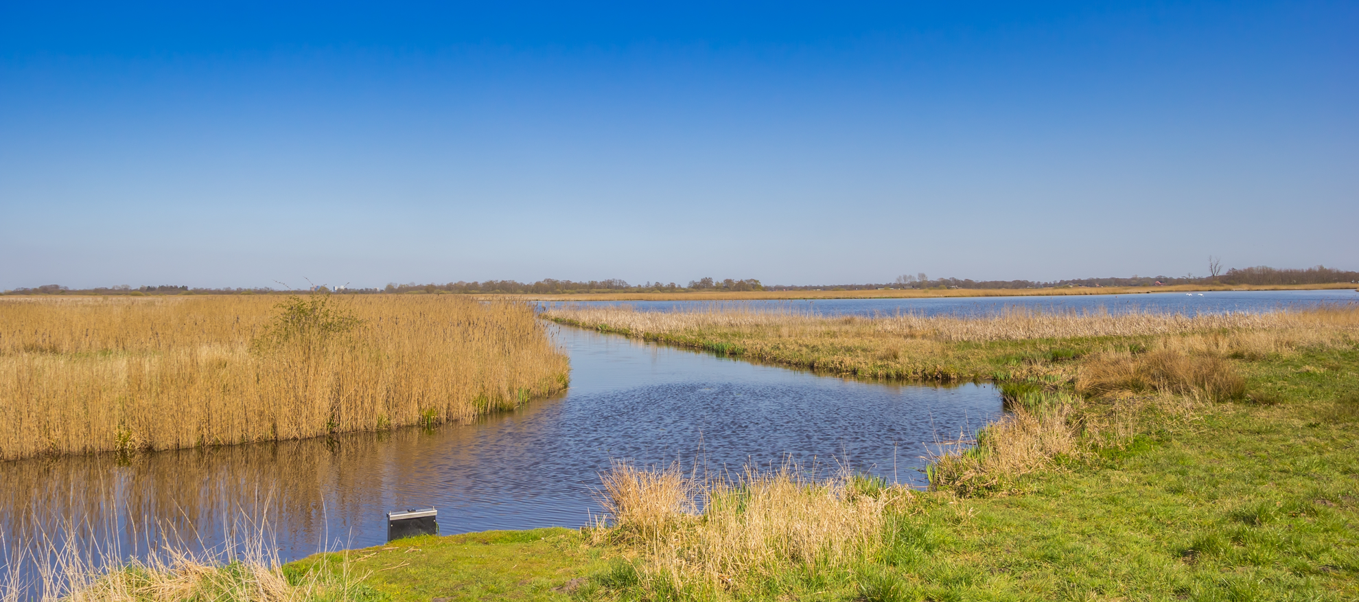
5–13 km / 3.1–8.1 mi: Roderwolderdijk through De Onlanden (big-sky wetland) Once you’re on/near Roderwolderdijk, the character becomes distinctly “dike walking”: long, level lines with water on one or both sides and very little shelter. This corridor borders/threads De Onlanden, a large wetland and water-storage nature area created to hold excess water and reduce flood risk for the region. Some of the roads here have existed for centuries; the Roderwolderdijk itself is described as one of the historic routes in the area, and it was built as a connection linked to clay extraction activities associated with the former monastery at Aduard. (deonlanden.nl)
Wildlife is a major highlight in this section:
- Expect lots of waterbirds (geese, ducks, herons), and in reedbeds you may hear (or, if you’re lucky, glimpse) secretive species. De Onlanden is managed as a high-quality wetland with strong ecological connections, and it’s known as an important area for wildlife. (deonlanden.nl)
- Bring binoculars if you have them; even on a casual hike, the open sightlines make birding easy.
13–21 km / 8.1–13.0 mi: Groningerweg onward → Noordwijk (rural settlement finish) Turning onto/along Groningerweg, you’ll be back in a more agricultural mosaic: fields, farm access lanes, and occasional small clusters of houses. The walking remains flat and straightforward, but pay attention at junctions—many intersections are unsigned or signed primarily for cyclists/drivers.
Your finish, Noordwijk, is a small village in the province of Groningen (municipality of Westerkwartier). It sits at a junction where road names point directions (a very “this-is-a-crossroads” kind of place), and it has a church that has been restored and is associated with the Stichting Oude Groninger Kerken (Old Groningen Churches Foundation). (en.wikipedia.org)
That church area is a good practical “end landmark” to aim for in HiiKER if you want a clean endpoint rather than a vague village boundary.
Terrain, conditions, and what to watch for
- Surface: Predominantly hard surfaces (asphalt/brick/concrete). Comfortable

Surfaces
Asphalt
Concrete
Unknown
Grass
Sand
Wood
Gravel
Paved
Comments and Reviews
User comments, reviews and discussions about the Centrum to Noordwijk via Roderwolderdijk and Groningerweg, Netherlands.
average rating out of 5
0 rating(s)