
Download
3D Flyover
Add to list
More
17.5 km
~3 hrs 31 min
6 m
Point to Point
“Wander through timeless fields, ancient woodlands, and storybook villages on this serene countryside escape.”
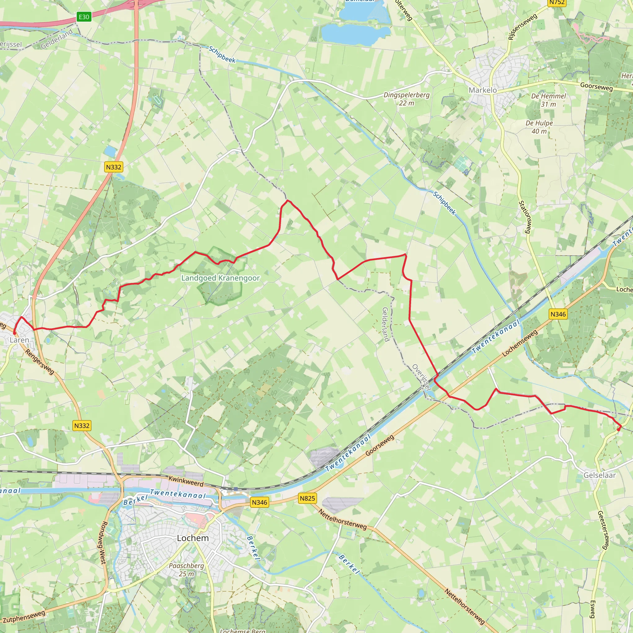
Starting near the charming village of Laren in the province of Gelderland, this 18 km (about 11.2 miles) point-to-point hike to Gelselaar via Rondje Exel is a gentle journey through the heart of the Dutch countryside, with virtually no elevation gain—perfect for those seeking a relaxed walk through scenic farmland, historic estates, and tranquil woodlands.
Getting There
The trailhead is conveniently located near the center of Laren, close to the Dorpsstraat and the historic Sint Antoniuskerk. Laren is accessible by regional bus from Zutphen or Lochem train stations, both of which connect to the Dutch national rail network. If arriving by car, parking is available near the village center, particularly around the Kerkplein area.
Through Farmland and Historic Estates
Leaving Laren, the route quickly immerses you in the Achterhoek’s patchwork of meadows, hedgerows, and small forests. The first few kilometers wind past traditional Dutch farmhouses, many of which date back to the 18th and 19th centuries. Keep an eye out for the characteristic timber-framed barns and thatched roofs, which are typical of this region.
About 4 km (2.5 miles) in, you’ll pass close to the Exel estate, a historic manor surrounded by ancient oak trees and landscaped gardens. The estate itself is private, but the surrounding woodlands are open to walkers. This area is particularly rich in birdlife—listen for woodpeckers and spot buzzards circling overhead.
Rondje Exel and Natural Highlights
The route loops through the Rondje Exel area, a mosaic of small forests, streams, and open fields. In spring and summer, wildflowers line the paths, and you may spot roe deer grazing at the forest edge. The terrain remains flat throughout, making navigation straightforward. For those who want to stay on track, the HiiKER app provides reliable mapping and waypoints for this route.
At approximately 10 km (6.2 miles), the trail crosses the Slinge river, a slow-moving waterway bordered by willows and reeds. This is a good spot for a break, with benches and picnic areas nearby. Dragonflies and herons are common sights along the riverbanks.
Approaching Gelselaar
The final stretch leads you through more open farmland and small patches of woodland before arriving in Gelselaar, a picturesque village known for its well-preserved Saxon farmhouses and the historic village green. The village is a protected heritage site, and its cobbled streets and traditional architecture offer a glimpse into rural Dutch life as it was centuries ago.
Practical Considerations
With a total distance of 18 km (11.2 miles) and no significant elevation gain, this hike is suitable for most fitness levels. The paths are a mix of paved lanes, gravel tracks, and grassy trails, so comfortable walking shoes are recommended, especially after rain when some sections can be muddy. Public transport from Gelselaar is limited, so plan your return journey in advance—regional buses connect to Borculo, where you can catch trains or buses to larger cities.
This route is ideal for those interested in Dutch rural history, gentle landscapes, and quiet, off-the-beaten-path walking. The combination of historic estates, wildlife-rich woodlands, and traditional villages makes it a rewarding day out in the Gelderland countryside.
AI Planner
Days planned around your pace, with somewhere to stay each night.
Surfaces
Asphalt
Unknown
Ground
Grass
Unpaved
Sand
Dirt
Comments and Reviews
User comments, reviews and discussions about the Laren to Gelselaar via Rondje Exel, Netherlands.
average rating out of 5
0 rating(s)
