Download
3D Flyover
Add to list
More
20.8 km
~4 hrs 10 min
7 m
Point-to-Point
“Big skies and borderland calm: a flat peat-moor ramble where wind and wet ground set the mood.”
This is a mostly flat, lowland borderland walk through peat moor, drainage-country, and small villages, linking Langeveen (NL) to Gramsbergen (NL) by way of the Balderhaarmoor and Wielen area. With roughly 21 km / 13.0 mi and essentially 0 m / 0 ft of climbing, it’s best planned around underfoot conditions (wet/soft) and wind exposure rather than elevation.
Getting to the start (Langeveen)
By car - Aim for Langeveen village (Overijssel, Netherlands) and park near the village center—look for parking around the church area (St. Pancratiuskerk / Dorpsstraat) or other signed public parking in town. Langeveen is a small place; parking is usually straightforward, but be considerate of farm access roads and narrow verges.
By public transport - The most practical rail hubs nearby are Almelo and Vriezenveen (both have train stations). From there, regional buses typically connect toward the Tubbergen/Langeveen area, though service can be infrequent outside peak times. Plan your bus legs in advance and build in buffer time. - If you’re coming from farther afield, a common approach is train to Almelo, then bus/taxi to Langeveen.
Start-point landmark - Use Langeveen village center as your anchor point in HiiKER. If you need a “nearest known place” to orient yourself, the church and main village streets (Dorpsstraat area) are the most recognizable reference.
What the route feels like underfoot (and what to pack)
Even with negligible elevation change, this route can feel “bigger” than the stats suggest because: - Peat/moor edges and field tracks can be soft, muddy, or waterlogged, especially after rain. - Straight drainage-side paths can be windy and exposed. - Surfaces often alternate between paved village lanes, compacted farm tracks, and narrower sandy/peaty paths.
Footwear: waterproof trail shoes or light boots are ideal; gaiters help after wet spells.
Navigation: keep HiiKER handy—moorland and agricultural grids can look similar, and small junctions can be easy to miss.
Weather: bring a wind layer even on mild days; open moor and polder-like fields amplify windchill.
Route breakdown with approximate distances
Distances are approximate and will vary slightly depending on the exact line you follow in HiiKER.
0.0–5.5 km (0.0–3.4 mi): Langeveen out to the countryside
You’ll leave the village on quiet lanes and farm access roads, quickly trading houses for open pasture and hedgerows. Expect: - Long, straight sightlines typical of reclaimed and managed lowland landscapes. - Drainage ditches alongside tracks—common throughout Overijssel—so keep an eye on footing near edges, especially if the verge is slick. - A calm start with easy pacing; this is a good section to settle into a steady rhythm.
Wildlife is often most visible early here: hares, pheasants, and small flocks of field birds. In wetter months, ditches can attract herons and other waders.
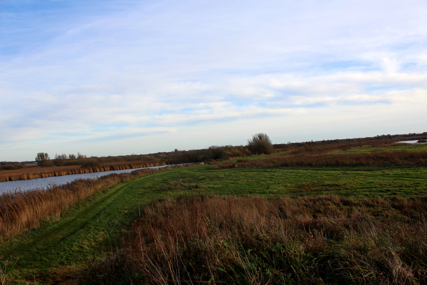
5.5–12.5 km (3.4–7.8 mi): Balderhaarmoor area—peatland character and big skies
As you approach the Balderhaarmoor vicinity, the landscape tends to feel more “moor-like”: fewer buildings, more open ground, and a stronger sense of the region’s peat history.
What to expect: - Softer ground in places and occasional damp patches where water lingers. - Vegetation shifts: more reeds, rushes, and scrubby edges depending on the exact path alignment. - Exposure: wind can be the main “difficulty” factor on an otherwise easy route.
Look out for:
- Marshy margins that can swallow a shoe if you step off the firm line.
- Seasonal water across low points after heavy rain.
- Ticks in warmer months where grass and low scrub meet—do a quick check during breaks.
12.5–16.5 km (7.8–10.3 mi): Through/near Wielen—quiet village interlude
Near Wielen (a small settlement close to the Dutch–German border region), the route typically threads back into a more settled patchwork of lanes and fields. This section often feels like a reset: - Firmer surfaces and clearer junctions - Occasional farm traffic—stay alert on narrow roads - Good spots for a short break if you find a bench or a quiet verge away from driveways
If you’re planning food/water, don’t assume services in tiny villages; carry what you need from the start unless you’ve confirmed options.
16.5–21.0 km (10.3–13.0 mi): Final approach into Gramsbergen
The last stretch trends toward Gramsbergen, where you’ll gradually pick up more signs of town life—more houses, tidier verges, and a clearer street network. Even though the elevation remains flat, legs can feel the distance here because the terrain is so steady and repetitive.
As you near Gramsbergen, you’re entering an area shaped by centuries of river and land management. The broader region is closely tied to the Vecht river system and the long Dutch tradition of controlling water through drainage,

Surfaces
Unknown
Paved
Asphalt
Ground
Gravel
Sand
Unpaved
Comments and Reviews
User comments, reviews and discussions about the Langeveen to Gramsbergen via Balderhaarmoor and Wielen, Netherlands.
average rating out of 5
0 rating(s)