Download
3D Flyover
Add to list
More
18.1 km
~3 hrs 37 min
0 m
Point-to-Point
“From Landsmeer’s lanes to Twiske’s shimmering lakes and wide-sky peat meadows, wind and water set the pace.”
You’ll be walking a classic North Holland lowland route: village streets out of Landsmeer, then long, flat “polder-edge” paths and waterside tracks through recreation lakes and open peat-meadow country. At ~18 km (11.2 mi) with essentially 0 m / 0 ft of climbing, the effort is mostly about steady pacing, wind exposure, and keeping your feet comfortable on mixed surfaces (pavement, compacted gravel, and potentially muddy/soft sections).
Getting to the start (Raadhuisstraat, Landsmeer)
Nearest practical start landmark: the Raadhuisstraat bus stop in Landsmeer (in/near the village center). (drgl.nl)
- Public transport: From Amsterdam, buses commonly run toward Landsmeer; one well-used option is the EBS 319 that stops at Raadhuisstraat (Landsmeer). Check times in HiiKER and plan around typical Dutch “once-per-hour” gaps outside peak periods. (sectiemasters.nkbv.nl)
- By car: Aim for parking around central Landsmeer (near the Raadhuisstraat/Dorpsstraat area) or signed parking for Recreatiegebied Het Twiske if you prefer starting closer to the lake section. (oostzaan.nl)
What the route feels like underfoot (and why it’s “easy”)
Expect a very flat profile with frequent straight, open stretches where wind can be the main “difficulty multiplier.” After rain, some field-edge and waterside segments can hold water or turn slick—especially where the path narrows beside ditches or reedbeds. Because there’s no meaningful elevation gain, your main prep is: - comfortable walking shoes with decent tread (muddy edges can surprise you), - a windproof layer (open polder = little shelter), - and enough water/snacks for 4–5 hours at an easy pace.
0–5 km (0–3.1 mi): Landsmeer out to the green edge
From Raadhuisstraat, you’ll leave the village feel fairly quickly and start threading toward the northern fringe of Amsterdam’s green belt. The landscape transitions into the Waterland/Twiske setting: low-lying land, drainage ditches, and broad skies. Navigation is straightforward, but there are many intersecting cycle paths and access tracks—use HiiKER to confirm each junction so you don’t drift onto a parallel path that looks identical.
5–10 km (3.1–6.2 mi): Stootersplas and the Het Twiske lake district
This middle section is the scenic centerpiece: Stootersplas, a large, clear lake within Recreatiegebied Het Twiske. (fishinginholland.nl)
You’ll likely pass:
- water crossings/bridges and short causeway-like links between ponds and inlets,
- reedbeds and marshy margins that attract waterbirds,
- and beach/recreation zones (in warm weather, expect more people near swimming areas). (alltrails.com)
Wildlife to look for: This is strong bird country—expect ducks, geese, and seasonal migrants; the reed edges are especially active early and late in the day. (alltrails.com)
Local backstory worth knowing: Stootersplas is widely described as a lake formed through sand extraction connected to major infrastructure works (the excavated pit later becoming a deep lake), after which marsh and waterbirds quickly colonized the new habitat. (routiq.com)
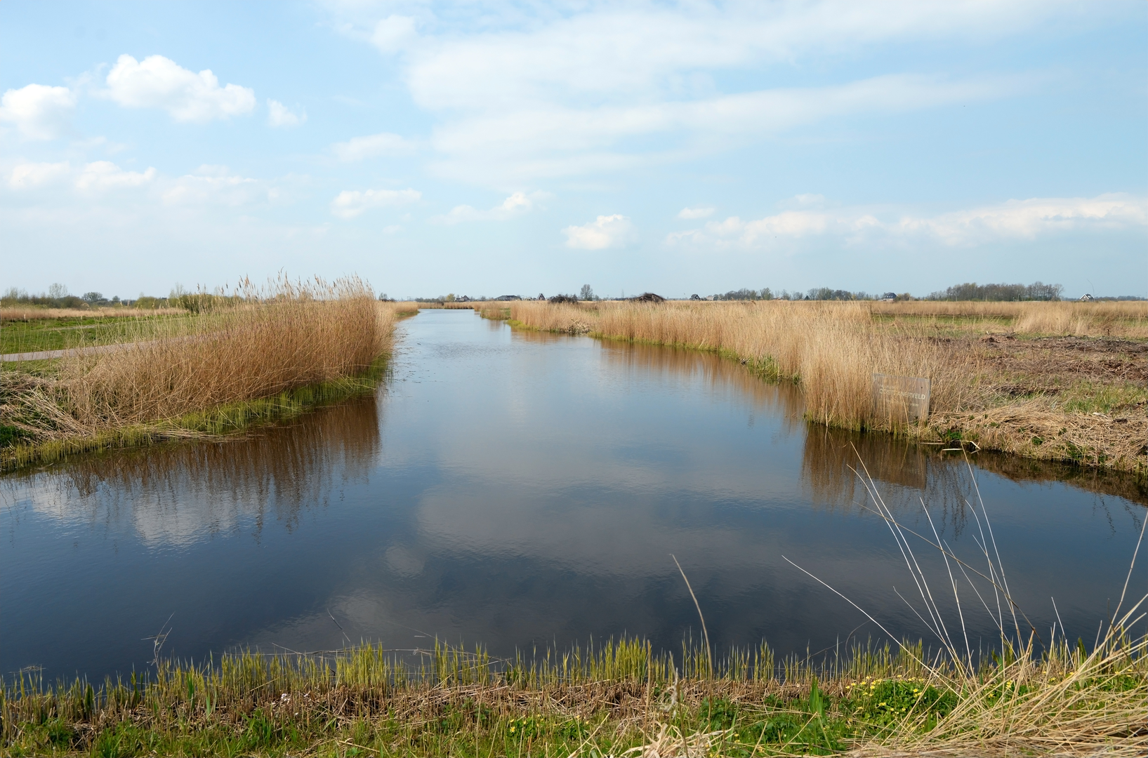
10–15 km (6.2–9.3 mi): Wormerpad and the peat-meadow world
As you swing away from the busier recreation core, the route character shifts toward quieter, more “big-sky” polder walking. The Wormerpad area ties into the wider Wormer- en Jisperveld landscape, a protected peat-meadow region known for its exceptional meadow-bird value. (natura2000.nl)
Here, the hazards are subtle:
- narrow path edges beside ditches (watch footing when passing cyclists),
- soft ground in wetter periods,
- and limited shade—sun and wind exposure can be constant.
If you

Surfaces
Unknown
Asphalt
Paved
Wood
Grass
Comments and Reviews
User comments, reviews and discussions about the Raadhuisstraat to Schipbeek via Stootersplas and Wormerpad, Netherlands.
average rating out of 5
0 rating(s)