Download
3D Flyover
Add to list
More
5.7 km
~1 hrs 12 min
35 m
Loop
“Meandering through emerald woodlands and rippling streams, this trail weaves nature’s beauty with echoes of history.”
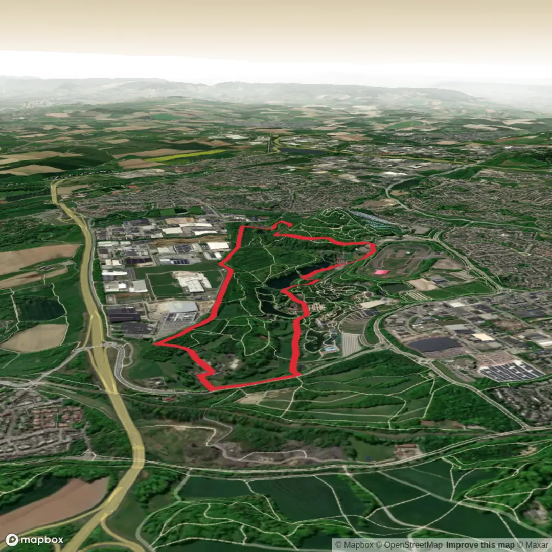
Starting from the leafy outskirts near GaiaZOO in Kerkrade, the Gravenrode Route and Strijthagermolen Weg offers a gentle 6 km (about 3.7 miles) loop with virtually no elevation gain, making it accessible for hikers of all abilities. The trailhead is easily reached by public transport—bus lines from Kerkrade Centrum station stop close to GaiaZOO, and there’s ample parking for those arriving by car.
Getting Oriented and Setting Out
The route begins near GaiaZOO, a well-known landmark in Kerkrade, and quickly immerses you in the lush, green landscapes of the Limburg region. The path is well-marked and mostly flat, winding through a mix of woodland, open meadows, and alongside tranquil streams. Navigation is straightforward, but for added confidence and route tracking, HiiKER provides detailed maps and waypoints.
Highlights Along the Trail
Shortly after setting out, you’ll pass through the scenic Anstel Valley, a haven for birdlife and wildflowers, especially in spring and early summer. The route follows the gentle curves of the Anstelerbeek stream, where you might spot kingfishers darting above the water or herons standing motionless at the banks. At around 2 km (1.2 miles), the path skirts the edge of the Cranenweyer reservoir, a peaceful spot for a rest and a chance to observe waterfowl.
Strijthagermolen and Historical Features
At approximately 4 km (2.5 miles), the trail reaches the historic Strijthagermolen, a watermill dating back to the 17th century. This beautifully restored mill is a reminder of the region’s industrial heritage, once central to local agriculture and trade. The surrounding area is dotted with remnants of old mining infrastructure, as Kerkrade was a significant coal mining center until the late 20th century. Interpretive signs along the route provide insight into this layered history.
Nature and Wildlife
The route is rich in biodiversity, with mixed deciduous forests providing habitat for deer, foxes, and a variety of songbirds. In the meadows, look for butterflies and bees among the wildflowers. The flat terrain and well-maintained paths make it suitable for families and those seeking a leisurely walk.
Practical Tips
The trail is accessible year-round, though waterproof footwear is recommended after heavy rain due to occasional muddy patches. Benches and picnic spots are available at intervals, particularly near the reservoir and the mill. There are no shops directly on the route, so bring water and snacks. Public toilets are available at GaiaZOO and nearby cafes.
For navigation, HiiKER offers up-to-date trail maps and offline access, ensuring you stay on track throughout your walk. The route is popular but never crowded, offering a peaceful escape into nature with a touch of local history.

Surfaces
Asphalt
Unknown
Concrete
Dirt
Comments and Reviews
User comments, reviews and discussions about the Gravenrode Route and Strijthagermolen Weg, Netherlands.
average rating out of 5
0 rating(s)