Download
3D Flyover
Add to list
More
22.2 km
~4 hrs 27 min
15 m
Loop
“Winding through wildflower-lined canals, dike-top vistas, and ancient woods, this route brims with Dutch charm.”
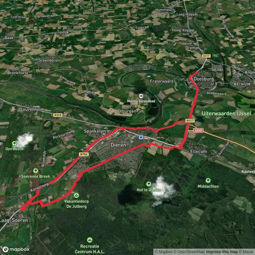
Starting from the outskirts of Doesburg, a charming Hanseatic town in Gelderland, the Kanaal Weg, Doesburgsedijk and Priesnitzlaan Loop offers a flat, leisurely circuit of approximately 22 km (13.7 miles) with virtually no elevation gain, making it accessible for hikers of all abilities. The trailhead is conveniently located near the intersection of Kanaalweg and Doesburgsedijk, just north of the IJssel river, and is easily reached by public transport—buses from Arnhem or Zutphen stop at Doesburg’s central station, from where it’s a short walk to the starting point. For those arriving by car, parking is available near the Doesburgse Veer ferry terminal.
Navigating the Route
The loop follows a mix of paved towpaths, dike roads, and tranquil forest lanes. Hikers are encouraged to use HiiKER for reliable navigation, as the route weaves through rural landscapes and small woodland patches where signage may be sparse.
Highlights Along the Way
Kanaal Weg and the IJssel Canal
The first stretch traces the Kanaalweg, running parallel to the Apeldoorns Kanaal. This historic waterway, constructed in the 19th century, was once vital for transporting goods between the IJssel and the Veluwe region. The flat towpath is lined with poplars and willows, and in spring and summer, the canal banks are alive with wildflowers and waterfowl—look for herons, grebes, and the occasional kingfisher darting over the water.
Doesburgsedijk and River Views
Turning onto Doesburgsedijk, the route follows the crest of the dike with sweeping views across the floodplains of the IJssel. This area is a haven for migratory birds, especially in autumn and winter, when flocks of geese and waders gather in the meadows. The dike itself is a testament to Dutch water management, protecting the low-lying farmland from seasonal floods for centuries.
Priesnitzlaan and Woodland Paths
Midway through the loop, the trail enters the leafy avenue of Priesnitzlaan, a quiet lane shaded by mature oaks and beeches. This section passes through the outskirts of the Veluwezoom National Park, where red deer and wild boar are sometimes spotted at dawn or dusk. The forest floor is carpeted with bluebells in late spring, and the air is filled with birdsong year-round.
Points of Interest and Historical Significance
Doesburg, at the southern end of the loop, is one of the Netherlands’ best-preserved medieval towns. Its cobbled streets, fortified gates, and the imposing Martinikerk (St. Martin’s Church) are well worth a detour. The town’s strategic location on the IJssel made it a key trading post in the Hanseatic League, and remnants of its defensive walls can still be seen.
Practical Information
The entire loop is flat, with a total elevation gain of less than 10 feet (0 meters), making it suitable for families, casual walkers, and cyclists. Surfaces are a mix of asphalt, gravel, and hard-packed earth, so comfortable walking shoes are recommended. There are several picnic spots along the dike and canal, and Doesburg offers cafés and restaurants for refreshments before or after your hike.
Public toilets are available in Doesburg town center, and water refill points can be found at local cafés. The route is accessible year-round, though sections along the dike can be exposed to wind and rain—pack accordingly. For up-to-date trail conditions and detailed mapping, consult HiiKER before setting out.

Surfaces
Asphalt
Unknown
Concrete
Comments and Reviews
User comments, reviews and discussions about the Kanaal Weg, Doesburgsedijk and Priesnitzlaan Loop, Netherlands.
average rating out of 5
0 rating(s)