Download
3D Flyover
Add to list
More
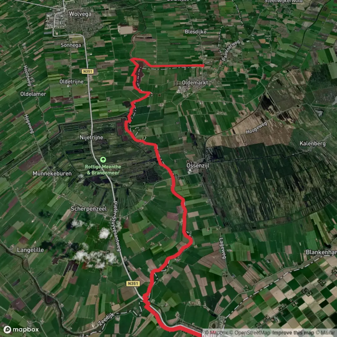
19.1 km
~3 hrs 48 min
0 m
Point-to-Point
“Stroll through a tapestry of Dutch history, wild beauty, and endless horizons on this tranquil journey.”
Starting near the historic village of Kuinre, this 19 km (about 11.8 miles) point-to-point hike to Dalhoeve via Lindedijk is a gentle journey through the low-lying landscapes of the northern Netherlands, with virtually no elevation gain—perfect for those seeking an easy, scenic walk. The trailhead is accessible by car, with parking available in Kuinre near the intersection of Kuinderweg and the village center. For those using public transport, buses from Steenwijk or Emmeloord stop at Kuinre, making it a convenient starting point.
Setting Out from Kuinre
Kuinre itself is steeped in history, once a bustling Zuiderzee port before the land reclamation projects of the 20th century transformed the region. The remnants of the old harbor and the outlines of medieval fortifications can still be seen near the village center. As you leave Kuinre, the route quickly immerses you in the open polder landscape, a patchwork of fields, drainage ditches, and tree-lined farm roads.
Traversing the Lindedijk
The Lindedijk is a defining feature of this hike, running for several kilometers as a raised embankment that once protected the hinterland from flooding. Walking along the dike, you’ll have expansive views across the reclaimed land, with the distant outlines of wind turbines and farmhouses dotting the horizon. The dike is also a corridor for wildlife—look for hares darting across the fields and a variety of waterfowl in the drainage canals, especially in spring and autumn when migratory birds are abundant.
Nature and Wildlife Highlights
About 7 km (4.3 miles) into the hike, you’ll pass through stretches of managed woodland and wetland reserves, remnants of the Kuinderbos. This area is home to roe deer, foxes, and a rich diversity of birdlife, including marsh harriers and herons. The flat terrain and well-maintained paths make this section particularly enjoyable for birdwatchers and those interested in the unique ecology of reclaimed land.
Approaching Dalhoeve
The final stretch toward Dalhoeve continues through open farmland, with the landscape gradually transitioning to more wooded areas as you near the endpoint. Dalhoeve itself is a small rural settlement, and while amenities are limited, the tranquility of the area is a fitting end to the hike. For navigation, the entire route is best followed using HiiKER, which provides up-to-date trail maps and waypoints.
Planning and Preparation
With a total distance of 19 km (11.8 miles) and no significant elevation gain, this hike is suitable for most fitness levels. The terrain is predominantly flat and can be muddy after rain, so waterproof footwear is recommended. There are limited facilities along the route, so bring sufficient water and snacks. Public transport options from Dalhoeve are sparse; plan your return journey in advance, either by arranging a pickup or checking local bus schedules.
This route offers a unique perspective on the Dutch landscape, blending centuries-old history with the modern reality of reclaimed land and vibrant wildlife habitats.

Surfaces
Asphalt
Unknown
Wood
Concrete
Comments and Reviews
User comments, reviews and discussions about the Kuinre to Dalhoeve via Lindedijk, Netherlands.
average rating out of 5
0 rating(s)