Download
Preview
Add to list
More
9.0 km
~1 hrs 47 min
0 m
Loop
“Meander through a vibrant tapestry of fields, canals, and history in the heart of the Dutch polder.”
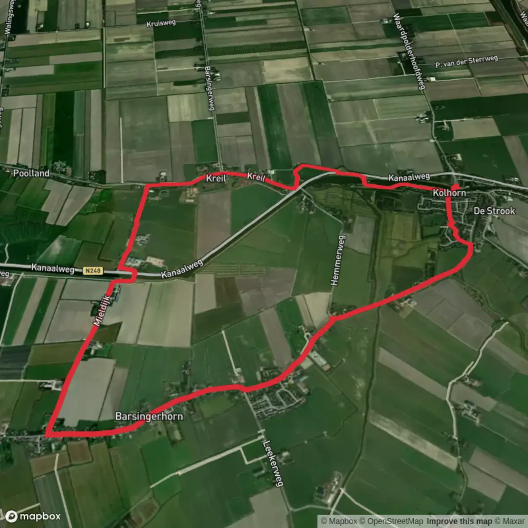
Starting from the vicinity of Kreil, a small hamlet in the province of North Holland, this 9 km (about 5.6 miles) loop trail offers a flat and leisurely walk through the heart of the Dutch polder landscape, with virtually no elevation gain—ideal for those seeking an easy, scenic outing. The trailhead is easily accessible by car, with parking available near Kreil, or by public transport via bus connections from nearby towns such as Anna Paulowna or Den Helder, followed by a short walk to the start.
Navigating the Route
The route is best followed using HiiKER, which provides up-to-date mapping and navigation for the area. The trail weaves through a patchwork of fields, dikes, and waterways, characteristic of the reclaimed land of the Wieringermeer polder. The path follows the Bovenkolk and Westergraftvaart canals, passing through the tranquil countryside and alongside the Mient, a historic stretch of common land once used for grazing.
Landmarks and Points of Interest
- Kreil and Heeren Weg: Early in the hike, you’ll traverse Kreil, a hamlet with roots dating back to the early 20th-century land reclamation projects. The Heeren Weg, or “Gentlemen’s Road,” is a historic route that once connected local estates and farms, and today offers a glimpse into the agricultural heritage of the region.
- Bovenkolk and Westergraftvaart: These waterways are central to the area’s drainage and irrigation system, vital for maintaining the fertile polder land. Watch for traditional Dutch windmills in the distance, which historically powered the pumps that kept the land dry.
- Mient: This open common land is a rare remnant of the communal grazing areas that once dotted the Dutch countryside. In spring and summer, the meadows are alive with wildflowers and the calls of lapwings, godwits, and other wading birds.
Nature and Wildlife
The flat, open landscape is a haven for birdlife, especially during migration seasons. Expect to see flocks of geese, swans, and various waders in the fields and along the waterways. The ditches and ponds are home to frogs and dragonflies, while the hedgerows shelter songbirds and the occasional hare.
Historical Significance
The Wieringermeer polder, where this hike is set, was one of the first major land reclamation projects in the Netherlands, completed in the 1930s as part of the Zuiderzee Works. The landscape you walk through was once seabed, transformed into productive farmland through the ingenuity of Dutch engineering. The network of dikes, canals, and pumping stations you’ll encounter are living reminders of this ambitious project.
Trail Conditions and Preparation
The route is almost entirely flat, with well-maintained paths and minor country roads. Sturdy walking shoes are recommended, especially after rain, as some sections can be muddy. There are few facilities along the way, so bring water and snacks. The open landscape offers little shelter from wind or sun, so dress accordingly and consider sun protection.
For navigation, HiiKER provides reliable mapping and waypoints, ensuring you stay on track through the maze of dikes and fields. The trail is suitable for families, casual walkers, and anyone interested in Dutch history and rural scenery.

Comments and Reviews
User comments, reviews and discussions about the Bovenkolk and Westergraftvaart of Mient via Kreil and Heeren Weg, Netherlands.
average rating out of 5
0 rating(s)