Download
3D Flyover
Add to list
More
26.1 km
~5 hrs 13 min
0 m
Loop
“A big-sky peatland loop of reedbeds and ruler-straight tracks—easy-going, yet exposed and remote.”
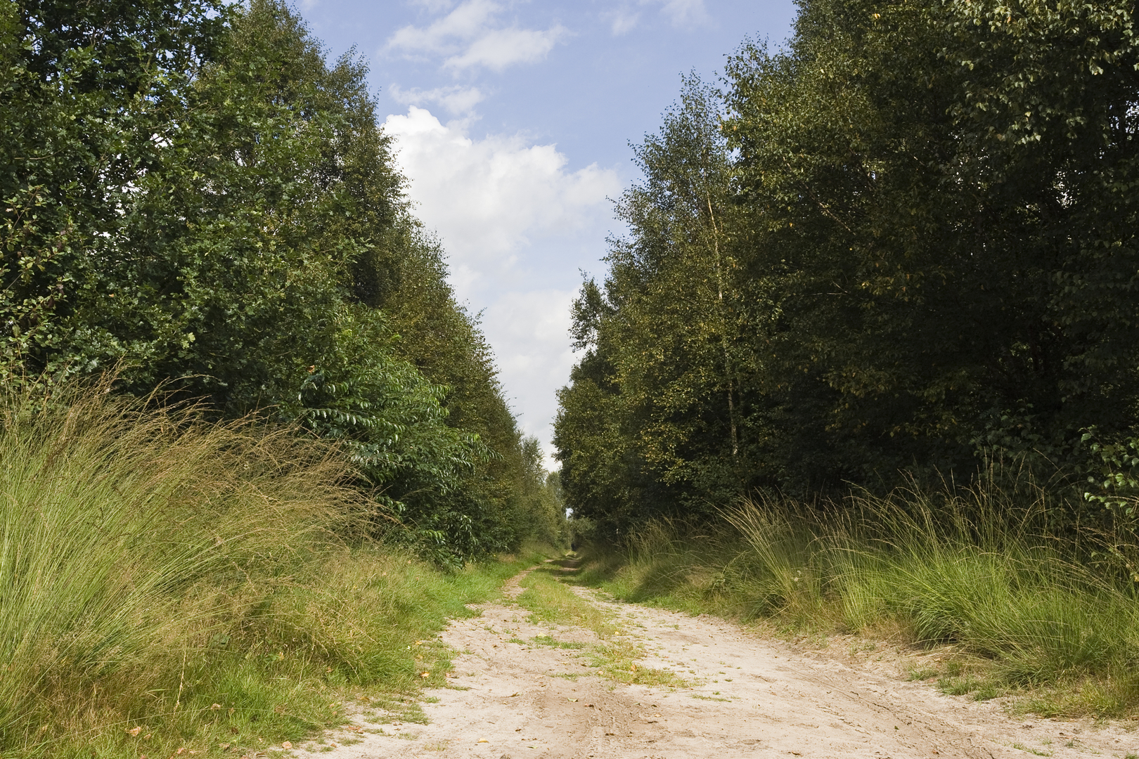
This is a long, flat, big-sky loop through one of the Netherlands’ most distinctive peatland landscapes: open bog, reedbeds, wet woodland edges, and long, ruler-straight farm tracks linking quiet hamlets. At roughly 26 km (16.2 mi) with about 0 m (0 ft) of climbing, it’s physically straightforward but can feel committing because the terrain is exposed, the ground can be wet at the margins, and services are sparse once you’re out among the reserves.
Getting to the start (car + public transport) + where “near” usually means here
The Engbertsdijksvenen and Hoevenwegsvenen area sits on the Overijssel / Drenthe border, close to the villages Kloosterhaar, Sibculo, and Lutten. Most loops of this name commonly begin near the main access points to Engbertsdijksvenen Nature Reserve—look for parking and trail information around the reserve entrances near Kloosterhaar/Sibculo (a reliable “significant landmark” to navigate to is Engbertsdijksvenen Nature Reserve main access/parking areas rather than a single street address, because there are multiple signed entry points).
- By car: Aim for the signed Engbertsdijksvenen access/parking near Kloosterhaar or Sibculo. Arrive early on weekends—these peat reserves are popular with walkers and birders, and parking is limited at the smaller trailheads.
- By public transport: The nearest practical hubs are typically Hardenberg (larger town with rail connections) and then a bus toward Kloosterhaar/Sibculo/Lutten, followed by a short walk to the reserve entrance. Check the day-of-week timetable before committing; rural services can be infrequent, especially Sundays and evenings.
If you share the start coordinates (lon/lat) you have, I can pin them to the nearest named entrance/parking area and the closest recognizable landmark for a cleaner meet-up point.
What the route feels like underfoot
Expect a mix of: - Firm gravel and farm tracks (easy, fast walking) - Narrower nature paths along reserve edges - Occasional boardwalk/plank sections or damp ground where the route skirts wetter peatland margins
Even though the elevation gain is essentially nil, the “effort” can come from wind exposure and soft ground after rain. Waterproof footwear is a good idea year-round; in drier spells, trail shoes can work, but you’ll still appreciate water resistance if you step off the firm line.
Landmarks, landscapes, and wildlife (what to look for)
The star attraction is the peat bog system—a rare habitat shaped by centuries of waterlogged conditions where plant material accumulates as peat. You’ll notice: - Open, treeless expanses with long sightlines - Reedbeds and sedge in wetter pockets - Birch and willow scrub encroaching at the edges (often actively managed to keep the bog open) - Drainage ditches and straight boundaries that hint at the area’s land-use history
Wildlife highlights are often best early and late in the day: - Birdlife: peatlands and reedbeds can be excellent for raptors and marsh birds; bring binoculars if you have them. - Amphibians and insects: in warmer months, expect dragonflies and other wetland specialists along still water and ditches. - Large mammals: deer can appear at the reserve margins and in adjacent woodland/farmland transitions, especially at quieter times.
Because this is a protected wetland landscape, stay on the signed line—peat surfaces can be deceptively fragile, and stepping off-trail can damage vegetation and create unsafe footing.
Historical significance of the region (why it looks like this)
This border region of Overijssel and Drenthe is strongly tied to the Netherlands’ long history of peat extraction and land reclamation. Many of the straight tracks, ditches, and sharp-edged parcels you’ll pass reflect: - Peat cutting (fuel and soil improvement historically depended on peat) - Drainage and agricultural conversion around the bog margins - Later conservation and restoration, where water levels are managed to slow peat degradation and preserve bog habitat
That contrast—intensively managed farmland beside carefully protected wetland—becomes a recurring theme as the loop swings between reserve edges and rural lanes.
Distance markers (approximate) and how to pace the day
For a 26 km (16.2 mi) easy loop, a typical walking plan (including stops) often looks like 5–7 hours, depending on wind, surface softness, and how long you spend at viewpoints.
A practical way to think about the day: - 0–6 km (0–3.7 mi): Settling in on firm tracks and reserve approach paths; good time to confirm your route line on HiiKER and note any junctions where farm lanes intersect. - 6–16 km (3.7–10 mi): The most “peatland” feeling section—open views, reedbeds, and long straight lines. This is where wind can be most noticeable and where you’ll want sun/rain protection handy. - 16–26 km (10–16.2 mi): Gradual return via mixed rural lanes and reserve edges; fatigue is more about repetition and exposure than hills, so keep snacks and hydration steady.
Navigation and wayfinding (keep it simple)
Junction density can be higher than it looks because of intersecting farm tracks and parallel lanes. Use **

Surfaces
Unknown
Sand
Asphalt
Concrete
Unpaved
Dirt
Grass
Gravel
Paved
Comments and Reviews
User comments, reviews and discussions about the Engbertsdijksvenen and Hoevenwegsvenen Loop, Netherlands.
average rating out of 5
0 rating(s)