Molenstraat and Achterkade via Donkse Laagten, Kortlandse Molen and Museum Windmill Nederwaard
Download
3D Flyover
Add to list
More
25.7 km
~5 hrs 8 min
0 m
Out and Back
“Wander through vibrant wetlands, blooming orchards, and iconic windmills in this enchanting Dutch landscape loop.”
Starting from the vicinity of the Donkse Laagten nature reserve, this 26 km (about 16 miles) loop hike is a flat, easy journey through the heart of South Holland’s polder landscape, with virtually no elevation gain. The trailhead is best accessed from the village of Streefkerk, which is reachable by bus from Rotterdam or Dordrecht, or by car with parking available near the Donkse Laagten entrance.
Getting Oriented and Navigation
The route is well-marked, but the intricate network of dikes, waterways, and rural roads can be confusing, especially in fog or low light. For reliable navigation, use HiiKER, which provides up-to-date trail maps and waypoints for this region.
Donkse Laagten and Wetland Wildlife
The first section leads you into the Donkse Laagten, a protected wetland area renowned for its birdlife. Expect to see herons, storks, and, in spring and autumn, migratory waterfowl. The flat, open landscape is punctuated by reed beds and grazing cattle. Boardwalks and gravel paths keep your feet dry, but after heavy rain, waterproof footwear is recommended.
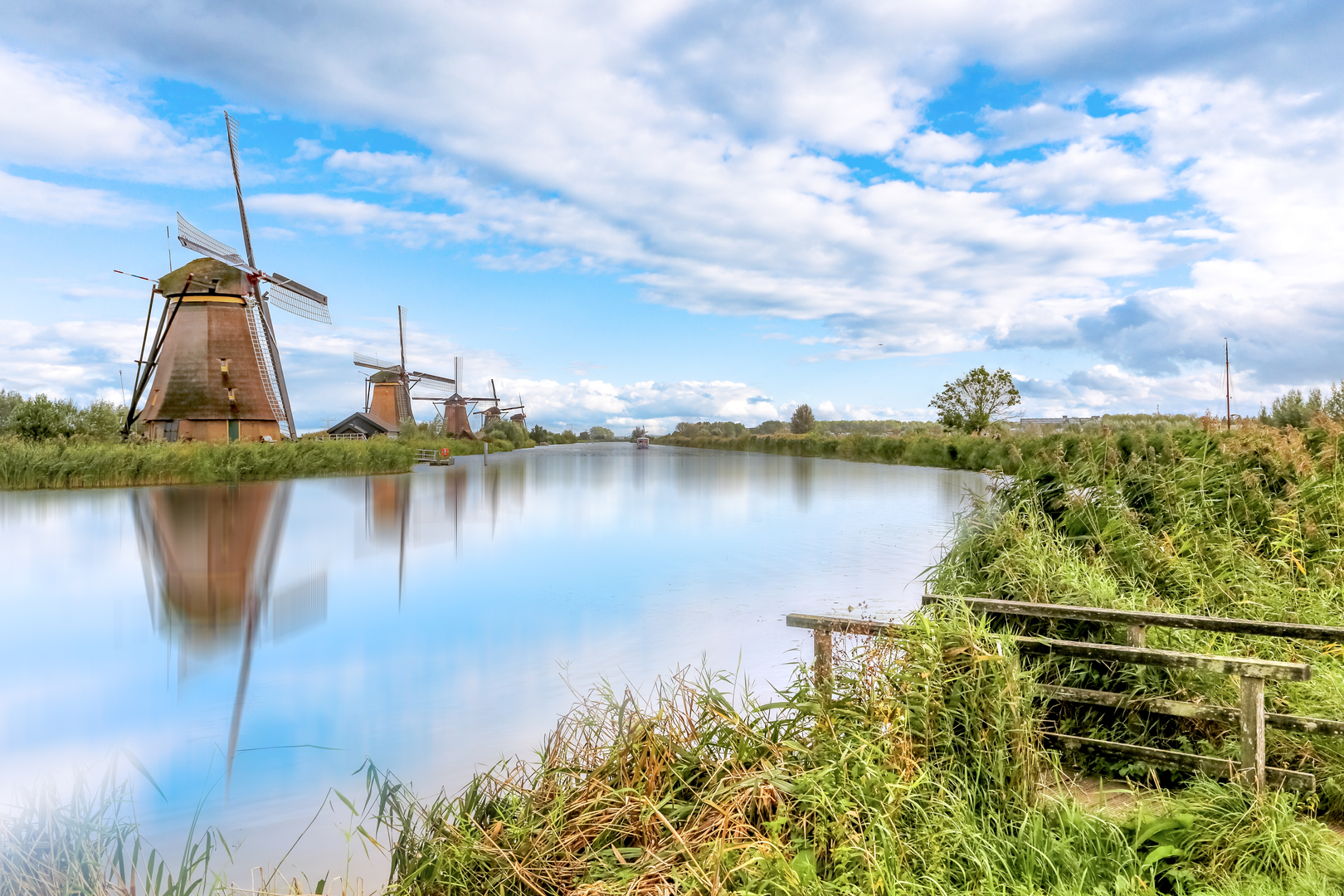
Kortlandse Molen and the Windmill Network
At around 8 km (5 miles), you’ll reach the Kortlandse Molen, a classic Dutch windmill still used for water management. This area is part of the Alblasserwaard polder, a region shaped by centuries of human effort to keep the land dry. The windmills here are not just picturesque—they are working monuments to Dutch engineering. Interpretive signs explain the history and function of these mills.
Achterkade and Rural Heritage
Continuing along Achterkade, the trail follows a raised dike road lined with traditional farmhouses and orchards. This section, roughly 13 km (8 miles) in, offers panoramic views of the surrounding fields and waterways. In spring, the orchards bloom with fruit blossoms, while summer brings lush green vistas.
Museum Windmill Nederwaard and Kinderdijk
At about 20 km (12.5 miles), the route passes near the Museum Windmill Nederwaard, part of the UNESCO World Heritage Site at Kinderdijk. This cluster of 18th-century windmills is one of the most iconic sights in the Netherlands. The museum windmill is open to visitors and provides insight into the lives of millers and the ongoing battle against water. The area is popular, so expect more foot traffic here, especially on weekends.
Flora, Fauna, and Seasonal Highlights
Throughout the hike, look for wildflowers along the dikes, especially in late spring and early summer. Marsh harriers and kingfishers are sometimes spotted near the waterways. The flat terrain makes this route accessible year-round, though winter can bring icy patches and strong winds.
Practical Tips
Public toilets are available at Kinderdijk and some cafes along the route, but facilities are sparse in the Donkse Laagten. Bring enough water and snacks, as shops are limited outside the villages. The entire loop is exposed, so sun protection is essential on clear days. Cyclists share some sections of the dike roads, so stay alert.
This hike offers a quintessential Dutch landscape experience, blending natural beauty, rural life, and remarkable water management history, all within a manageable, easy walk.

Surfaces
Asphalt
Grass
Unknown
Gravel
Wood
Paved
Comments and Reviews
User comments, reviews and discussions about the Molenstraat and Achterkade via Donkse Laagten, Kortlandse Molen and Museum Windmill Nederwaard, Netherlands.
average rating out of 5
0 rating(s)