Download
3D Flyover
Add to list
More
22.2 km
~4 hrs 26 min
0 m
Point-to-Point
“A wind-swept, waterside wander through Lauwersmeer’s dikes, marinas, and wide skies—best savoured steadily.”
This is a low-lying, waterside walk through the Lauwersmeer area in the north of the Netherlands, linking small settlements, marinas, and open polder landscapes. With roughly 22 km / 13.7 miles and essentially 0 m / 0 ft of climbing, it’s best planned as a steady, all-day stroll where wind exposure and surface conditions matter more than elevation.
Getting to the start (Le / Lauwersmeer area)
Because “Le” is ambiguous as a place name, the most reliable way to reach the start is to aim for the Lauwersmeer National Park gateway area near Lauwersoog (a major, well-known access point with parking and bus connections), then use HiiKER to pinpoint the exact trailhead used for your route file.
- By car: Drive toward Lauwersoog (Groningen) and use one of the large public car parks around the harbour/visitor areas as your staging point. From there, follow your HiiKER start point to the exact trailhead.
- By public transport: Regional buses serve Lauwersoog from nearby hubs (commonly via Groningen or Dokkum depending on the line/season). Plan the final connection and walking approach using HiiKER so you don’t lose time hunting for the correct dike path or marina access.
If you share the route’s lon/lat points, I can translate them into the nearest named landmark (harbour, lock, bridge, visitor centre, or village street) so you can navigate to the start without guesswork.
What the route feels like underfoot
Expect a mix of dike-top paths, compacted gravel, paved cycleways, and short stretches of farm track. The walking is straightforward and generally accessible, but the area is very open—wind and weather can be the main challenge. After rain, some track edges can be soft, and in colder months exposed sections can feel significantly chillier than inland.
Because the terrain is flat, pacing is the key: 22 km / 13.7 miles is still a long distance on hard surfaces. If you’re not used to flat, firm walking, consider cushioned footwear and plan a couple of longer breaks.
Route character: water engineering, wide skies, and big birdlife
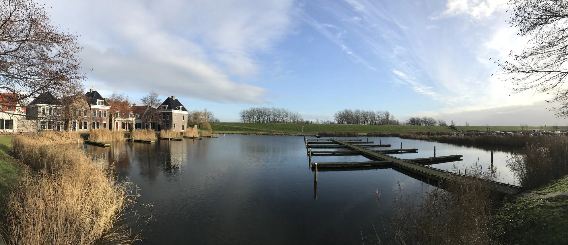
This walk threads along waterways tied to the Netherlands’ long history of land reclamation and water management. Names like “Vaarwater” (navigable water) and the presence of dikes, locks, and canals reflect a landscape shaped as much by engineering as by nature.
You’ll move through: - Canal and marina edges where you’ll see moored boats, small jetties, and working water infrastructure. - Polder farmland with long sightlines, drainage ditches, and straight tracks. - Lauwersmeer-adjacent wetlands (depending on the exact line of your route), where reedbeds and open water attract large numbers of birds.
Wildlife is often the highlight here. In the broader Lauwersmeer region, hikers commonly encounter geese, ducks, swans, waders, and birds of prey such as harriers over reedbeds and fields. Dawn and late afternoon tend to be most active. Bring binoculars if you have them, and keep dogs close—ground-nesting birds can be present in open grassland and marshy margins.
Key waypoints and landmarks to watch for
Even without steep climbs, this route stays interesting because it repeatedly shifts between “human-made water landscape” and “big nature”:
- De Skâns / De Skans area: “Skans” typically refers to a sconce/earthwork—a small defensive structure or fortified position. In many parts of the Netherlands, these names preserve the memory of regional military lines and local fortifications from early-modern conflicts. Even if little is visible today, the place name itself is a clue to the area’s strategic past: controlling waterways and crossings mattered.
- Veerhaven (ferry harbour): Expect a functional harbour setting—quays, signage, and open water views. It’s a good place to reset your bearings on HiiKER because harbour infrastructure creates clear, fixed reference points.
- Oostmahorn: A small settlement near the Lauwersmeer, known for its waterside setting and holiday/marina character. It’s a natural “checkpoint” for time, snacks, and a mental reset before the final kilometres.
Navigation and practical planning (flat doesn’t mean foolproof)
This is the kind of landscape where it’s easy to drift onto the wrong parallel track because everything looks similar—straight dikes, straight canals, straight farm roads.
- Use HiiKER to confirm each junction, especially where a dike path meets a service road or where a track splits around a drainage channel.
- Watch for restricted access signs near working water infrastructure, marinas, and private farmyards. The correct route usually stays on the public dike/cycleway rather than cutting through yards.
- In open country, wind direction can affect your pace more than you expect. A headwind for 10 km can feel like a completely different hike.
Timing, breaks, and services
For most hikers, 22 km / 13.7 miles on flat ground typically takes 4.5–6 hours of walking time, plus breaks. Services can be clustered (near harbours/villages) with long quiet gaps between them.
Plan for: - Water: carry enough for the full distance; don’t assume frequent refill points. - Food: bring lunch and a couple of snacks; harbours/villages may have

Surfaces
Asphalt
Unknown
Concrete
Grass
Cobblestone
Wood
Comments and Reviews
User comments, reviews and discussions about the Le to Veerhaven via De Skans Vaarwater naar Oostmahorn, Netherlands.
average rating out of 5
0 rating(s)