Download
3D Flyover
Add to list
More
105.5 km
~4 days
19 m
Multi-Day
“A breezy, canal-stitched lowland loop from Houten—flat underfoot, big on quiet endurance.”
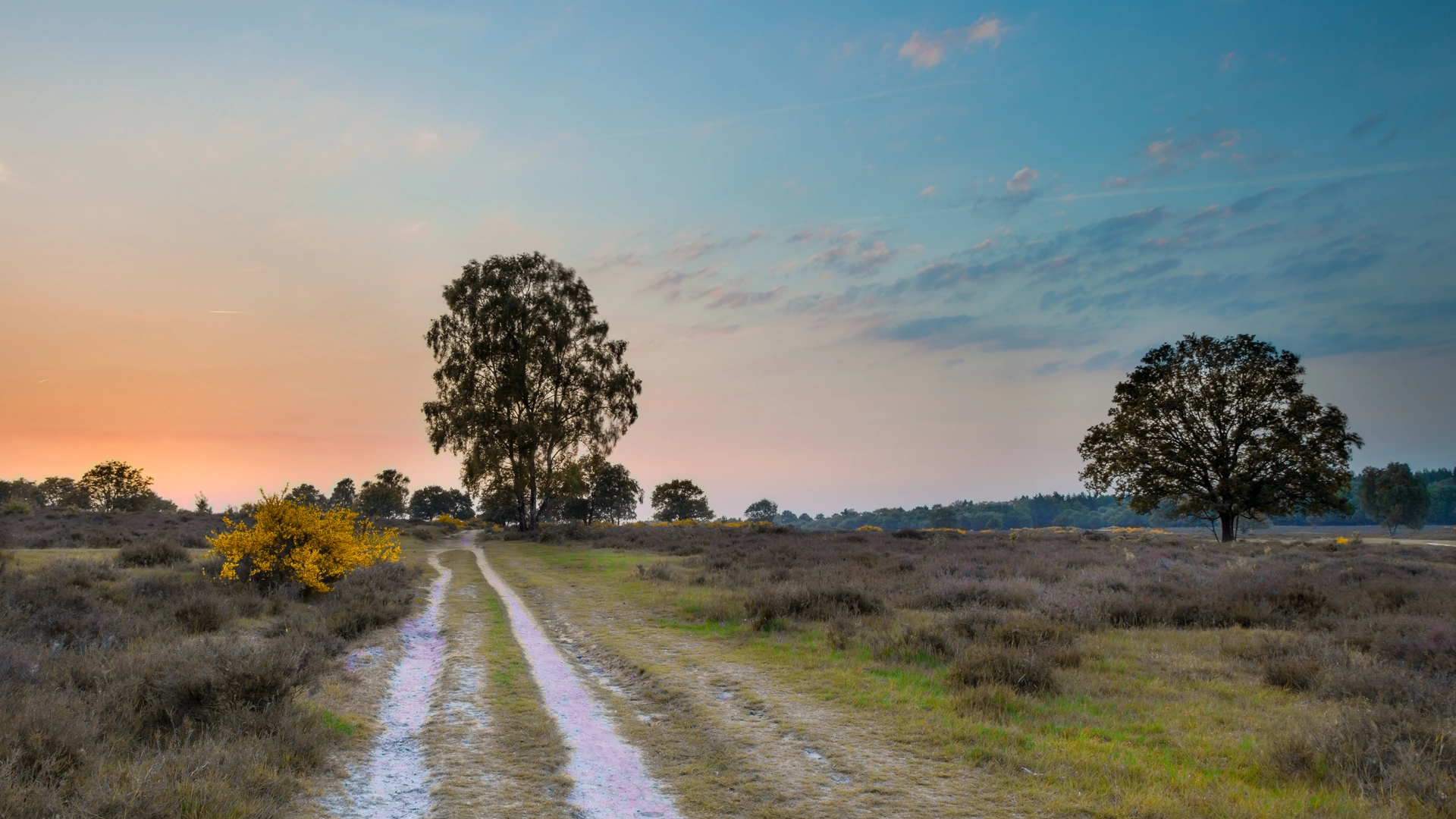
This is a long, flat, lowland loop of roughly 105 km / 65 mi with essentially 0 m / 0 ft of meaningful elevation gain, best treated as an easy, multi-day endurance walk rather than a “hard” hike. Expect a mix of paved paths, compacted gravel, canal-side tracks, and farm lanes typical of the Kromme Rijn / Houten area—easy underfoot, but with plenty of exposure to wind and weather.
Because your start point is listed only as “near,” the most practical, well-known place to anchor the start/finish is Houten railway station (Station Houten), Houten, Utrecht, Netherlands—a logical hub with services nearby and straightforward access to the green corridors and outer countryside.
Getting to the start (car + public transport)
By public transport (recommended): - Take a train to Station Houten (frequent connections via Utrecht Centraal). From the station, you can step straight onto Houten’s extensive car-light walking/cycling network and link into the outer loop using HiiKER for turn-by-turn guidance.
By car: - Houten is directly accessible from the A27 motorway (Houten has its own A27 exit). Park near the station area or at a designated public car park on the edge of town, then begin the loop from Station Houten. (Houten’s road design discourages cutting through neighborhoods by car, so plan your parking before you arrive.) (en.wikipedia.org)
What the terrain feels like (and why it’s “easy” but still serious)
Even with almost no climbing, 105 km / 65 mi is a big day-count. Most hikers will split it into 3–5 days: - 3 days: ~35 km / 22 mi per day (long, but doable with early starts) - 4 days: ~26 km / 16 mi per day (comfortable for most fit walkers) - 5 days: ~21 km / 13 mi per day (very relaxed pace with time for stops)
Underfoot, you’ll likely rotate between: - Smooth paved multi-use paths through Houten’s green structure - Dike-top and canal-side tracks (often breezy, sometimes slick after rain) - Agricultural lanes with occasional mud at field edges - Short urban connectors near neighborhoods and crossings
The main “difficulty” factors here are usually: - Wind exposure across open polders and along water - Repetitive surfaces (pavement can fatigue feet faster than soft trail) - Navigation at junction-dense path networks—use HiiKER and keep an eye on frequent turns
Landmarks and places you’ll want to route past
If you build or follow a 105 km loop around Houten and its surrounding green belt/countryside, these are the kinds of highlights that make the distance feel like a journey rather than a long march:
Fort ’t Hemeltje (Fortweg 11, 3992 LX Houten)
A standout historical waypoint tied to the New Dutch Waterline, the Dutch defensive system that used controlled flooding as a military tool. The fort dates to 1877–1881 and sits right by the A27; the terrain around the moat and fort grounds is great for a quiet break, birdlife, and a change of scenery from straight farm lanes. (hollandsewaterlinies.nl)
Fort bij Vechten + Waterliniemuseum (Achterdijk 12, 3981 HB Bunnik)
If your loop swings northwest toward Bunnik, this is one of the most worthwhile detours: a major fort site where you can connect the landscape you’re walking through to the bigger story of Dutch water engineering and defense. It’s also a good “civilization stop” for facilities and a structured break. (fortvechten.nl)
Schonauwen (castle site on the southern edge of Houten)
The former castle/estate area of Schonauwen adds a layer of local history—once a separate jurisdiction (heerlijkheid) and later absorbed into Houten’s municipal story. Depending on your exact

Surfaces
Unknown
Asphalt
Sand
Dirt
Concrete
Unpaved
Gravel
Ground
Paved
Wood
Comments and Reviews
User comments, reviews and discussions about the Houten Loop, Netherlands.
average rating out of 5
0 rating(s)