Download
3D Flyover
Add to list
More
114.6 km
~4 days
87 m
Multi-Day
“A sprawling Dutch polder loop of dikes, canals, and orchards—flat, exposed, and quietly demanding.”
This is a long, low-relief loop of roughly 115 km (71 mi) with only about 100 m (330 ft) of total climbing—so the challenge is almost entirely time-on-feet, weather exposure, and surface fatigue rather than hills. Expect a predominantly flat Dutch river-landscape feel: long straight farm lanes, dike-top stretches, canal edges, and quiet rural roads linking small villages and hamlets. Underfoot is typically paved cycleway/asphalt, compacted gravel farm track, and occasional grassy or muddy verge—comfortable in dry spells, but after rain the unpaved connectors can turn slick.
Because your start point is listed only as “near”, share any coordinates (lon/lat) you have and I’ll convert them to the nearest recognizable address or landmark and tailor the access directions precisely. Until then, plan on starting near a signed trailhead/parking pull-in along Defensieweg / Nieuwe Veenendaalseweg / Beusichemseweg in the central Netherlands river-and-polder belt, where these kinds of roads commonly sit near dikes, orchards, and drainage canals.
Getting to the start (car + public transport)
By car - Look for a practical start at a public parking area near a village center, church, or sports complex close to the loop’s roads—these are the most reliable all-day options in this region. - If you end up starting on a narrow farm lane, avoid blocking gates and field access; many “roadside” spots are working access points for tractors.
By public transport - The easiest approach is usually train to a nearby regional station, then bus or a short walk to the chosen start. In this part of the Netherlands, stations are often a few kilometers from the quieter farm roads, and buses can be infrequent outside commuter hours. - Once you provide the start coordinates (or the nearest town name), I can suggest the most sensible station/bus pairing and the simplest walk-in route.
For navigation, plan to load the full loop in HiiKER and also download it for offline use—this landscape has many similar-looking junctions, parallel farm tracks, and long straight segments where it’s easy to drift onto the wrong lane.
What the day-to-day effort feels like
Even with minimal ascent, 115 km (71 mi) is an ultra-distance outing. Most hikers will treat it as:
- A 2–3 day hike (common pacing: ~35–55 km / 22–34 mi per day), or
- A very long single push only if you’re conditioned for all-day movement and night navigation.
A useful way to think about the elevation: 100 m (330 ft) spread across 115 km is almost imperceptible—more like gentle dike undulations, bridge ramps, and overpasses than “climbs.”
Terrain, surfaces, and pacing
Surfaces - Asphalt/cycle paths: likely the majority. Great for steady progress, but hard on feet over multiple days—consider cushioned footwear and proactive blister care. - Farm tracks (gravel/compacted dirt): often fast when dry; can become greasy after rain, especially where tractors churn the edges. - Dike-top grass and canal-side verges: scenic but can be uneven, with hidden holes and slick grass in the morning.
Pacing reality - On flat ground, it’s tempting to overstride early. A better strategy is a shorter stride + steady cadence, especially if you’re doing back-to-back days. - Plan micro-breaks every 60–90 minutes to manage foot hotspots before they become blisters.
Landmarks, landscape character, and what you’ll see
This loop’s roads—Defensieweg, Nieuwe Veenendaalseweg, and Beusichemseweg—suggest a route that stitches together classic Dutch lowland features:
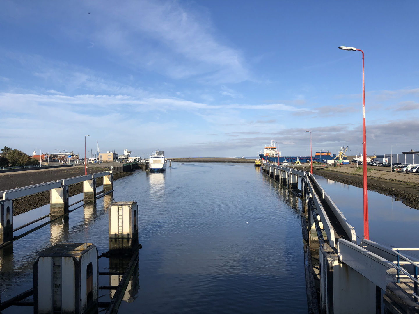
- Dikes and floodplains: You’ll likely spend time on or near embankments built to manage river levels. These provide the “high points” of the day and wide views over fields and water.
- Canals, drainage ditches, and sluices: Expect frequent small bridges, culverts, and water-control structures—quiet but defining elements of the landscape.
- Orchards and pasture: In many river areas, you’ll pass fruit-growing country (apples/pears/cherries depending on the exact province) and open grazing land.
- Village edges: The route will periodically brush past compact settlements—watch for historic church towers, old farmsteads, and traditional field patterns.
Historical significance to watch for
- Water management heritage: Much of the region’s “infrastructure” is historical in function even when modern in appearance—dikes, pumping stations, and canal networks reflect centuries of engineering to keep land habitable and productive.
- Defensive landscape clues: A road named Defensieweg often hints at former defensive lines, inundation areas, or military logistics routes (the Netherlands has a long history of using controlled flooding and fortifications). Even if you don’t pass a fort directly, the straight alignments and raised embankments can be remnants of that planning.
If you share the approximate town/coordinates, I can point out any specific nearby forts, linies, or protected heritage sites that the loop passes close to.
Nature and wildlife (seasonal expectations)
Even in heavily managed farmland, wildlife viewing can be excellent—especially near water.
Birdlife - Along canals and wet fields: herons, egrets, ducks, geese, swans, and seasonal waders. - Over open pasture

Surfaces
Asphalt
Unknown
Concrete
Grass
Paved
Sand
Gravel
Comments and Reviews
User comments, reviews and discussions about the Defensieweg, Nieuwe Veenedaalseweg and Beusichemseweg Loop, Netherlands.
average rating out of 5
0 rating(s)