Download
3D Flyover
Add to list
More
54.2 km
~2 days
0 m
Multi-Day
“A big, near-flat Limburg loop linking glittering lake, soggy broek woods, sandy pines, and a murmuring mill-valley—long, sometimes muddy.”
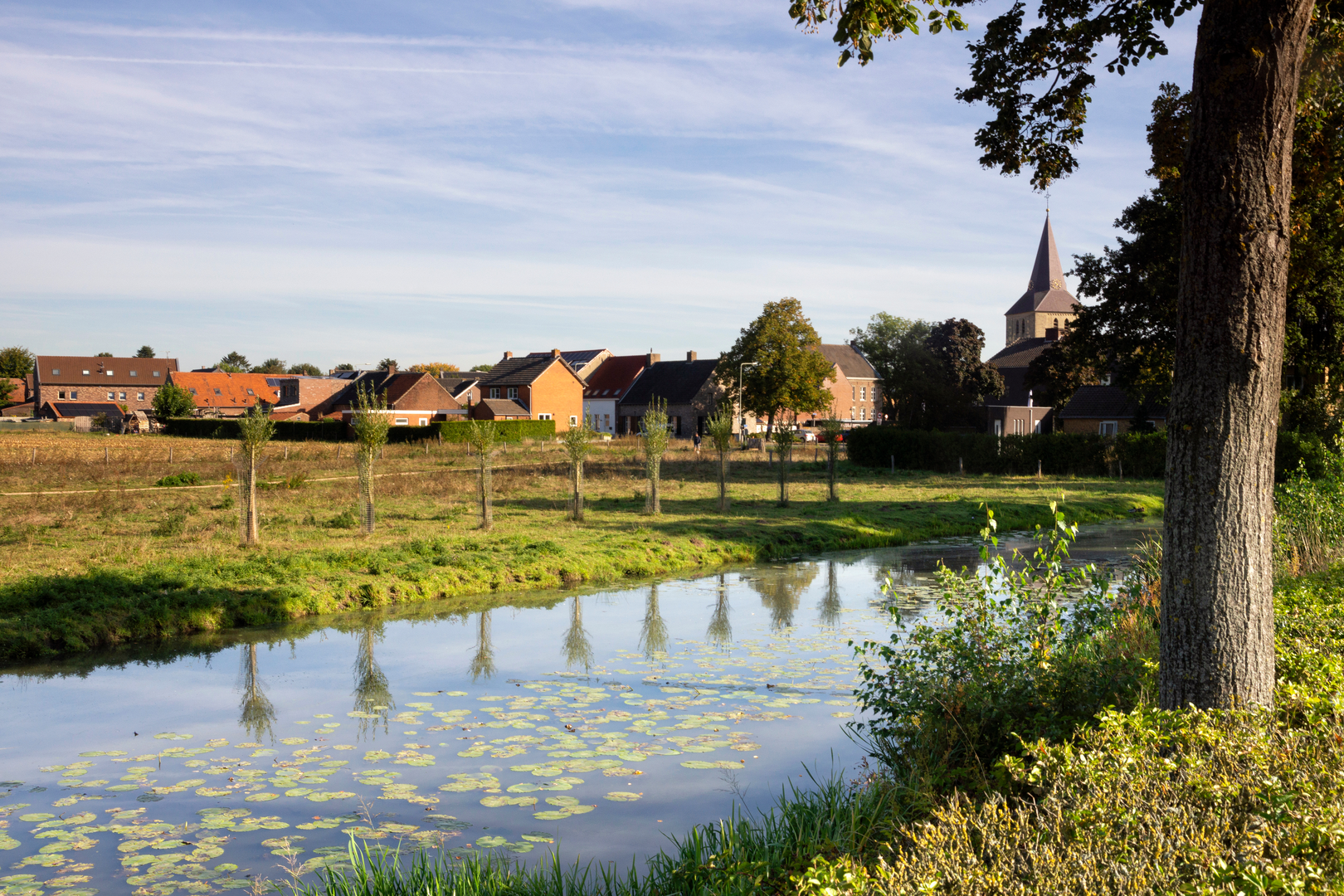
You’re looking at a big, almost completely flat, long-distance loop (about 54 km / 33.6 mi, roughly 0 m / 0 ft of sustained climbing) that stitches together four very different Middle-Limburg landscapes: a Maasplassen gravel lake (De Lange Vlieter), wet meadows and alder/poplar “broek” woodland (Keversbroek), sandy pine-woods with restoration toward heath and broadleaf forest (Ophovense Zandberg), and the stream-cut forested valley of Het Leudal with its historic watermill corridor. Expect a mix of dike-top paths, farm tracks, forest lanes, and streamside trails, with the main challenge being distance, foot care, and occasional mud, not elevation.
Getting to the start (car + public transport)
Because your “Hike head” is listed as “near” without a place name or coordinates, the most practical, well-documented access point for this set of areas is to start near Beegden (Limburg) at the church area on Kerkstraat—commonly used for access to De Lange Vlieter. Parking is typically done behind the church on Kerkstraat in Beegden. (birdingplaces.eu)
If you’re coming by public transport, a straightforward option is to ride the bus to Beegden, bus stop “Heerstraat/Centrum”, then walk a short distance to the lake loop access. (birdingplaces.eu)
If you prefer to anchor the day around Leudal facilities (visitor center / mill), another logical “hub” is Leumolen 3, 6083 BL Nunhem (the Leumolen / Sint-Ursulamolen), which is deep in the Leudal reserve and works well for breaks and logistics. (molens.nl)
For navigation on the day, load the route into HiiKER and keep an eye on where your loop crosses larger roads and canals—those are the spots where small deviations can cost you kilometers.
What the terrain feels like over 54 km
This is “easy” in the technical sense—no scrambling, no steep grades—but it’s a full-day endurance walk for most hikers. Plan on 10–13 hours moving time depending on pace and stops. Underfoot, you’ll rotate through: - Firm dike and cycle-path surfaces around water bodies (fast walking, but repetitive impact) - Sandy forest tracks (softer, sometimes slower) - Broekland edges and stream-valley paths that can turn drassig (waterlogged) after rain, especially in cooler months (allewandelroutes.nl)
A good strategy is to treat it as four linked mini-hikes of roughly 10–16 km (6–10 mi) each, with deliberate resupply and foot checks at the transitions.
De Lange Vlieter (lake loop feel) — ~0 to 8 km (0–5 mi)
Early on, you’ll likely circle or skirt De Lange Vlieter, a former gravel-extraction lake along the Maas (Meuse) near Beegden. (birdingplaces.eu) The walking/cycling path around the lake is about 5 km / 3.1 mi if you do the full circuit, with frequent open-water views and small wooded patches along the banks. (birdingplaces.eu)
Wildlife to watch for: this is a strong waterbird area, especially in late autumn and winter when the deep lake often stays ice-free. You may see diving ducks and grebes; rarer divers can appear in the cold season. (birdingplaces.eu) Bring binoculars if you enjoy birding—open water means birds can sit far out.
What to look out for: exposed shorelines can be windy and cool even on mild days; keep a light shell accessible. Also, shared-use paths mean you’ll likely meet cyclists—hold a

Surfaces
Unknown
Asphalt
Concrete
Ground
Unpaved
Comments and Reviews
User comments, reviews and discussions about the De Lange Vlieter, Keverbroek, Ophovense Zandberg and Leudal Loop, Netherlands.
average rating out of 5
0 rating(s)